



Tonight's Forecast:
Tonight, there will be a few storms that push into the eastern plains. A couple of sprinkles are possible for the I-25 corridor. The rain will clear out from west to east and we will be left with a few clouds. Overnight lows will be in the 50s and 60s.
Colorado Springs forecast: Low: 60; High: 86;
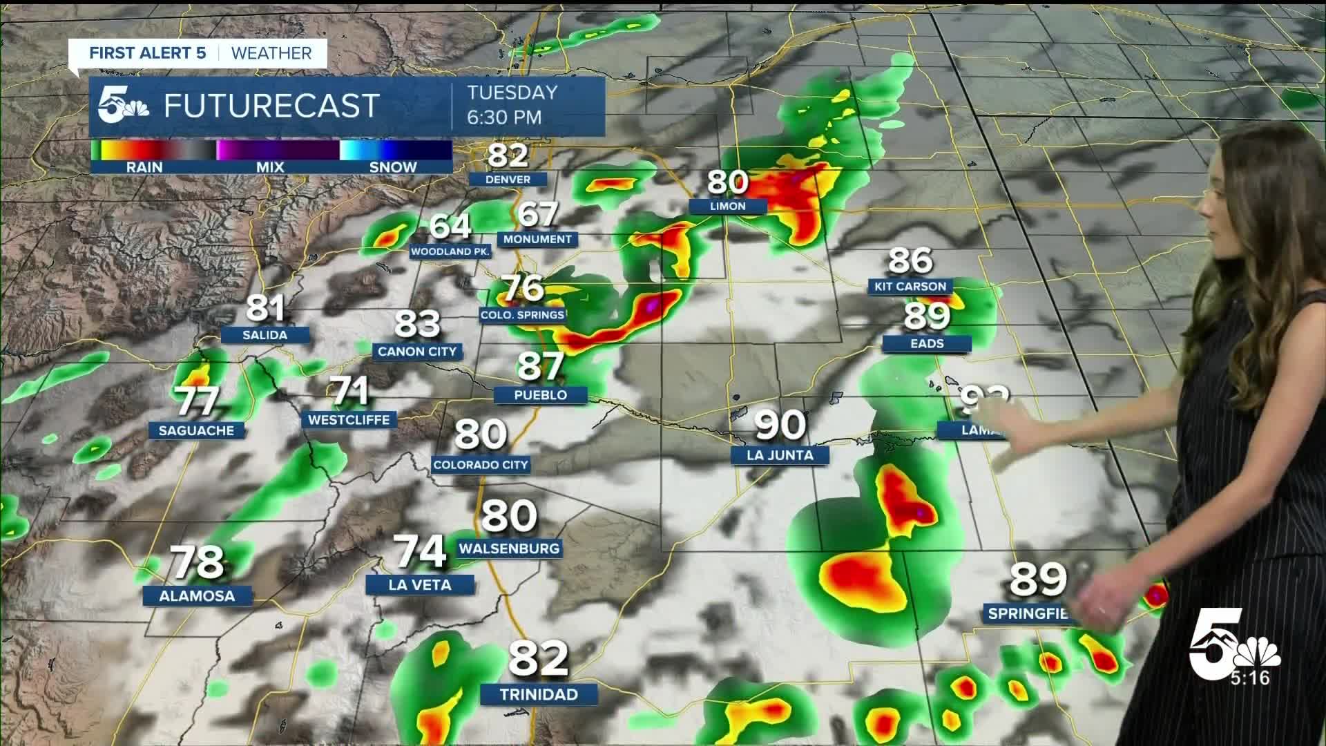
Colorado Springs will have temperatures in the lower 60s overnight. A cold front will move through early Tuesday morning and give us afternoon storms. Gusty winds and lightning will be a possibility with a few of these storms. Highs will be in the mid-80s.
Pueblo forecast: Low: 63; High: 93;
Pueblo will have overnight lows in the lower 60s. Pueblo will stay mostly dry, but towards the northern portion of the county there is a chance for a couple of storms. Afternoon highs will be in the lower 90s.
Canon City forecast: Low: 65; High: 91;
Canon City will have lows overnight in the mid-60s. There will be some sunshine and a mix of clouds to start off the day. Rain chances increase in the afternoon. Highs will be in the lower 90s.
Woodland Park forecast: Low: 52; High: 79;
Woodland Park will have overnight lows dip in the lower 50s. There will be a few clouds in the morning. Rain chances will pick up in the afternoon and last into the evening. Highs will reach the upper 70s.
Tri-Lakes forecast: Low: 57; High: 80;
The Monument area will have overnight lows in the upper 50s. Temperatures by the afternoon will still be on the warmer side in the 80s. A cold front moves through and will bring some rain chances in the afternoon.
Plains forecast: Low: 60s; High: 90s;
The eastern plains will wake up to temperatures in the 60s. Another hot day is in store, but not quite as warm as Monday. Thanks to a cold front temperatures will drop a few degrees and highs will be in the lower 90s.
Walsenburg and Trinidad forecast: Low: 64/62; High: 86/90;
The southern I-25 corridor will have morning temperatures in the lower to mid 60s. Clouds will increase throughout the day and a few storms will pop up in the afternoon. These storms will push east across Las Animas county. Highs will be in the mid 80s and lower 90s.
Mountains forecast: Low: 50s; High: 80s;
The mountains will have a few clouds to start the day. There will be a few areas over the central mountains that have some lingering gusts of wind. Storms will start to pop up by the afternoon. Highs will be in the 80s.
Extended outlook forecast:
Looking ahead, temperatures will continue to dip into the mid-80s. Wednesday will have some more rain chances and looks to be one of the coolest days of the week. Thursday starts to dry out and temperatures warm back up. We won't have rain chances again until Sunday.
____
Curious about the First Alert 5 Weather Storm Impact Scale? Check out our cheatsheet explainer.
Watch KOAA News5 on your time, anytime with our free streaming app available for your Roku, FireTV, AppleTV and Android TV. Just search KOAA News5, download and start watching.
