



Today’s Forecast:
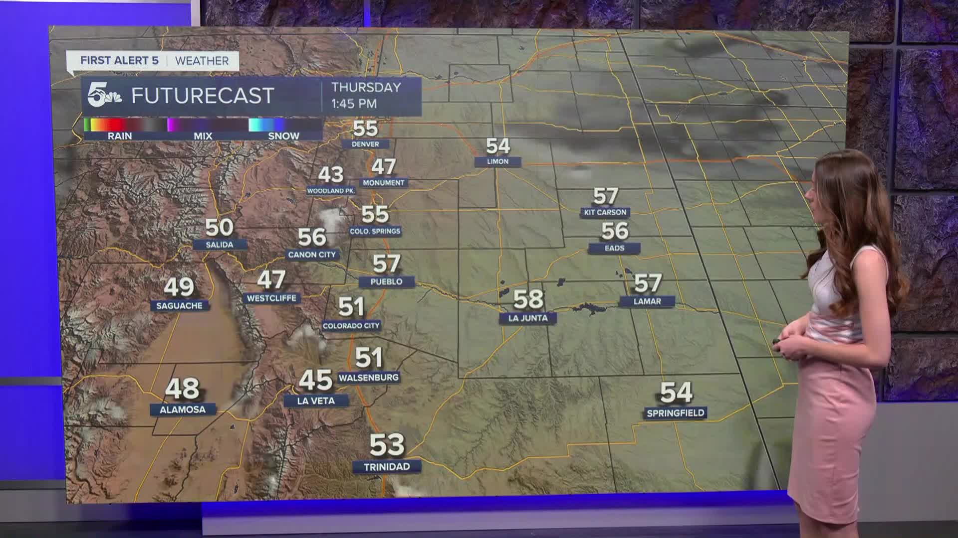
This morning we are tracking a few clouds that will eventually push east. Bright and sunny conditions will last throughout today. Afternoon highs will break into the 50s for both Colorado Springs and Pueblo. The north side of El Paso county won't quite reach the 50s.
See the full forecast in the video below
Colorado Springs forecast: High: 55; Low: 33.
Colorado Springs is sitting in the 30s this morning. By 9AM temperatures will be in the 40s. Afternoon temperatures will be seasonable for this time of year breaking into the mid-50s. Clouds will stay away throughout the day today.
Pueblo forecast: High: 58; Low: 36.
Pueblo will start the day with temperatures in the lower 40s. Clouds are already clearing across I-25. Sunshine will last throughout the day and help highs to reach the 50s again. Active weather will stay at bay today. More clouds move in overnight.
Canon City forecast: High: 53; Low: 35.
Canon City will start the day with lows in the 40s. Temperatures will be very seasonable today with highs reaching the 50s. Clouds will clear and sunshine will be in store for Fremont county. There will be more clouds that push into the area overnight.
Woodland Park forecast: High: 46; Low: 27.
Woodland Park has temperatures this morning in the 20s. There wasn't much snowfall overnight, and with road temperatures above freezing there wasn't much accumulation. Roads will be dry and sunshine will be back across the area today. Highs will be chilly in the mid-40s. Clouds move back in overnight.
Tri-Lakes forecast: High: 49; Low: 29.
Monument has some good rainfall overnight, so some roads will be a slightly wet. They will continue to dry throughout the morning. Sunshine will last throughout the day and highs will get into the upper 40s. Breezy conditions will be possible this morning, but that will eventually calm.
Plains forecast: High: 50s; Low: 30s.
The eastern plains have some showers pushing east into Kansas. Clouds will eventually clear and sunshine will move in. Afternoon highs will get into the 50s today. Clouds move back in overnight.
Walsenburg and Trinidad forecast: High: 52/53; Low: 34/32.
The southern I-25 corridor is waking up to temperatures in the 30s. These temperatures will warm though and highs will eventually top out in the lower 50s. A light jacket may be needed today. Clouds will move back in overnight.
Mountains forecast: High: 40s & 50s; Low: 20s.
The mountains had a couple inches of snowfall overnight. There will be some melting today as temperatures remain above freezing. We a tracking more sunshine across the higher terrain with some clouds moving back in overnight. Highs will reach the 40s and 50s.
Extended outlook forecast:
Looking ahead, our pattern will remain calm. A few more clouds will move into Colorado on Friday as a system passes towards the south. We aren;t expecting any moisture for I-25. Sunshine returns over the weekend and with a ridge settling in it will also bring some warmer temperatures. Highs will get back into the 60s by Sunday. Monday looks very warm with highs reaching the upper 60s.
____
Curious about the First Alert 5 Weather Storm Impact Scale? Check out our cheatsheet explainer.
Watch KOAA News5 on your time, anytime with our free streaming app available for your Roku, FireTV, AppleTV and Android TV. Just search KOAA News5, download and start watching.
