

Tonight's Forecast:
This evening will have some cloud cover across the area. Any rain that we see will be further south in Huerfano and Las Animas counties. Temperatures will steadily cool into the 50s and 40s overnight.
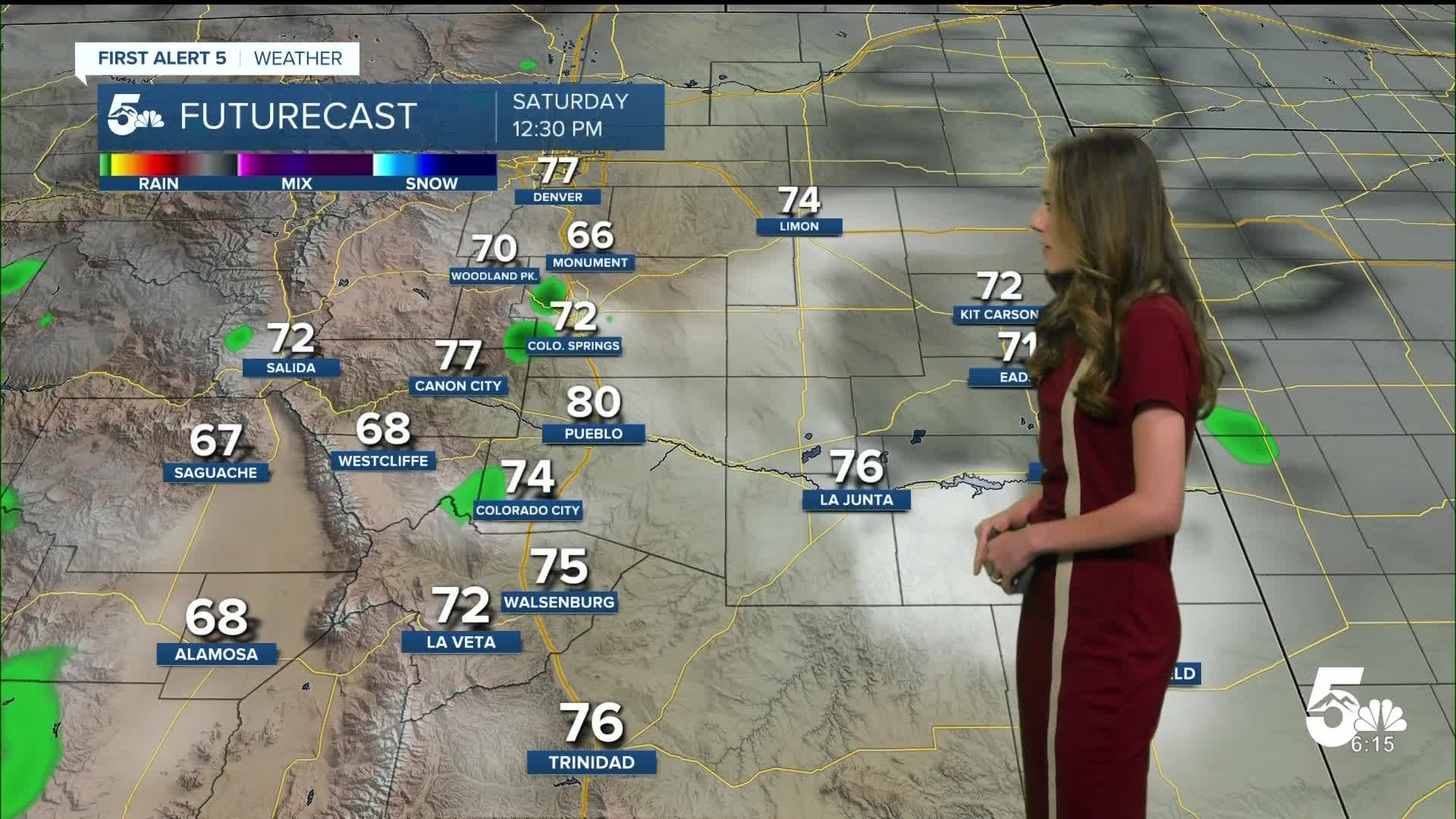
Colorado Springs forecast: Low: 50; High: 75;
Colorado Springs will see a few spotty showers during the afternoon on Saturday. Highs in the afternoon will rise into the mid-70s. This will be the rainier of the two days over the weekend.
Pueblo forecast: Low: 53; High: 84;
Pueblo will dip into the lower 50s for the early morning lows. Temperatures will eventually rise into the mid-80s by the afternoon. There is a possibility for spotty showers in the area, so if you are headed to the Chile and Frijoles Festival it wouldn't be a bad idea to carry and umbrella.
Canon City forecast: Low: 55; High: 79;
Canon City will start Saturday off with temperatures in the mid-50s. The chance for rain will move in during the afternoon. Highs will be in the upper-70s.
Woodland Park forecast: Low: 42; High: 69;
Woodland Park will dip into the lower 40s overnight. By the afternoon temperatures will be in the upper 60s. There will be a chance for rain in the afternoon.
Tri-Lakes forecast: Low: 46; High: 70;
Monument will be on thew chilly side overnight and into the early morning hours. Morning lows will be in the mid-40s. This will change once we get into the afternoon and temperatures will be in the 70s. The chance for rain will arrive in the afternoon.
Plains forecast: Low: 50s; High: 70s & 80s;
The Plains will have a few clouds overnight and early Saturday morning there is a chance for rain closer to Baca and Prowers counties. The afternoon will also bring a chance for rain and temperatures will be in the 70s and 80s again.
Walsenburg and Trinidad forecast: Low: 49; High: 78/79;
The southern I-25 corridor will have morning lows in the upper 40s. The afternoon will be warm with highs in the upper 70s. Rain chances will also increase going into the afternoon and evening.
Mountains forecast: Low: 40s; High: 70s;
The mountains will have the best chances for rain going into Saturday afternoon. Highs will be in the 70s across the area, but places where rain moves through will likely cool down temperatures.
Extended outlook forecast:
Looking ahead, Sunday looks much better especially if you are trying to get outside. Highs will be very similar to Saturday.
Monday is when our next big system moves through. Some tropical moisture will be transported up to Colorado all the way from the eastern Pacific. Combined with a cold front this will bring some rain into the Centennial State. Rain will move into the northern portion of the state and work its way south. This will linger overnight into Tuesday morning.
____
Curious about the First Alert 5 Weather Storm Impact Scale? Check out our cheatsheet explainer.
Watch KOAA News5 on your time, anytime with our free streaming app available for your Roku, FireTV, AppleTV and Android TV. Just search KOAA News5, download and start watching.
