


Today’s Forecast:
Get ready for the start of a very hot weekend!
High will warm into the 80s and 90s today with a little extra monsoon humidity to make you sweat.
Scattered strong to severe storms will be possible today, mainly east of I-25. Storms will start over the mountains and Palmer Divide this afternoon, and as they move east of the interstate, they'll grow stronger with large hail and strong winds as our two main threats.
Colorado Springs forecast: High: 88; Low: 60. Hot with isolated thunderstorms in the afternoon, but the best storm chances are north of town along the Palmer Divide and east across El Paso County. If we do see strong to severe storms in the region, it's mostly likely east of the city.
Pueblo forecast: High: 94; Low: 62. Mostly sunny and very hot today with dry skies through the afternoon and overnight hours.
Canon City forecast: High: 91; Low: 60. Hot with a small chance of an isolated thunderstorm in the afternoon. Storm chances are best over the mountains over Fremont County.
Woodland Park forecast: High: 78; Low: 52. Warm with an isolated storm or two through the afternoon. If we do see storms today, they could be strong with small hail and lightning.
Tri-Lakes forecast: High: 80s; Low: 50s. Scattered strong thunderstorms are possible today with small hail and lightning as the main daytime threats.
Plains forecast: High: 90s; Low: 60s. Very hot with areas of strong to severe storms today. Whatever storms survive east off the mountains, Palmer Divide, and Raton Mesa, could be strong to severe with large hail and strong winds as the main threats.
Walsenburg and Trinidad forecast: High: 80s; Low: 50s. Isolated strong storms today, especially south near Trinidad and along the Raton Mesa. Small hail and strong winds are the main threats.
Mountains forecast: High: 70s; Low: 50s. Scattered storms will start over the mountains after the lunch hour and spread east through the plains.
Extended outlook forecast:
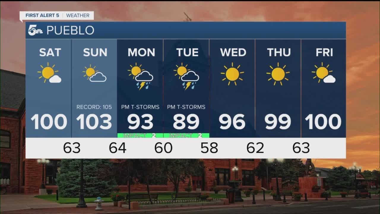
The big story over the weekend will be heat. We're going to see building heat on Saturday and Sunday, with Sunday being the hottest day of the weekend.
We could get close to records on Sunday, but we probably won't get there. Highs are forecast to be 91 and 95 on Saturday and Sunday in Colorado Springs, and 99 and 102 in Pueblo.
We'll see the return of widespread thunderstorms next week on Monday and Tuesday.
____
Curious about the First Alert 5 Weather Storm Impact Scale? Check out our cheatsheet explainer.
Watch KOAA News5 on your time, anytime with our free streaming app available for your Roku, FireTV, AppleTV and Android TV. Just search KOAA News5, download and start watching.
