

Tonight's Forecast:
A few clouds will remain with moisture sticking around. Temperatures will fall into the 20s and 30s overnight. Winds will remain light overnight.
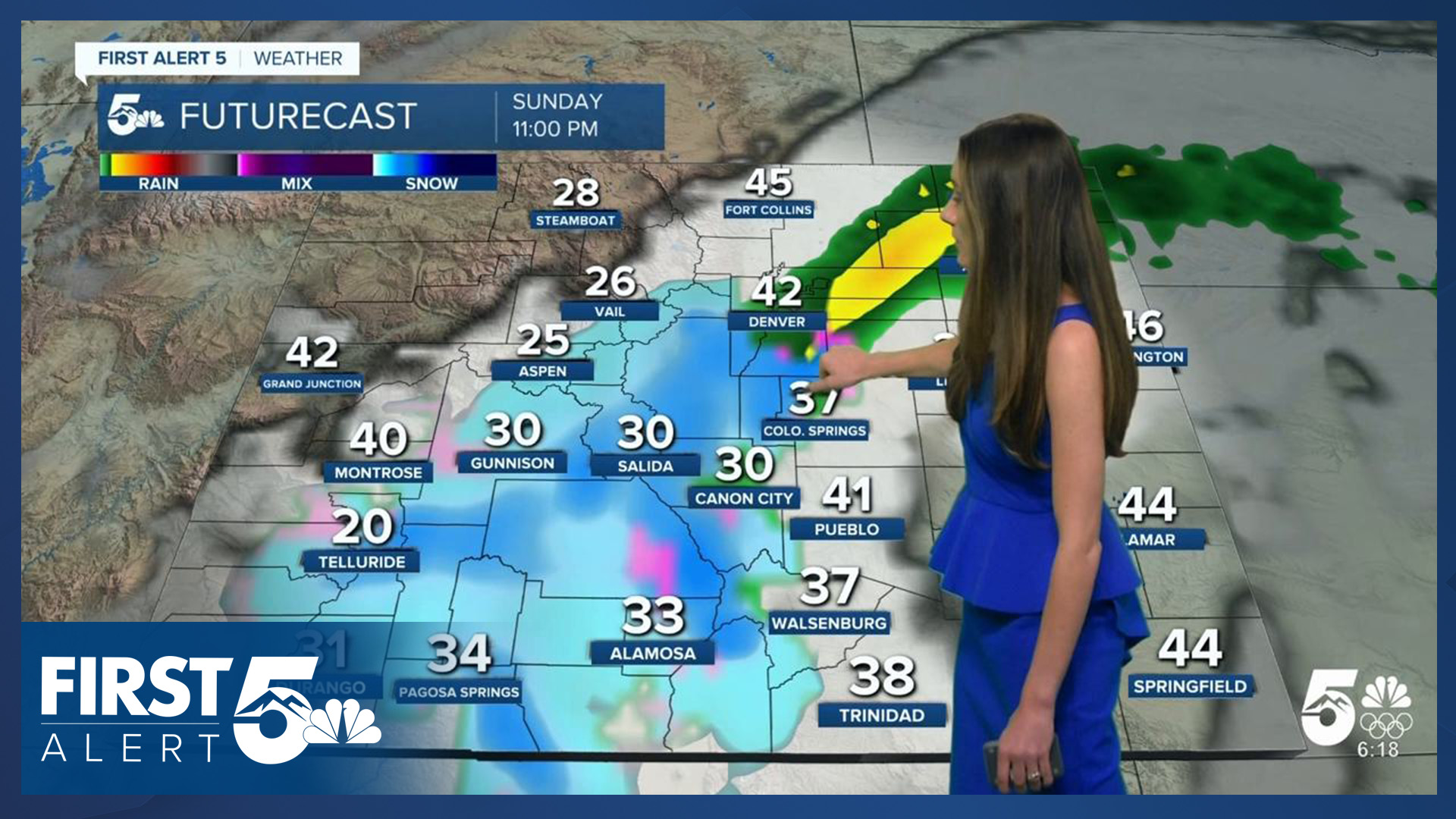
Colorado Springs forecast: Low: 30; High: 58;
Tomorrow will be a nice day with afternoon highs in the upper 50s. There will be plenty of sunshine with only a few upper-level clouds in the area. Winds will be light throughout the day.
Pueblo forecast: Low: 26; High: 58;
Pueblo will have a chilly morning with lows reaching the mid-20s. Things will warm up by the afternoon with temperatures in the upper 50s. Not too many clouds in the area. Definitely take advantage of these conditions because by Sunday rain enters the forecast.
Canon City forecast: Low: 33; High: 60;
Canon City will start the day with lows in the lower 30s. With sunny skies, this will help temperatures get up into the 60s. It will be a fairly calm day.
Woodland Park forecast: Low: 22; High: 51;
Woodland Park will wake up to temperatures in the lower 20s, so if you have an early morning grab that jacket! The afternoon will still be a little chilly, but winds will stay light.
Tri-Lakes forecast: Low: 28; High: 55;
The Monument area will have morning lows in the upper 20s. A few upper-level clouds will pass through during the day. Afternoon temperatures will be in the mid-50s, and things will stay clam.
Plains forecast: Low: 20s; High: 60s;
The eastern counties and Hwy 50 will get chilly tonight with lows in the 20s. This will be short-lived because by the afternoon, highs will be in the 60s. It will be dry tomorrow with sunny skies and calm conditions.
Walsenburg and Trinidad forecast: Low: 30/29; High: 59/62;
The southern I-25 corridor will have overnight lows drop into the upper 20s and lower 30s. Conditions will remain dry with plenty of sunshine. There may be a few upper level clouds that push into the area. Highs will be in the upper 50s and lower 60s.
Mountains forecast: Low: 30s; High: 40s & 50s;
The mountains have a small chance for some overnight showers. This will stay isolated in the mountains. Morning temperatures will be in the 30s. By the afternoon, temperatures will be in the 40s and 50s.
Extended outlook forecast:
Things start to change going into Sunday with this next system. It looks very similar to this last system that we just had. Since temperatures will stay above freezing during this time, much of I-25 will be seeing rain. This will also start during the morning on Sunday. The higher terrain will get some snow.
Looking ahead to the week, the coldest day looks to be Tuesday. Thanksgiving day will have highs in the 50s and just a few clouds. The forecast looks dry.
____
Curious about the First Alert 5 Weather Storm Impact Scale? Check out our cheatsheet explainer.
Watch KOAA News5 on your time, anytime with our free streaming app available for your Roku, FireTV, AppleTV and Android TV. Just search KOAA News5, download and start watching.
