


Today’s Forecast:
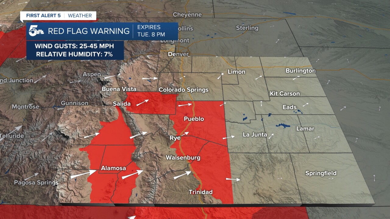
Record heat is back in the forecast today with highs in the 80s from Colorado Springs to Pueblo and down into the eastern plains. Fire danger is highest in the Red highlighted counties due to the strong afternoon wind gusts and very low humidity. We'll actually see stronger winds tomorrow even through temperatures will be cooler.
COLORADO SPRINGS: High: 81; Low: 46. Sunny morning and a cloud afternoon with increased winds out of the southwest through the afternoon.
PUEBLO: High: 88; Low: 46. Hot, dry, and pretty wind in the afternoon with increased daytime cloud cover. Gusts could be in the 20 to 30 mph range today.
CANON CITY: High: 82; Low: 43. Very warm and windy today with high fire danger through the afternoon. Wind gusts could be in the 30 to 40 mph range today.
WOODLAND PARK: High: 68; Low: 36. Increasing daytime clouds, warm and very windy in the afternoon with 30 mph gusts. Fire danger will be elevated in grassy areas.
TRI-LAKES: High: 70s; Low: 30s. Sunny start to a cloudy finish today with strong afternoon wind gusts and very warm afternoon temperatures.
PLAINS: High: 80s; Low: 40s. Hot, sunny with some late day clouds and windy through the afternoon with high fire danger in Las Animas county.
WALSENBURG/TRINIDAD: High: 70s; Low: 40s. Warm and very windy today with gusts in the 20 to 30 mph range along with high fire danger. Red Flag Warnings are in effect through the evening.
MOUNTAINS: High: 60/70s; Low: 40s. Warmer than normal with increasing daytime cloud cover. We'll see strong daytime wind gusts in the 20 to 40 mph range today with elevated fire danger in spots where the snow has been melted for a while.
Extended Outlook:
Tuesday will be cooler but we'll have stronger winds and higher fire danger compared to Monday.
Red Flag Warnings will be more prevalent on Tuesday and we could see stronger gusts reach the 50 mph range. Highs will fall back to the 60s and 70s Tuesday and stay that way through the upcoming weekend.
We could see light rain to snow showers in northern El Paso county Tuesday that then move east along the Palmer Divide. We'll be dry but windy through the rest of the week.
KOAA News5 on your time, streaming on your Roku, FireTV, AppleTV and AndroidTV.
News5 App | First Alert 5 Weather App | Youtube | Facebook | Instagram | Twitter
