

Today’s Forecast:
We're finally back in the 60s today, a welcome change from the 30s we saw earlier in the week!
Downslope warmth will kick 60s across the plains today with a few areas like La Junta and Las Animas getting close to 70 in the afternoon!
The strongest winds today will be in the southern mountains and along the Raton Mesa, but we should be less windy compared to Thursday.
Winter Storm Warnings go into effect across the Continental Divide today and expire early Sunday morning. Heavy snow with dangerous mountain pass travel is expected, especially today and tomorrow.
Colorado Springs forecast: High: 62; Low: 41. Mostly cloudy, breezy, and really warm with highs in the low 60s.
Pueblo forecast: High: 68; Low: 39. Partly sunny, windy, and really warm with highs in the upper 60s!
Canon City forecast: High: 67; Low: 42. Mostly cloudy, windy, and warm with highs in the mid-60s.
Woodland Park forecast: High: 53; Low: 36. Mostly cloudy, windy, and dry with highs in the mid-50s.
Tri-Lakes forecast: High: 60s; Low: 30s. Mostly cloudy and windy with dry skies and highs in the low 60s.
Plains forecast: High: 60s; Low: 40s. Partly sunny, windy, and really warm with La Junta hitting the low 70s today! The strongest winds will be south of Highway 50 with elevated fire danger across Las Animas County.
Walsenburg and Trinidad forecast: High: 60s; Low: 40s. Partly sunny, really windy, and warm with dry skies and highs in the mid 60s.
Mountains forecast: High: 50s; Low: 30s. Windy and cold with heavy snow through the afternoon and overnight hours. Dangerous travel over high mountain passes is expected with even more snow through the daytime tomorrow.
Extended outlook forecast:
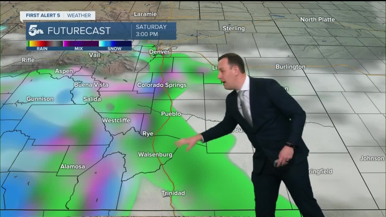
Saturday will be cooler, cloudy, and wet with scattered rain to snow showers moving out of the mountains in the afternoon.
The St. Patrick's Day parade in Colorado Springs starts at 12 pm on Tejon Street, and there could be rain. Bring a jacket or an umbrella just in case we start seeing showers.
More spotty daytime showers are possible on Sunday, but we'll be cold enough that snow may mix down to the Pikes Peak Region and the Raton Pass area.
Foothill showers are possible on Monday with a huge warm-up Tuesday. The next chance for widespread snow falls on Thursday of next week.
____
Curious about the First Alert 5 Weather Storm Impact Scale? Check out our cheatsheet explainer.
Watch KOAA News5 on your time, anytime with our free streaming app available for your Roku, FireTV, AppleTV and Android TV. Just search KOAA News5, download and start watching.
