

Tonight's Forecast:
Most of the showers and storms will be for the southern I-25 corridor in Las Animas county. Temperatures will slowly decline into the 50s and 60s overnight.
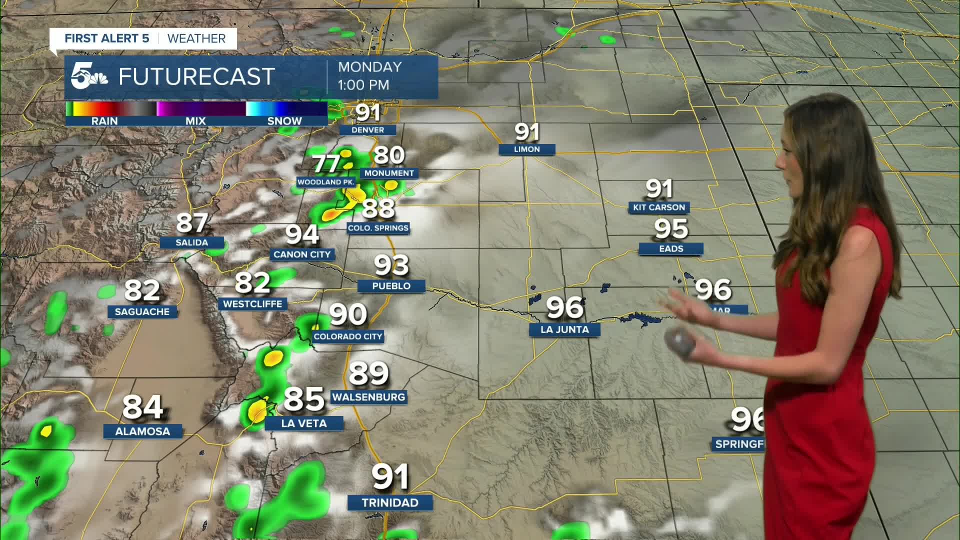
For Monday, rain chances will remain and pick up coverage across the area. Main concerns with these storms will be gusty winds and lightning.
Colorado Springs forecast: Low: 59; High: 88;
Colorado Springs will have a warm evening with temperatures slow to cool. Overnight lows will be in the upper 50s and lower 60s in some areas. Monday will have rain chances return with showers moving into the area around noon. These will last through the afternoon and into the evening.
Pueblo forecast: Low: 61; High: 95;
Pueblo will have 90 degree temperatures through 7PM, and overnight lows are expected to drop into the lower 60s. Rain chances will remain on the lower side for tonight and going into Monday. Pueblo will have a 20% chance of rain on Monday. Highs will be in the mid-90s.
Canon City forecast: Low: 63; High: 94;
Canon City will have morning lows in the lower 60s. Highs by the afternoon on Monday will be in the mid-90s. Not much rain is expected across the area.
Woodland Park forecast: Low: 49; High: 78;
Woodland Park will hole onto more moisture which will give an increased chance of rain through Tuesday. Temperatures overnight will drop into the upper 40s. Highs will be in the upper 70s.
Tri-Lakes forecast: Low: 57; High: 83;
The Monument area will have overnight lows in the upper 50s. There is a small chance for some lingering showers overnight, but things will be clear by morning. Temperatures on Monday will get into the lower 80s. Rain will return in the afternoon.
Plains forecast: Low: 60s; High: 90s;
The plains have a few thunderstorms in Baca county, but other than that things will stay clear. Lows will drop into the 60s throughout our eastern counties. Temperatures will climb back into the 90s for Monday.
Walsenburg and Trinidad forecast: Low: 59/57; High: 89/92;
The southern I-25 corridor will have a few showers Sunday evening, but things will clear out overnight. Temperatures will be slow to cool and lows will eventually reach the upper 50s. Highs on Monday will be in the upper 80s and lower 90s. Rain chances will remain in the forecast.
Mountains forecast: Low: 50s; High: 80s;
The mountains will have showers and thunderstorms popping up around noon and will last throughout the majority of the day on Monday. The will pick up in coverage during the late afternoon. Highs will be in the 80s across the central mountains.
Extended outlook forecast:
Rain chances will go down towards the middle of the week around Wednesday and Thursday. Temperatures will remain above average. The monsoon pattern will kick back on towards the end of the week and rain chances will also pick back up.
____
Curious about the First Alert 5 Weather Storm Impact Scale? Check out our cheatsheet explainer.
Watch KOAA News5 on your time, anytime with our free streaming app available for your Roku, FireTV, AppleTV and Android TV. Just search KOAA News5, download and start watching.
