
Tonight’s Forecast:
An upper level disturbance is running through the state but primarily only affecting the northern half. Northern Colorado has been active today with scattered showers and thunderstorms. On the other hand, Southern Colorado has been rather quiet with partly to mostly sunny skies and gusty mountain winds. Once this disturbance clears the state, we’ll clear our skies overnight and drop our temperatures into the upper 50s and lower 60s.
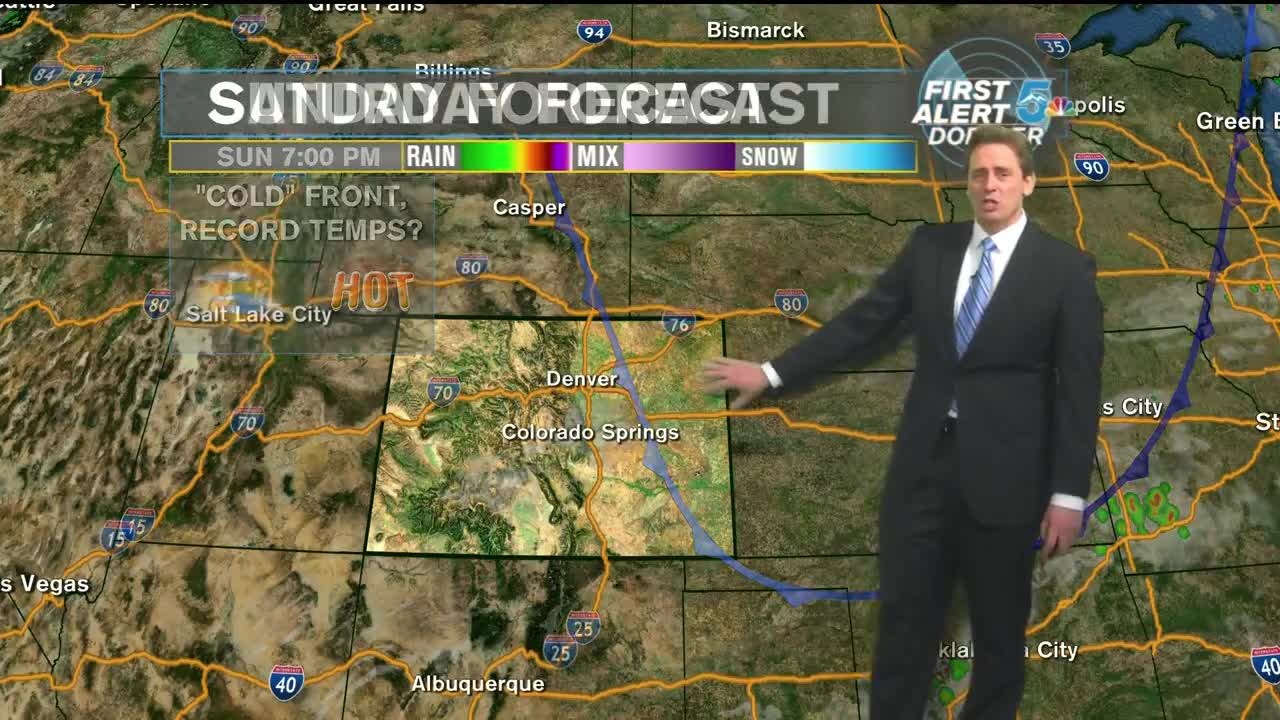
For the next few days, it’s going to be a good idea to keep a close watch on your thermometers. A “cold front” will move into the Eastern Plains for Sunday. Instead of afternoon highs in the lower 100s, look for highs in the upper 90s. Regardless, afternoon temps along the I-25 corridor will come close to record highs. If not for that few degrees shaven off by the “cold front”, we might break some records on Sunday. Overall, mostly sunny and HOT with highs in the 90s for the Springs and near 100 for Pueblo.
COLORADO SPRINGS: Low: 59, High: 93. Clear tonight with temperatures near 60. Mostly sunny and HOT on Sunday afternoon with highs near 93. The record high is 95.
PUEBLO: Low: 62, High: 100. Clear tonight with temperatures in the lower 60s. Mostly sunny and HOT on Sunday afternoon with highs near 100. The record high is 103.
CANON CITY: Low: 62, High: 98. Clear tonight with temperatures in the lower 60s. Mostly sunny and HOT on Sunday afternoon with highs in the upper 90s.
WOODLAND PARK: Low: 50, High: 83. Clear tonight with temperatures near 50. Mostly sunny and HOT on Sunday afternoon with highs in the lower 80s.
TRI-LAKES: Low: 50s, High: 80s. Clear tonight with temperatures in the 60s. Mostly sunny and HOT on Sunday afternoon with highs in the upper 80s.
PLAINS: Low: 60s, High: 90s/100s. Clear tonight with temperatures in the lower 60s. Mostly sunny and HOT on Sunday afternoon with highs in the upper 90s to lower 100s.
WALSENBURG/TRINIDAD: Low: 50s, High: 90s. Clear tonight with temperatures in the 50s. Mostly sunny and HOT on Sunday afternoon with highs in the 90s.
Extended Outlook:
High pressure will build into the state on Sunday night. This will keep things dry and HOT for Monday and Tuesday. The records in Colorado Springs and Pueblo, for Monday and Tuesday respectively, are 94 & 93, and 100 & 101. We should beat these records, if not come close and tie them. By Tuesday night, moisture will creep back into the state and bring back the chances for thunderstorms on Wednesday and Thursday. By next weekend, we’ll dry out once again and return to the hot afternoon highs.
