
Today’s Forecast:
Snow moves out of the mountains today and pushes through southern Colorado. We'll see the heaviest snow across the Sangre De Cristos, Wet Mountains, and southern I-25 corridor from Walsenburg to Trinidad. Decent snow will fall across the plains south of highway 50, but mainly in the afternoon and overnight hours. Lunch time and early afternoon commutes will be most affected from snow today.
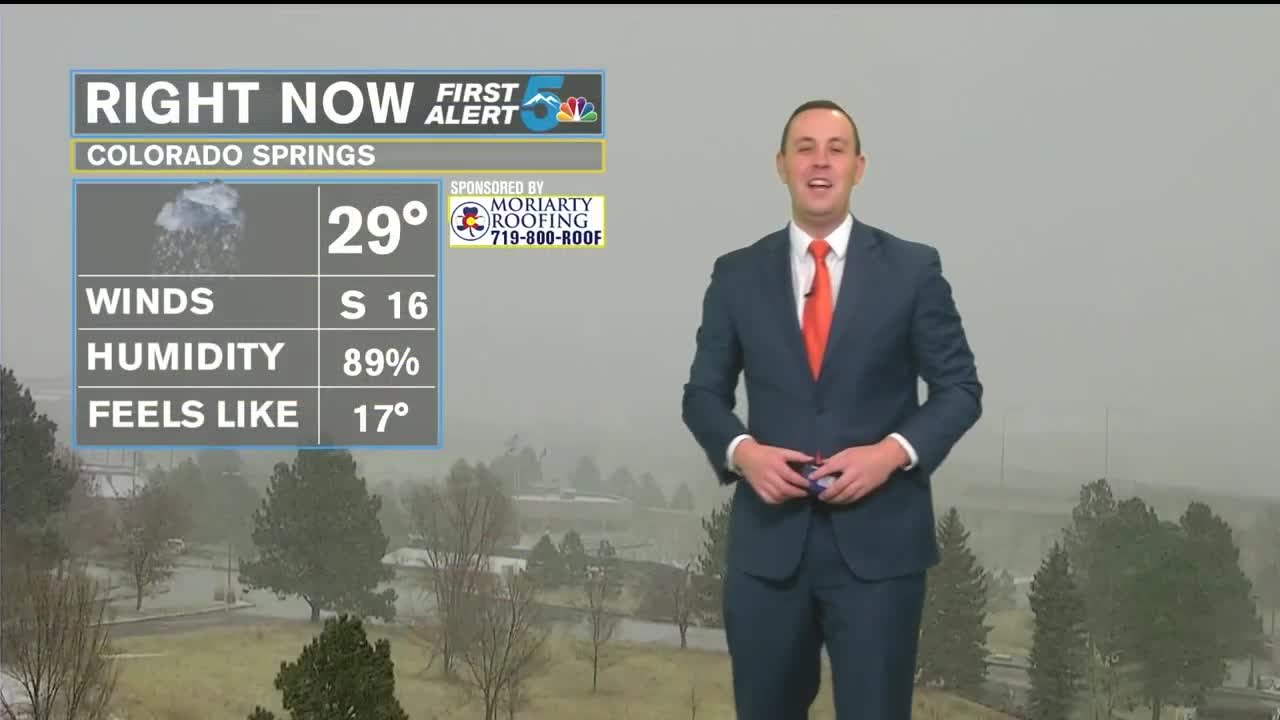
COLORADO SPRINGS: High: 30↓; Low: 20. Periods of flurries to light snow showers from the morning to lunchtime, with more light snow and flurries through the overnight hours into Friday morning. Snowfall totals will range from a dusting to 2 inches across town.
PUEBLO: High: 31↓; Low: 22. Periods of mist to light snow from the morning, to light snow around lunchtime. Light snow to flurries will fall overnight to early Friday morning, with snow totals ranging from a trace to 2 inches.
CANON CITY: High: 31↓; Low: 21. Periods of mist to light snow from the morning, to light snow around lunchtime. Light snow to flurries will fall overnight to early Friday morning, with snow totals ranging from a 1 to 3 inches.
WOODLAND PARK: High: 30↓; Low: 20. Periods of flurries to light snow showers from the morning through lunchtime, with more light snow and flurries overnight to early Friday morning. Snowfall totals will range from a dusting to 3 inches across Teller County.
TRI-LAKES: High: 30s↓; Low: 10s. Periods of fog and flurries to light snow showers from the morning through lunch time, with more light snow and flurries overnight to early Friday morning. Snowfall totals by Friday morning will range from 1 to 3 inches.
PLAINS: High: 30s↓; Low: 20s. Periods of snow from lunchtime through the afternoon, with the heaviest snow falling along and south of highway 50s through the second part of the day. Light snow to flurries will fall overnight into Friday morning. Snow totals will range from 1 to 3 inches in La Junta, 2 to 4 inches in Springfield, and 3 to 6 inches near Kim.
WALSENBURG/TRINIDAD: High: 30s↓; Low: 10s. Periods of snow from the mid morning through the afternoon from Walsenburg to Trinidad, and west out in the mountains. Snowfall could be heavy at times from lunch through the afternoon, with flurries to light snowfall overnight into early Friday morning. Snow totals will range from 3 to 5 inches in Walsenburg, and 4 to 6 inches in Trinidad.
Extended Outlook:
Other than a few flurries or a very light snow Friday morning, most of the region will be dry on Friday, but cold with highs in the 30s. The weekend looks dry with highs in the 50s and a few 60s on Sunday. The next chance for snow comes Monday night through Tuesday morning.
