

Tonight's Forecast:
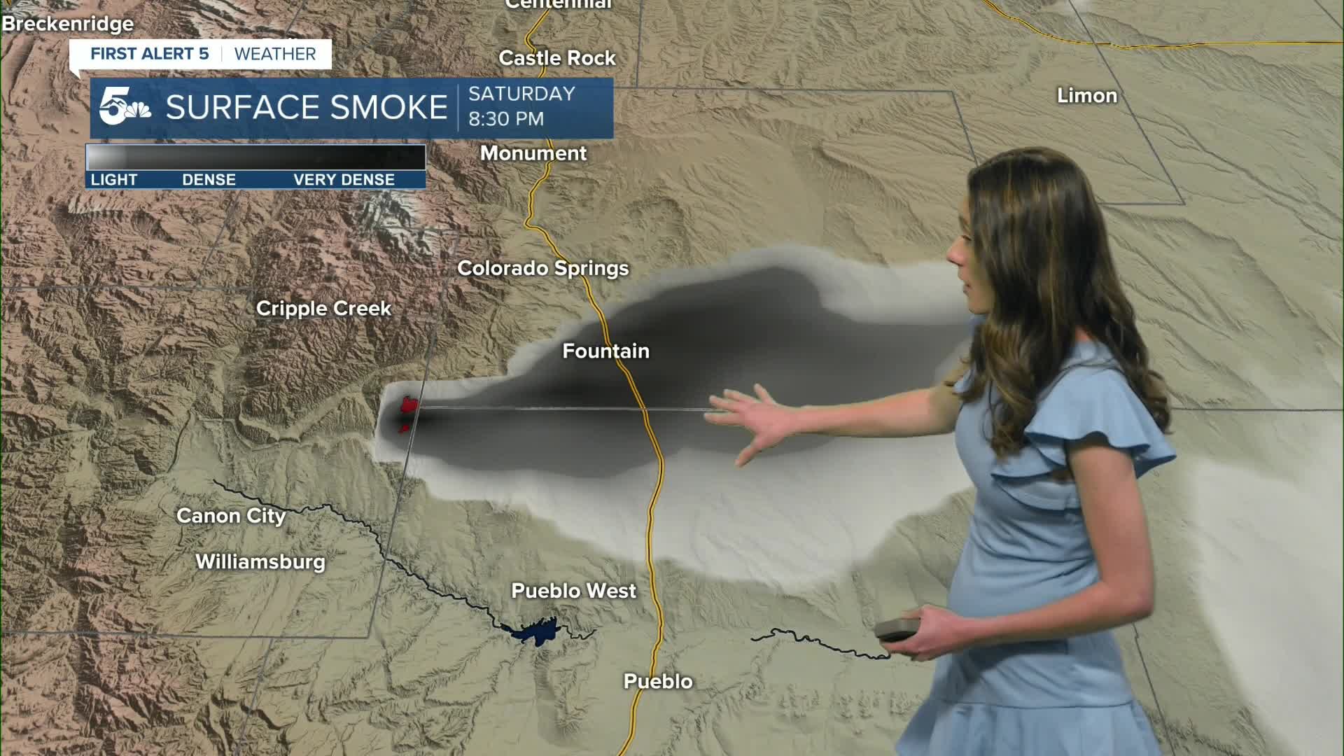
Smoke will remain a concern across the Fort Carson area, as well as parts of El Paso and Pueblo counties. If smoke is present near you, it’s best to stay indoors and keep windows closed.
A cold front moving in overnight will shift winds out of the north, causing the smoke to continue moving through the region rather than settling in one place.
Colorado Springs forecast: Low: 49; High: 68;
Colorado Springs will have smoke throughout the evening. Winds will shift out of the north overnight and help to push some of the smoke south. Unfortunately, winds will also pick up in the morning and this isn't good news for the fire. Highs will be a little cooler, but still warm.
Pueblo forecast: Low: 49; High: 73;
Pueblo will have smoky skies overnight and into tomorrow morning. With the cold front moving through this will likely push smoke further south into parts of Pueblo county. Keep windows closed and stay indoors if the smoke continues to worsen. Highs tomorrow afternoon will be in the lower 70s.
Canon City forecast: Low: 51; High: 73;
Canon City will have morning temperatures in the lower 50s. Smoke will still be visible in the area, if the fire continues to grow. Winds will shift out of the north overnight, and more clouds will move in. Highs will be a few degrees cooler, but still warm.
Woodland Park forecast: Low: 40; High: 64;
Woodland Park will wake up to temperatures in the lower 40s. There will be more clouds tomorrow from the increased moisture from this front. Highs by tomorrow afternoon will be in the mid-60s.
Tri-Lakes forecast: Low: 47; High: 65;
Monument will be mild overnight with temperatures reaching the upper 40s. A cold front will drop highs on Sunday, but these temperatures will still be warm and above average. Afternoon temperatures will be in the mid-60s, and there will be more cloud cover.
Plains forecast: Low: 40s; High: 60s & 70s;
The eastern plains will have some of the strongest gusts tomorrow morning behind this front. Gusts will get up to 40mph. Morning temperatures will be in the 40s. There will be more cloud cover, and temperatures will be a few degrees cooler from yesterday.
Walsenburg and Trinidad forecast: Low: 50/49; High: 70/73;
The southern I-25 corridor may also have some smoke in the area from a fire burning further west. It all depends on how quickly this fire is contained. Morning temperatures will be in the upper 40s and lower 50s. Afternoon highs will be in the lower 70s.
Mountains forecast: Low: 40s; High: 60s & 70s;
The mountains will have clouds move in overnight as temperatures drop into the 40s. Tomorrow will be a cooler day, but still above average. Tomorrow's highs will be in the 60s and 70s for some.
Extended outlook forecast:
Smoke lingering depends on how quickly the fire get contained. This cold front and an inversion overnight definitely won't help. Winds pick up tomorrow morning with gusts reaching 40mph. Highs will begin to warm on Monday. We won't stop there because another ridge builds and brings temperatures back into the 80s and 90s for southern Colorado.
____
Curious about the First Alert 5 Weather Storm Impact Scale? Check out our cheatsheet explainer.
Watch KOAA News5 on your time, anytime with our free streaming app available for your Roku, FireTV, AppleTV and Android TV. Just search KOAA News5, download and start watching.
