

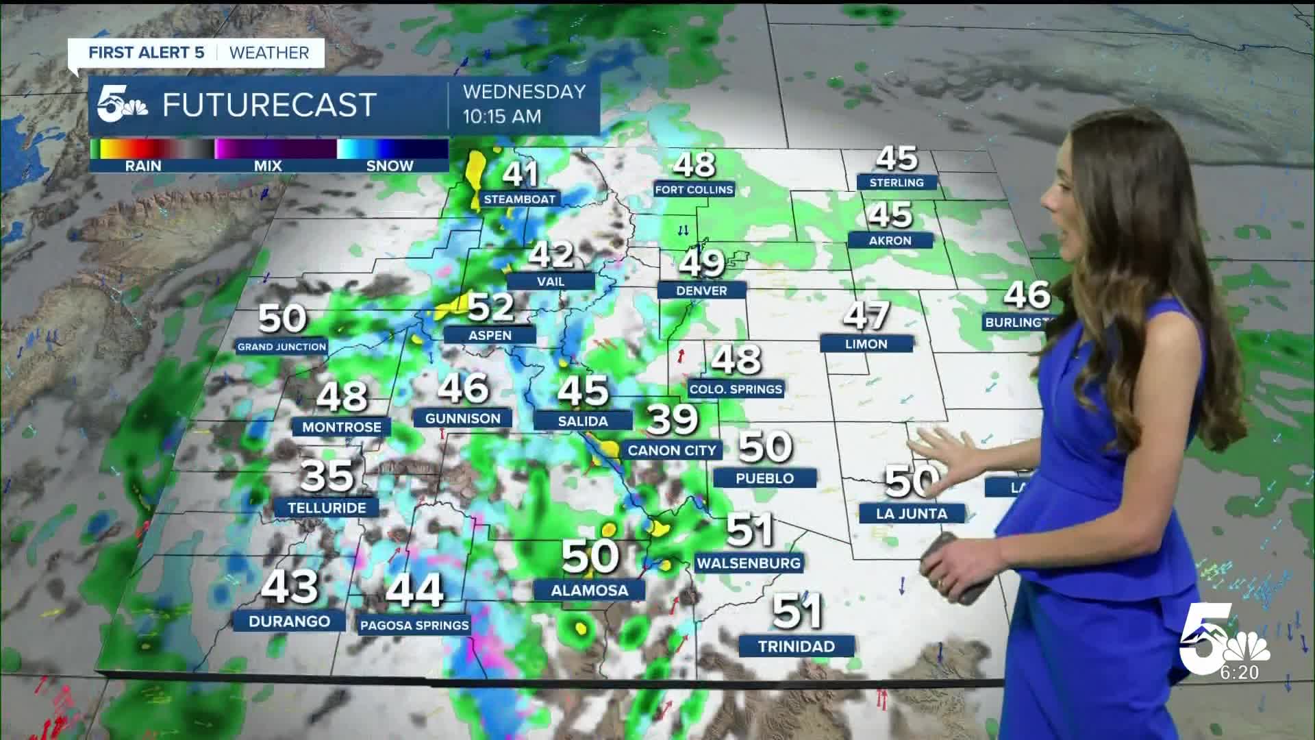


Today’s Forecast:
We have one more day of above average temperatures and sunny conditions before rain and snow moves in. Winds will still be breezy this afternoon and highs will rise into the 70s and 80s. The warmest temperatures will be east of I-25. Higher elevations will have highs in the 60s.
Colorado Springs forecast: High: 71; Low: 43.
Colorado Springs will have temperatures this morning in the lower 40s. These temperatures will rise quickly and eventually get into the lower 70s. Winds won't be as breezy as yesterday, but will slightly increase in the afternoon. Overnight lows headed into Wednesday morning will drop into the lower 40s.
Pueblo forecast: High: 79; Low: 46.
Pueblo will wake up to temperatures in the 40s and 50s this morning. We have another day of bright and sunny conditions. Still tracking above average highs with temperatures breaking back into the 70s. This is the last day before cold temperatures move in over the next few days.
Canon City forecast: High: 73; Low: 48.
Canon City will have morning temperatures in the 40s. There will be a few clouds with rain off towards the west. Not expecting rainfall in the area today and afternoon highs will reach the lower 70s. Winds will be light coming out of the southwest between 5-15mph.
Woodland Park forecast: High: 62; Low: 38.
Temperatures this morning are sitting in the upper 30s, so a jacket may be needed. There are a couple of sprinkles from passing showers, but this will clear out. Still tracking sunny conditions today and above average temperatures. Highs will get back into the 60s.
Tri-Lakes forecast: High: 64; Low: 41.
Monument and the surrounding areas will have temperatures in the lower 40s this morning. These temperatures will rise pretty quickly. Afternoon highs will get into the 60s. Winds will be light coming out of the southwest between 5-15mph. Changes will arrive on Wednesday.
Plains forecast: High: 70s & 80s; Low: 40s.
The eastern plains have calm and clear conditions today and that will last into the afternoon. Temperatures this morning are sitting in the 50s and 60s. We will continue to see a rise in our temperatures as the sun comes out. Afternoon highs will get into the 70s and 80s.
Walsenburg and Trinidad forecast: High: 672/78; Low: 45/42.
This morning temperatures are sitting in the 50s for the southern portion of I-25. Bright and sunny conditions will continue throughout the day and help temperatures to reach the upper 60s and lower 70s. The warmest temperatures will be located near Trinidad. Rain will move in on Wednesday.
Mountains forecast: High: 60s; Low: 30s.
The mountains already have some moisture moving in with rain ongoing. As this low-pressure system moves in it will bring some cooler temperatures and drop snow levels down to 8,000 feet. The ski resorts have a chance to get a couple of inches of snow and for most of the central mountains. This afternoon will still be warm with highs reaching the 60s.
Extended outlook forecast:
This low pressure system is slowing moving towards Colorado and this will bring much cooler temperatures. Highs will take quite a dip with parts of I-25 dropping into the 40s and 50s. Along with this incoming system, there will be some moisture that moves in. Snow will move in for the mountains and will be possible as low as 8,000 feet. Parts of Teller county could wake up to a dusting Thursday morning. Overnight lows will drop into the 30s and 40s. Temperatures will eventually warm back into the 60s and 70s by the weekend.
____
Curious about the First Alert 5 Weather Storm Impact Scale? Check out our cheatsheet explainer.
Watch KOAA News5 on your time, anytime with our free streaming app available for your Roku, FireTV, AppleTV and Android TV. Just search KOAA News5, download and start watching.
