


Today’s Forecast:
We're in for a very hot afternoon with highs in the 90s and 100s.
The winds look light today, so it'll just be hot and uncomfortable through the afternoon.
Storms look very spotty today and generally best west of I-25 over the mountains. Storms would be more likely to push down gusty winds instead of rain east of the mountains.
Colorado Springs forecast: High: 97; Low: 65. Near record heat this afternoon with the current record standing at 98 degrees. We could see spotty showers or thunderstorms late today or early this evening, but we're more likely to see gusty wind than rain.
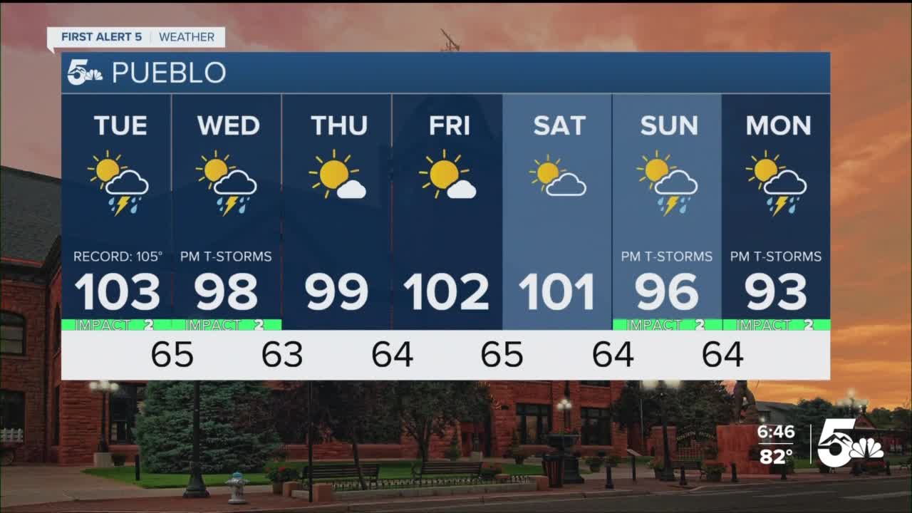
Pueblo forecast: High: 104; Low: 68. Near record heat this afternoon with the current record standing at 105 degrees. We have a very small chance for isolated showers and storms that would put down more wind than rain.
Canon City forecast: High: 99; Low: 71. Really hot today with a small chance for isolated showers or storms at the end of the day. We're more likely to see gusty wind than rain.
Woodland Park forecast: High: 82; Low: 58. Hot with a chance for spotty showers and thunderstorms in the mid to late afternoon.
Tri-Lakes forecast: High: 90s; Low: 60s. Hot with just a small chance for spotty showers or storms in the afternoon.
Plains forecast: High: 100s; Low: 60s. Extremely hot across the plains with widespread high temperatures in the 100s and no cloud cover to provide heat relief.
Walsenburg and Trinidad forecast: High: 90s; Low: 60s. Hot with light winds and a very small chance of spotty showers and storms.
Mountains forecast: High: 80s; Low: 50s. Spotty thunderstorms in the mountains today that would put down more wind than rain.
Extended outlook forecast:
Storm chances look a little better over the next couple of days along and just east of I-25. Storms will still in general be best over the mountains and valleys, but locally we see a better chance in Colorado Springs, Pueblo, and Canon City from Tuesday to Wednesday. Wednesday is probably the best chance for storms along and east of I-25 this week.
We should be drier by the end of the week with only spotty storm chances west of I-25 on Thursday and Friday. Monsoon moisture will return this weekend with Sunday as the wettest day of the weekend.
Next week does look a little cooler with highs in the 80s and 90s.
____
Curious about the First Alert 5 Weather Storm Impact Scale? Check out our cheatsheet explainer.
Watch KOAA News5 on your time, anytime with our free streaming app available for your Roku, FireTV, AppleTV and Android TV. Just search KOAA News5, download and start watching.
