

Tonight's Forecast:
Temperatures will be mild again, getting down into the 30s and 40s. Some clouds will clear out overnight, but will be back tomorrow morning.
Colorado Springs forecast: Low: 47; High: 79;
Colorado Springs will have morning temperatures in the upper 40s. The clouds will stick around and there is a small chance for a spot shower. The majority of the area will stay dry though. Highs will be in the upper 70s.
Pueblo forecast: Low: 44; High: 85;
Pueblo will have overnight temperatures get into the mid-40s. Records are likely going to be broken tomorrow with the previous record at 75 degrees. Afternoon highs will get much warmer than that in the mid-80s. Fire danger will return on Monday.
Canon City forecast: Low: 47; High: 81;
Canon City will have winds calm overnight and clouds will start to clear out. Lows will dip into the upper-40s. Temperatures will climb into the lower-80s during the afternoon. There will be one more day of warm temperatures on Monday before an incoming system cools the area off dramatically.
Woodland Park forecast: Low: 39; High: 69;
Woodland Park will have a few clouds overnight and lows will get into the upper 30s. There will be a chance for some showers in the afternoon. Highs will still be warm making it into the upper 60s.
Tri-Lakes forecast: Low: 47; High: 74;
The Monument area will dip into the upper 40s overnight and into tomorrow morning. Clouds will increase in coverage during the day and winds will be light between 5 and 10mph. Afternoon temperatures will make it into the mid-70s.
Plains forecast: Low: 40s; High: 80s;
The eastern plains are in for another warm day with afternoon highs breaking back into the 80s. Areas near La Junta and Lamar will be in the upper 80s. There will be mostly sunny conditions and winds will be coming out of the southwest at 5 to 10mph.
Walsenburg and Trinidad forecast: Low: 47/44; High: 77/81;
The southern I-25 corridor will dip into the mid-to-lower 40s, but once the sun rises temperatures will heat up quickly. Highs in the afternoon will make it into the upper 70s/lower 80s. Winds will remain light out of the southwest.
Mountains forecast: Low: 30s; High: 70s;
The higher terrain and mountains will be chilly overnight and dip into the 30s. Clouds will increase throughout the day. Winds will be light, but will be stronger towards the mountain peaks. Highs will be in the 70s
Extended outlook forecast:
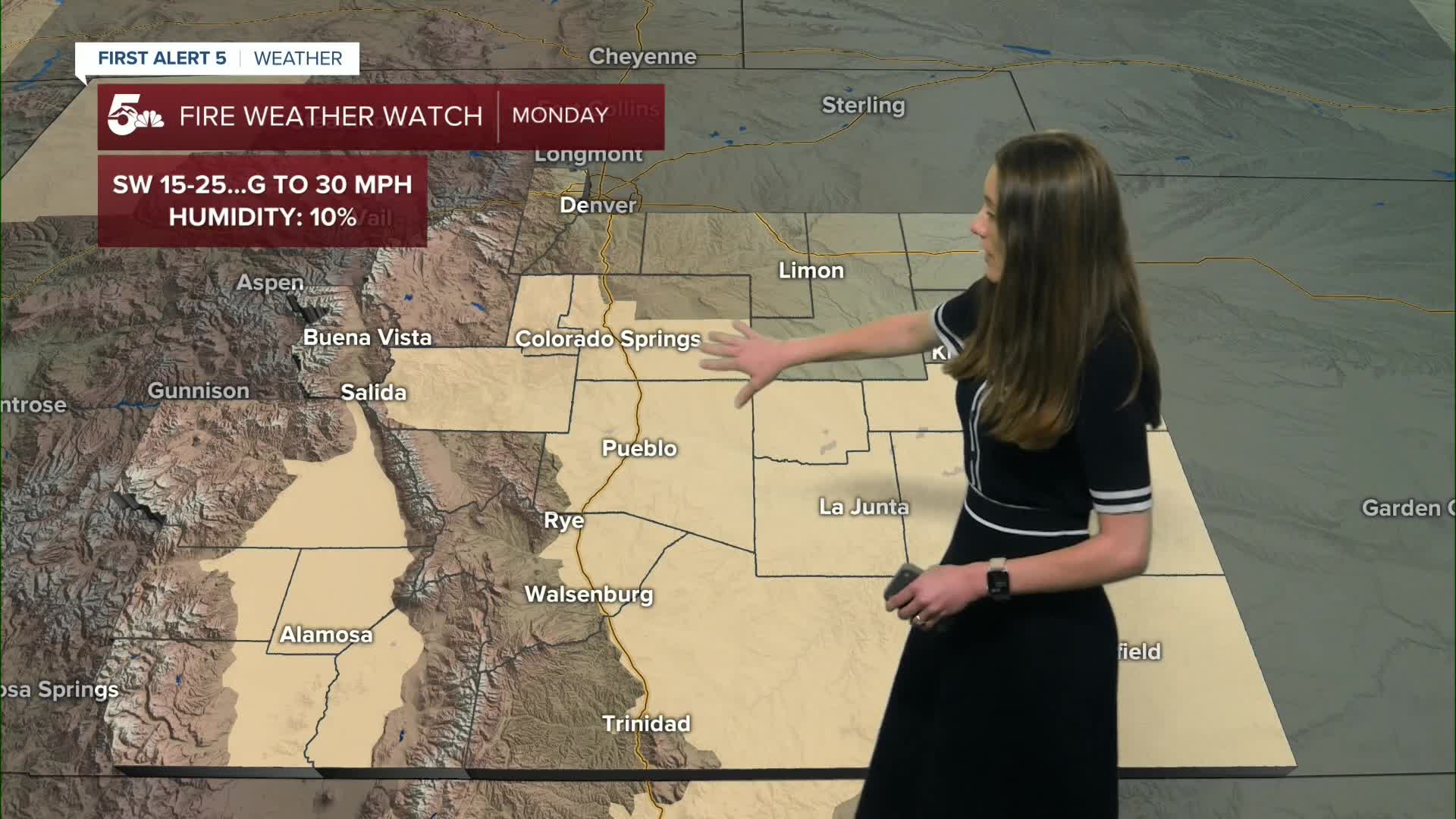
Fire danger returns on Monday with fire weather watches in place throughout the day. A passing low will increase rain and snow chances on Tuesday. This will be mainly during the evening and pick up overnight. Once we get into Wednesday, the chance for precipitation remains, but with temperatures warming this will likely be rain for the I-25 corridor. Beyond that, temperatures warm each day.
____
Curious about the First Alert 5 Weather Storm Impact Scale? Check out our cheatsheet explainer.
Watch KOAA News5 on your time, anytime with our free streaming app available for your Roku, FireTV, AppleTV and Android TV. Just search KOAA News5, download and start watching.
