



Tonight's Forecast:
Tonight, temperatures will gradually cool into the 50s and 60s for I-25. Further east, those temperatures will be in the 60s. The mountains and higher terrain will have temperatures in the 50s.
There will be a few clouds in the area, especially in the Pikes Peak Region. Further south, those clouds will start to thin out. We are not expecting any rain overnight.
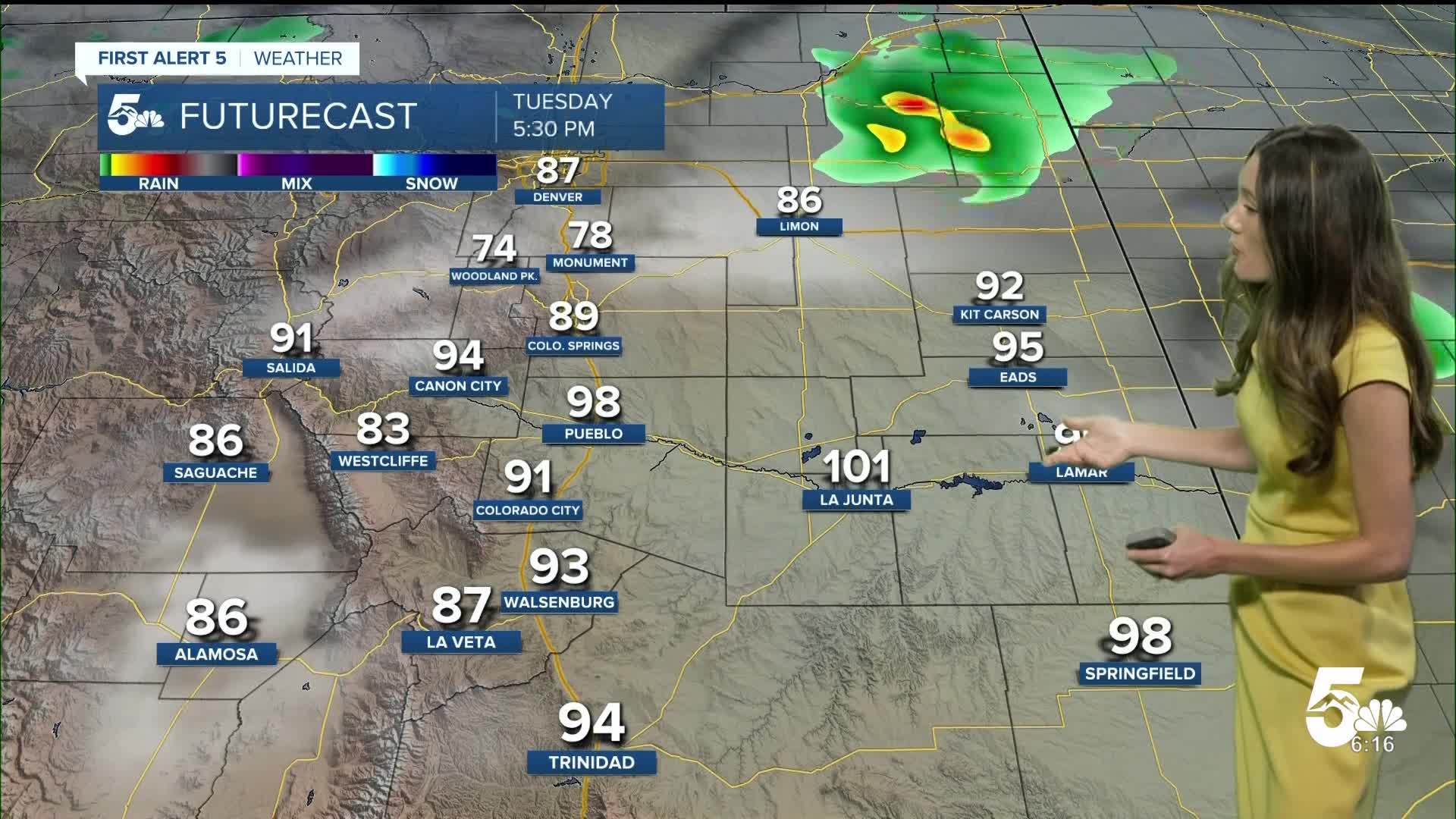
Colorado Springs forecast: Low: 59; High: 91;
Colorado Springs will have morning temperatures in the upper 50s. Expect afternoon highs to be a couple of degrees warmer than Monday. Highs will reach the lower 90s for Colorado Springs. We will have a cold front move in during the evening, and there's a small chance of some showers closer to eastern El Paso county. This chance does remain small, and most of the day will be dry.
Pueblo forecast: Low: 61; High: 98;
Pueblo will have morning temperatures will dip into the lower 60s. Mostly clear conditions will start off in the morning and then more clouds will move in towards the afternoon and evening. Afternoon highs will reach the upper 90s.
Canon City forecast: Low: 63; High: 95;
Canon City will have morning temperatures in the lower 60s. There will be mostly clear conditions throughout the day with more clouds moving in during the afternoon and evening. We are not tracking any rain during the day. Afternoon highs will reach the mid-90s.
Woodland Park forecast: Low: 53; High: 81;
Woodland Park will have overnight lows in the lower 50s. There will be a small chance for an isolated shower in the afternoon. Rain chances will remain around 20%. Winds will be coming out of the southeast around 5-15mph. Afternoon highs will be in the lower 80s.
Tri-Lakes forecast: Low: 54; High: 85;
The Monument area will have overnight lows in the mid-50s. There will be more clouds as the morning goes on, but there will still be sunshine during the day. Afternoon highs will get into the mid-80s. A cold front will move in from the north later in the afternoon.
Plains forecast: Low: 60s; High: 90s & 100s;
The eastern plains will have morning temperatures in the 60s. There will be clouds and sunshine during the day. Highs will be getting into the 90s and 100s.
Walsenburg and Trinidad forecast: Low: 61; High: 92/95;
The southern I-25 corridor will have overnight lows in the lower 60s. Winds will be coming out of the southeast between 5-10mph. Afternoon highs will be in the 90s.
Mountains forecast: Low: 50s; High: 80s;
The mountains will have morning temperatures in the 50s. Afternoon highs will eventually reach the 80s. There is a small chance for a couple of storms over the higher terrain from recycled moisture.
Extended outlook forecast:
A cold front moves in Tuesday evening and will bring cooler temperatures on Wednesday. Storm chances increase in the afternoon and evening. Flash flooding will need to be watched for the Beulah area Wednesday and Thursday. Highs will continue to warm into the weekend.
____
Curious about the First Alert 5 Weather Storm Impact Scale? Check out our cheatsheet explainer.
Watch KOAA News5 on your time, anytime with our free streaming app available for your Roku, FireTV, AppleTV and Android TV. Just search KOAA News5, download and start watching.
