

Tonight's Forecast:
Tonight, more clouds will move into the area with this next incoming system. Overnight lows will drop into the 30s across I-25. By the morning the southern I-25 corridor will have rain and snow in the higher elevations.
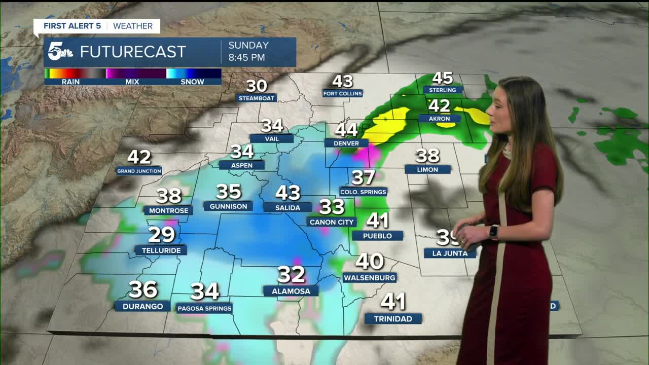
Colorado Springs forecast: Low: 32; High: 48;
Colorado Springs will start to see the rain in the morning, and it will be chilly. Highs will only make it into the 40s. As this low wraps around there is a small chance for higher elevations closer to the Palmer Divide to see a trace of snow. There will be some areas on the north side that will be cooler than other areas. Downtown Colorado Springs will see rain.
Pueblo forecast: Low: 30; High: 48;
Pueblo will have overnight lows in the 30s and by morning more clouds will have pushed into the area. It won't take long for the rain to move in. This will last throughout the morning and into the late afternoon. By the evening mostly clouds will be left behind. Highs will be in the upper 40s.
Canon City forecast: Low: 33; High: 48;
Canon City will have overnight lows very close to freezing and clouds will begin to move into the area. Rain will move in closer to noon, and coverage will increase throughout the day. We are only expecting rain with temperatures in the 40s. Coverage will decrease going into Monday morning.
Woodland Park forecast: Low: 25; High: 45;
Highs will be in the 40s during the afternoon, so it will likely start off as rain. Woodland Park has the chance to add a few inches of snow on the ground. This will likely be as the low pressure system is wrapping around later in the day and winds will switch out of the north. Coverage will begin to decrease overnight Sunday into Monday.
Tri-Lakes forecast: Low: 31; High: 47;
Monument will have overnight lows tonight drop below freezing. Highs in the afternoon will be similar to surrounding areas. Rain moves in during the day. The Palmer Divide has a chance to have a trace of snow in grassy areas.
Plains forecast: Low: 20s; High: 50s;
The Plains will only have rain, but this is still beneficial moisture for the area. Highs in the afternoon will be in the 50s across the area. Rain will be closer to the hwy 50 area by the morning and will decrease in coverage throughout the day.
Walsenburg and Trinidad forecast: Low: 32; High: 49/52;
The southern I-25 corridor will wake up to rain and snow. Snow will move in towards La Veta Pass, and lower elevations like Walsenburg and Trinidad will have rain. Afternoon highs will be in the upper 40s and lower 50s. Western Huerfano county has the best chance to see snow.
Mountains forecast: Low: 20s; High: 40s;
The mountains have a couple of winter weather advisories in place across the San Juans and Sangre de Cristos. The heaviest snow will arrive around 4PM-6PM. Winds will be as strong as 35 mph in some areas, so if you are traveling in the mountains use caution.
Extended outlook forecast:
The week will start off pretty boring with the sun returning and temperatures rising again. A cold front will move in from the north on Tuesday and drop temps back into the 40s again.
Looking ahead to Thanksgiving Day, temperatures will be in the 50s and we will have partly cloudy skies.
____
Curious about the First Alert 5 Weather Storm Impact Scale? Check out our cheatsheet explainer.
Watch KOAA News5 on your time, anytime with our free streaming app available for your Roku, FireTV, AppleTV and Android TV. Just search KOAA News5, download and start watching.
