

Tonight's Forecast:
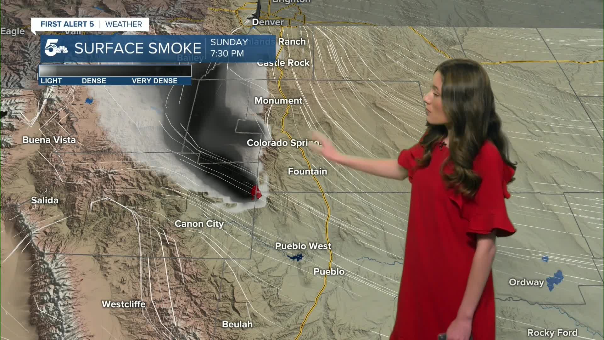
Smoke and haze will get pushed up against the mountains and will linger overnight. Make sure windows are closed and you limit your time outside if you are sensitive. Temperatures will dip into the 30s and 50s.
Colorado Springs forecast: Low: 38; High: 70;
Tomorrow, temperatures will dip into the 30s during the morning. This cold front helped to cool down some of our temperatures for us. The afternoon will still be warm with highs making it into the 70s. Some smoke will also stick around as well.
Pueblo forecast: Low: 38; High: 75;
Pueblo will get into the upper 30s overnight. As this high-pressure builds, temperatures will also warm. Highs in the afternoon will be in the mid- 70s, and warmer than Sunday. Expect highs to warm each day through Wednesday. Some smoke is also possible to stay in the area.
Canon City forecast: Low: 40; High: 75;
Canon City will have more smoke move in overnight. Temperatures will drop into the lower 40s. More sunshine and drier conditions make a return as well and afternoon highs will push into the mid-70s.
Woodland Park forecast: Low: 34; High: 67;
Woodland Park won't get spared from any smoke. With winds pushing this smoke up against the mountains, it's one of the areas that has been seeing the most of it. Highs tomorrow afternoon will be warmer than Sunday. Highs will reach the upper 60s.
Tri-Lakes forecast: Low: 36; High: 67;
Monument and the surrounding area will have overnight temperatures in the mid-30s. Sunshine will return and help temperatures to reach the upper 60s. An upper level ridge will raise temperatures each day through Thursday.
Plains forecast: Low: 30s; High: 70s & 80s;
The eastern plains will have overnight temperatures drop into the 30s. These temperatures will warm quickly once the sun rises. Highs will make it into the 70s and 80s. The warmest temperatures will be towards La Junta.
Walsenburg and Trinidad forecast: Low: 37/38; High: 76/77;
The southern I-25 corridor and surrounding mountains will be under a red flag warning from noon until 7pm on Monday. Conditions will be dry and windy. Highs will make it into the mid-to-upper 70s.
Mountains forecast: Low: 30s; High: 70s;
The mountains will be cool overnight dipping into the 30s. There will be some smoke located in the higher terrain tomorrow for the counties closest to the highway 115 fire. Highs in the afternoon will reach the 70s.
Extended outlook forecast:
A high pressure system builds back in and this means the heat will be back. Fire danger will continue to be a concern for southern Colorado. The best chance to break records will be towards the middle of the week.
A cold front moves in around Friday and highs look to drop back into the 50s. Whether or not we will get moisture will this remains to be seen. This could definitely change and it's something we are keeping a close eye on.
____
Curious about the First Alert 5 Weather Storm Impact Scale? Check out our cheatsheet explainer.
Watch KOAA News5 on your time, anytime with our free streaming app available for your Roku, FireTV, AppleTV and Android TV. Just search KOAA News5, download and start watching.
