

Tonight's Forecast:
There will be a few more showers and thunderstorms this evening, but things will begin to wrap up around 8PM for I-25. There will be some showers that push out towards the far eastern counties and will dissipate overnight. Lows across the area will be in the 50s and 60s.
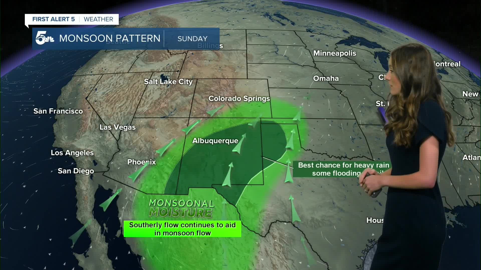
For Sunday, that monsoonal moisture starts to become limited due to the high-pressure system (currently over the central plains) continuing to push East. There will be enough leftover moisture for more showers and thunderstorms to pop back up in the afternoon with enough heating. It will likely not be as widespread as Saturday, but don't be surprised if you run into a shower or two.
Colorado Springs forecast: Low: 59; High: 88;
Morning lows on Sunday will be in the upper 50s. Showers and thunderstorms will return again on Sunday starting around 1PM. Temperatures will remain above average for the next few days in the upper 80s.
Pueblo forecast: Low: 61; High: 96;
Pueblo will have morning lows in the lower 60s. Temperatures will warm quickly Sunday morning and by the afternoon highs will be in the mid-90s. There is a small chance for some afternoon thunderstorms across the area.
Canon City forecast: Low: 59; High: 92;
Canon City will have overnight temperatures in the upper 50s. Any lingering showers and storms will begin to dissipate overnight. A few clouds will be leftover. Storm chances pick up again Sunday afternoon around 12/1PM. Highs will be in the lower 90s.
Woodland Park forecast: Low: 48; High: 78;
Woodland Park will have some chilly morning lows in the upper 40s. Temperatures will stay on the cooler side throughout the day and highs will only make it into the upper 70s. Showers and storms will pick back up during the afternoon.
Tri-Lakes forecast: Low: 56; High: 83;
The Monument area will have a few more showers and thunderstorms this evening, but this will clear overnight. Overnight lows into Sunday morning will be in the mid-50s. Temperatures throughout the day will warm into the lower 80s. Showers and thunderstorms will pick back up in the afternoon.
Plains forecast: Low: 60s; High: 90s;
The plains will have a few isolated storm chances this evening and some showers overnight. Most of the area will stay dry though. Sunday morning lows will be in the 60s. The afternoon will have temperatures in the 90s. Mostly clear conditions will prevail throughout the day.
Walsenburg and Trinidad forecast: Low: 58/57; High: 88/91;
The southern I-25 corridor will have some isolated storms and showers this evening. They will wrap up by the time the sun goes down. Overnight lows will be in the upper 50s across the area. The heat returns on Sunday with highs in the upper 80s closer to Walsenburg and lower 90s for Trinidad. Some isolated storms will be possible throughout the day.
Mountains forecast: Low: 40s & 50s; High: 80s;
The higher terrain will have the best chances for rain on Sunday and this will last throughout the day, and pick up coverage later in the afternoon. Highs will be in the 80s for the higher terrain.
Extended outlook forecast:
Looking ahead, the beginning of the work week will still have some isolated rain chances.Recycled moisture and daytime heating will keep storms and showers popping up each afternoon until Wednesday. This is when we will start to dry out. The warmest temperatures are set to arrive in Thursday and they will be above average. Rain chances return into Friday and the weekend.
____
Curious about the First Alert 5 Weather Storm Impact Scale? Check out our cheatsheet explainer.
Watch KOAA News5 on your time, anytime with our free streaming app available for your Roku, FireTV, AppleTV and Android TV. Just search KOAA News5, download and start watching.
