

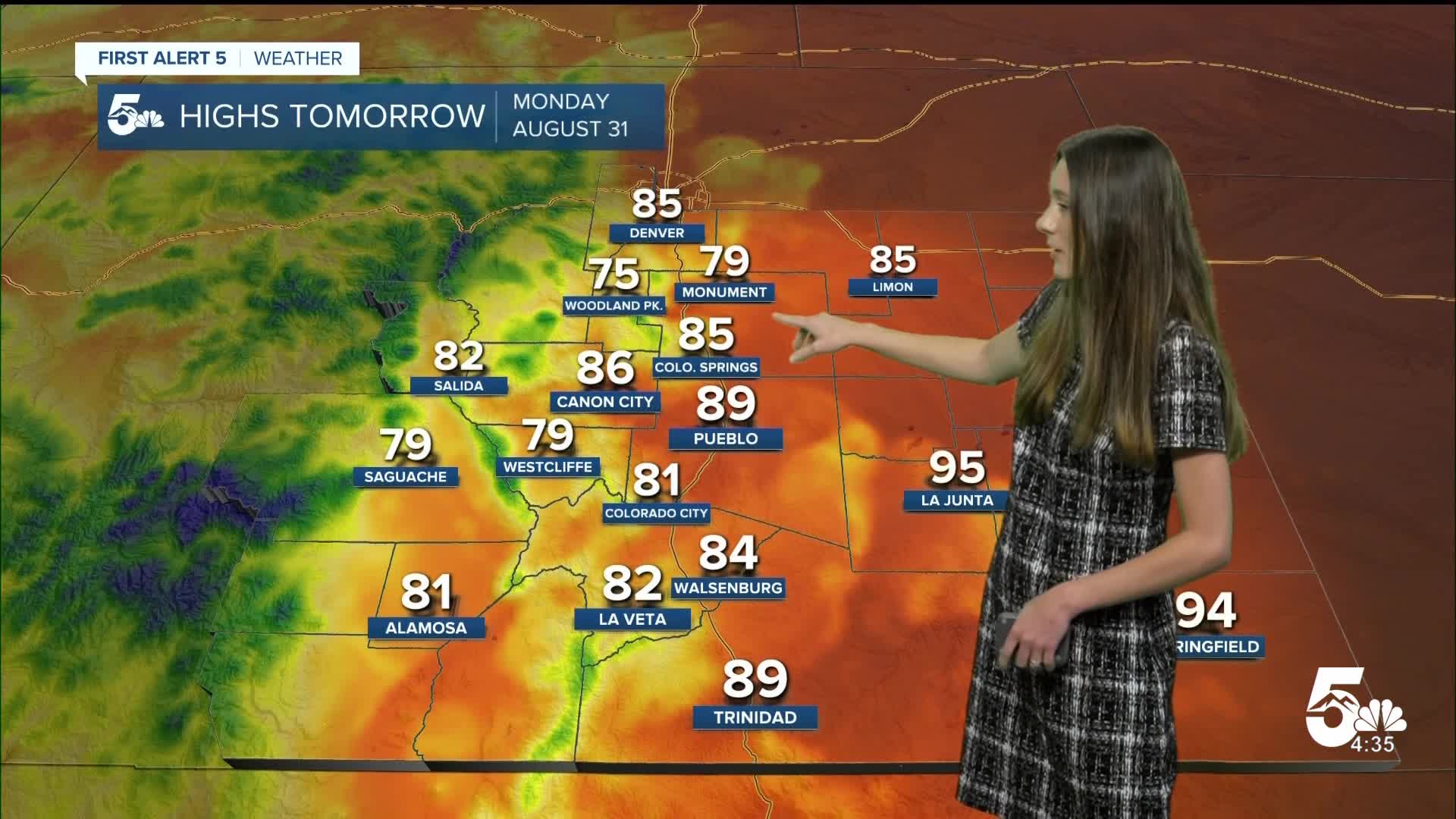


Tonight's Forecast:
Tonight, there will be a few showers over the eastern plains, but most of us will stay dry. This stubborn layer of clouds will stick around into tomorrow. Overnight lows will dip into the 50s and 60s.
Colorado Springs forecast: Low: 59; High: 85;
Colorado Springs will have some clouds overnight, but conditions will stay calm. Overnight lows will dip into the upper 50s. By the afternoon, more storms will move into the Pikes Peak Region. Highs will be a few degrees cooler than Sunday dipping into the mid-80s.
Pueblo forecast: Low: 62; High: 89;
Pueblo will have overnight lows hit the lower 60s. There will be a little bit of sunshine in the morning, but that stubborn cloud layer will be sticking around. Rain chances will increase in the afternoon and this will help to cool us off a few degrees. Highs will get into the upper 80s.
Canon City forecast: Low: 65; High: 86;
Canon City will dip into the mid-60s overnight. Temperatures won't be quite as warm as Sunday with afternoon highs getting into the mid-80s. With the clouds sticking around, it will prevent our temperatures from getting too warm. Rain chances will also help to cool things off in the afternoon.
Woodland Park forecast: Low: 56; High: 75;
Woodland Park has a few more days of some afternoon rain chances. Morning temperatures on Monday will be in the mid-50s. Afternoon highs will be a touch cooler than Sunday in the mid-70s.
Tri-Lakes forecast: Low: 56; High: 79;
The Monument area wil have morning temperatures in the mid-50s. There will be a layer of clouds in the morning and the afternoon will bring more showers and storms. Afternoon highs will get into the upper 70s.
Plains forecast: Low: 60s; High: 90s;
The eastern plains will have a few small showers overnight. Temperatures will dip into the 60s. By the afternoon, more rain will arrive and temperatures will top out in the 90s.
Walsenburg and Trinidad forecast: Low: 61/59; High: 84/89;
The southern I-25 corridor will have overnight lows in the upper-50s and lower 60s. With more moisture in place we will have another round of showers and storms in the afternoon. Highs will eventually get into the mid-to-upper 80s.
Mountains forecast: Low: 50s; High: 70s;
The mountains will have a flood watch in effect until Monday evening. This is for the western slope and central mountains. Rain will return on Monday afternoon ad highs will reach the 70s.
Extended outlook forecast:
Tuesday will start to dry out for the majority of us. There will still be enough leftover moisture for a couple of isolated showers and storms, but this will mainly be for the mountains. Wednesday will start to warm as another high shifts back over Colorado. This will keep our conditions dry and warm. Our highs will stay stagnant and will stay in the 80s and 90s.
____
Curious about the First Alert 5 Weather Storm Impact Scale? Check out our cheatsheet explainer.
Watch KOAA News5 on your time, anytime with our free streaming app available for your Roku, FireTV, AppleTV and Android TV. Just search KOAA News5, download and start watching.
