


Today’s Forecast:
We have a very active 24 hours ahead of us here in southern Colorado. The forecast today focuses on High wind and fire danger, but tomorrow we'll be talking cold and snow!
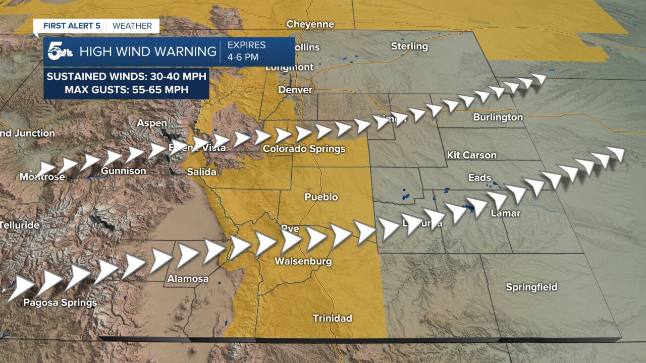
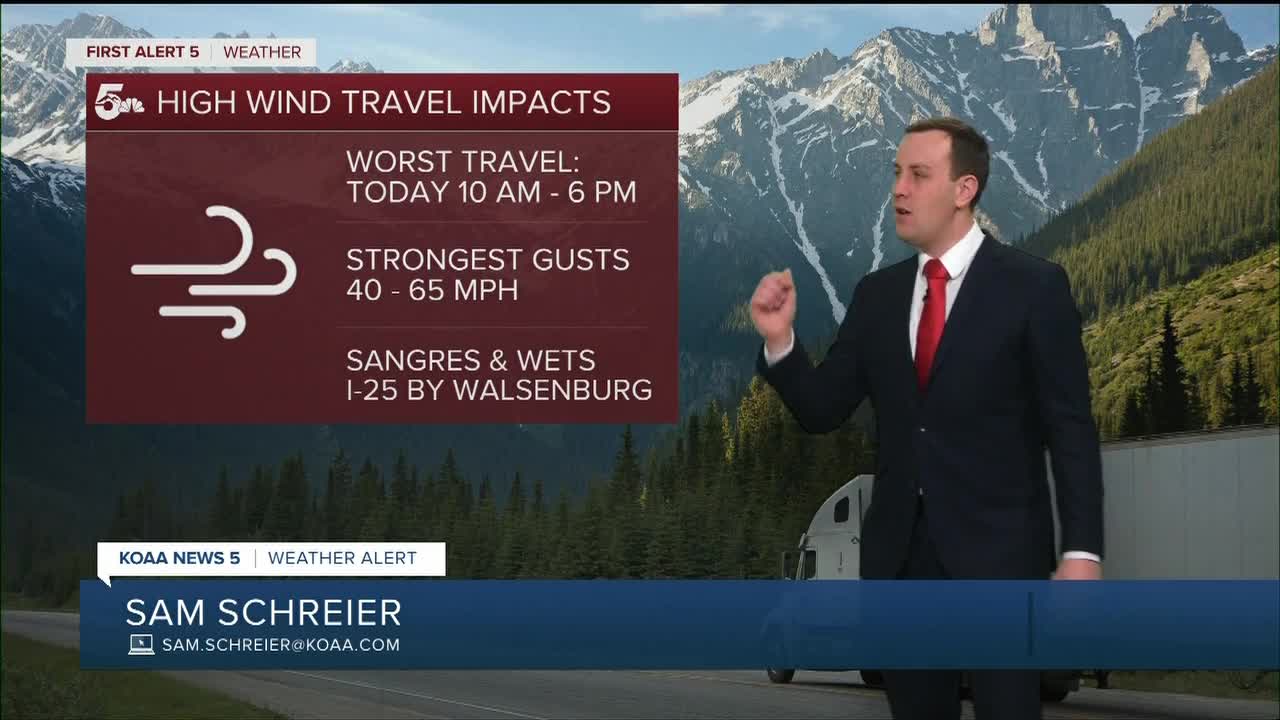
A high wind warning is in effect across the mountains, valleys, and I-25 corridor today through the end of the afternoon. The wind gusts will be strongest over the mountains and passes, but we could have widespread 40 to 60 mph gusts in the valleys and even out near the I-25 corridor. I-25 near Walsenburg could see wind restrictions this afternoon.
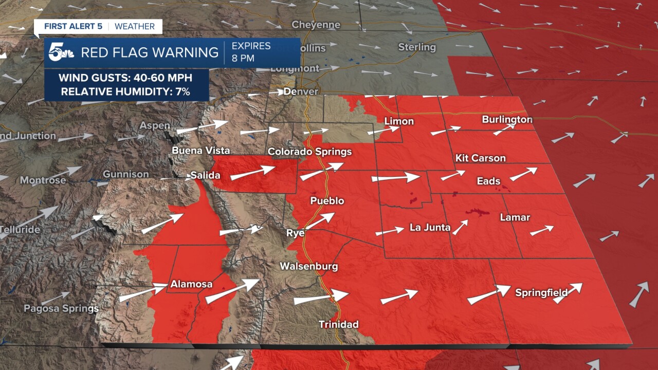
Grass fires will be a huge concern today from high winds and low humidity later this afternoon. Any flame that catches today could spread easily and quickly in the plains. If you see smoke today, report it quickly.
COLORADO SPRINGS: High: 75; Low: 26. Warm and very windy today with high fire danger in the grassy areas. Gusts could be in the 40 mph range at their highest today, possibly higher on the west side of town near the foothills. Any spark in the grass could ignite and spread quickly today, so no burning.
PUEBLO: High: 83; Low: 30. Hot and windy today with gusts in the 40 to 50 mph range today. Grass fires would be a big concern today so no burning and the gusts could impact semi-truck driving especially south of town to Walsenburg.
CANON CITY: High: 79; Low: 29. Warm with strong winds gusts and high fire danger today. Gusts could be as high as 50 mph and any spark today could easily ignite and spread quickly through pretty much all of Fremont County. No burning and watch the chains on trailers so they don't drag and spark.
WOODLAND PARK: High: 58; Low: 17. Very windy and dry today with elevated fire danger over any grassy areas. Winds gusts could be as high as 55 mph today with a westerly direction.
TRI-LAKES: High: 60s; Low: 10s. Windy and warm today with gusts in the 30 to 40 mph range this afternoon. Grass fire concern is high today with snow likely to start forming late tonight through Tuesday morning.
PLAINS: High: 80s; Low: 30s. Dry, hot, and very windy today with strong west to southwest wind gusts in the 30 to 40 mph range. Grass fires will be a big concern over the dry plains, so no burning and check for dragging chains on any trailers.
WALSENBURG/TRINIDAD: High: 70s; Low: 20s. Warm and windy today with some of the strongest gusts along I-25 from Colorado City through Aguiar. If we see a wind restriction or today or if I-25 was closed for wind, it would be in that stretch. La Veta Pass could see an easy 60 mph wind gusts, and I-25 south of Pueblo could see daytime gusts in the 55 to 65 mph range.
MOUNTAINS: High: 60s; Low: 20s. Very strong winds today in the mountains and surrounding valleys from the morning through the end of the day. We could see high mountain gusts over 60 mph, but most of the gusts from mid-mountain down to the valleys will max out between 45 to 65 mph. We stay dry today and tonight but snow moves in from the north tonight through Tuesday afternoon.
Extended Outlook:
A cold front tonight slams in from the north with more wind overnight and snow.
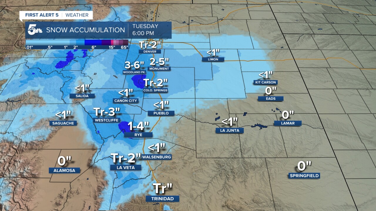
Snow will accumulate from the morning through the early afternoon, but there could be some mountain accumulation into the end of the day. We'll stay dry through the rest of the week with highs back in the 70s and 80s through the weekend.
KOAA News5 on your time, streaming on your Roku, FireTV, AppleTV and AndroidTV.
News5 App | First Alert 5 Weather App | Youtube | Facebook | Instagram | Twitter
