

Today’s Forecast:
Heavy rain is expected to return to southern Colorado today and tonight, elevating flooding concerns from the mountains through the plains. Storms will start over the mountains and then push east to the I-25 corridor and plains from the late afternoon through the overnight hours. Burn Scar flooding is not only possible, but expected later today, especially in and around the mountains where rain has fallen heavier over the last few days. Storms will dry up across the plains not too long after midnight and leave us with a dry start to Friday. While severe weather is not expected, plenty of lightning, small hail, and localized street flooding is possible.
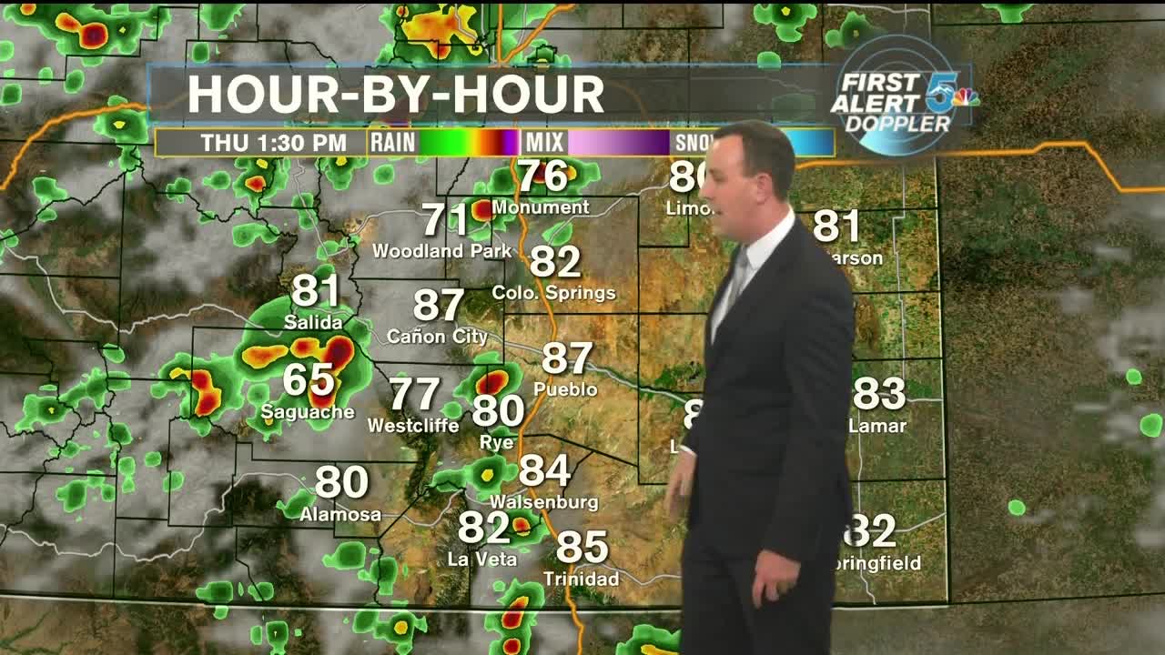
COLORADO SPRINGS: High - 84; Low - 57. Thunderstorms with heavy rain, lighting, and localized flooding arrive in the afternoon and leave to the east overnight. Small hail is also possible in some of the stronger storms.
PUEBLO: High - 92; Low - 62. Hot and muggy through the early afternoon with thunderstorms arriving at the end of the day and leaving to the eastern plains overnight. Heavy rain, lightning, localized flooding, and small hail are possible.
CANON CITY: High - 88; Low - 62. Thunderstorms with heavy rain, lighting, and localized flooding arrive in the afternoon and leave to the east overnight. Small hail is also possible in some of the stronger storms.
WOODLAND PARK: High - 72; Low - 53. Thunderstorms with heavy rain, lighting, and possible flash flooding arrive in the afternoon and leave to the east overnight. Small hail is also possible in some of the stronger storms.
TRI-LAKES: High - 70s; Low - 50s. Thunderstorms with heavy rain, lighting, and localized flooding arrive in the afternoon and leave to the east overnight. Small hail is also possible in some of the stronger storms.
PLAINS: High - 90s; Low - 60s. Hot and muggy in the afternoon with storms arriving tonight and lasting till a few hours after midnight. Heavy rain, lightning, strong winds, and small hail are all possible in storms tonight.
WALSENBURG/TRINIDAD: High - 80s; Low - 50s. Thunderstorms with heavy rain, lighting, and localized flooding arrive in the afternoon and leave to the east overnight. Small hail is also possible in some of the stronger storms.
Extended Outlook:
Friday starts dry but we'll still have enough monsoon moisture rattling around in the mountains to spark some scattered storms in the afternoon and early evening, a few of which could wander into the I-25 corridor. Rain chances ramp up again through the weekend with some storms looking like they could be strong to severe, especially on Sunday. Drier and hotter air comes back by Monday and Tuesday.
