
Tonight's Forecast:
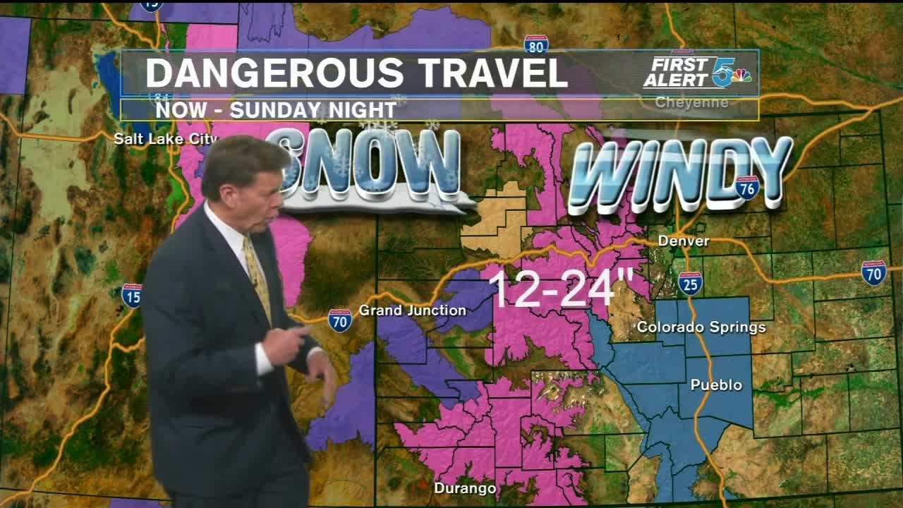
Snow across the high country in and around the Continental Divide will pick up in intensity overnight and continue as heavy snow through the day Saturday. The winds will relax overnight through southern Colorado, and we'll have a few areas see overnight light snow, most likely through Teller and western Fremont Counties. Light snow and flurries are more likely early Saturday morning in Fremont, Teller, and El Paso County, with a few flakes and flurries possible near Pueblo and Crowley county.
The bulk of the day Saturday will be dry and chilly, with lighter winds and cloudy skies. Snow will move into our southern mountains late Saturday night, and become heavy and widespread through the region on Sunday.
COLORADO SPRINGS: Low: 23; High: 40. Winds dying overnight with cloudy skies and temperatures falling into the low 20s. Light snow showers and flurries are possible in the morning, with dry skies expected through the afternoon and evening.
PUEBLO: Low: 24; High: 47. Winds relaxing overnight with cloudy skies and low falling into the mid 20s. Flurries are possible early in the morning with dry skies expected through the afternoon and evening.
CANON CITY: Low: 29; High: 45. Winds dying overnight with cloudy skies and occasional flurries or light snow, especially in western Fremont County. Light snow or flurries are more likely early Saturday morning, with dry skies expected in the afternoon and evening.
WOODLAND PARK: Low: 22; High: 39. Relaxing winds overnight with occasional flurries and lows falling into the low 20s. Light snow is expected early Saturday morning, with stray flurries possible off and on through the day, even though the chances of dry skies in the afternoon are fairly high.
TRI-LAKES: Low: 20s; High: 30s. Winds dying overnight with lows falling into the low 20s. Light snow to flurries are possible early Saturday morning with dry skies expected from the afternoon to the evening hours.
PLAINS: Low: 20; High: 40s. Relaxing winds overnight with cloudy skeis and lows falling into the low 20s by Saturday morning. A few flurries are possible east of El Paso and Pueblo counties early Saturday morning, with dry skies expected in the afternoon and evening hours.
WALSENBURG/TRINIDAD: Low: 20s; High: 40s. Breezy overnight with dry skies and lows falling into the 20s. Saturday will likely stay dry from Walsenburg to Trinidad, but light snow is possible out west across the mountains, espeically Saturday night.
Extended Outlook:
Snow will intensify and become more widespread through the region on Sunday. Snow will fall in waves all day Sunday, ending late Sunday night or early Monday morning. Temperatures will be in the 20s and falling during the day Sunday, with lows in the teens by Monday morning. Snow totals will need refined over the weekend, but the Colorado Springs will see a range of 3 to 6 inches, 6 to 9 in Woodland Park, 4 to 7 in Canon City, 2 to 5 in Pueblo, 1 to 3 Trinidad, and 2 to 4 in La Junta, with 6 to 12 inches likely from the Wet Mountains west and down along the Sangre De Cristos.
