

Tonight's Forecast:
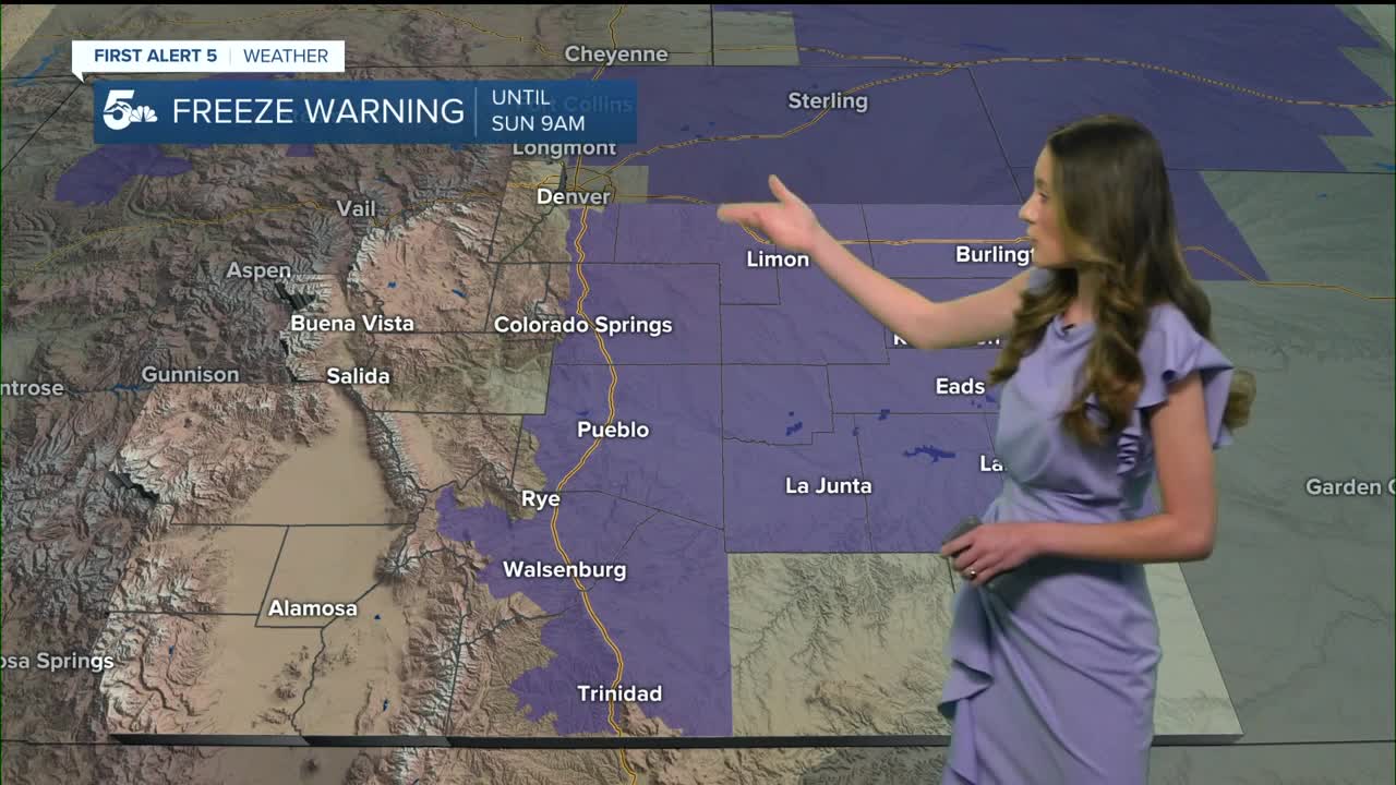
Freeze warnings are in place for I-25 and highway 50 until 9AM. Overnight lows will dip into the lower 30s across the area. Bring in any potted plants and cover exposed pipes.
Colorado Springs forecast: Low: 30; High: 76;
Tonight, temperatures will dip into the lower 30s, but by the afternoon temperatures will rise into the mid-70s. Breezy conditions will remain, but winds won't be as strong as they were on Saturday.
Pueblo forecast: Low: 31; High: 80;
Pueblo will have overnight lows in the lower 30s, but once the sun rises these temperatures will rise back into the 80s. Some breezy conditions will remain, but sustained winds will be between 5-15mph.
Canon City forecast: Low: 35; High: 78;
A frost advisory is in place for Canon City and temperatures won't quite make it to freezing. It is still a good idea to take any extra precautions. Highs will be in the upper 70s later on in the day.
Woodland Park forecast: Low: 29; High: 67;
Woodland Park will have lows in the upper 20s, and across Teller county. Highs will be cooler than what they have been recently, but still comfortable. There will still be plenty of sunshine throughout the day.
Tri-Lakes forecast: Low: 32; High: 73;
The Monument area will get right around freezing overnight. Freeze warnings are in place until 9AM on Sunday. Temperatures in the afternoon will rise into the lower 70s. Breezy conditions will pick up during the afternoon between 15-25mph.
Plains forecast: Low: 30s; High: 70s & 80s;
The plains are also included in the overnight freeze watches. Baca and Eastern Las Animas counties are included within the frost advisory where temperatures won't be as cold. By the afternoon temperatures will rebound back into the 70s and 80s.
Walsenburg and Trinidad forecast: Low: 34/35; High: 77/80;
The southern I-25 corridor overnight lows will reach the mid-30s. Freeze warnings are in place until 9AM on Sunday. Downsloping winds and sunshine will help to warm things up going into the afternoon. Highs will be in the upper 70s and lower 80s.
Mountains forecast: Low: 20s & 30s; High: 60s & 70s;
The mountains will have the coolest overnight temperatures in the 20s in some areas. Clear conditions will remain overnight and into tomorrow. Afternoon highs will be in the 60s and 70s.
Extended outlook forecast:
Fire weather watches are in place for Monday. With dry and gusty conditions there is a concern for fire danger. Temperatures will cool a touch to start off the work week. 60s will stick around for most of the area throughout the week.
We are tracking a low-pressure system that will increase the moisture on Thursday. This will also increase rain chances throughout the area. For the higher terrain a wintry mix is possible, but only rain for the I-25 corridor.
____
Curious about the First Alert 5 Weather Storm Impact Scale? Check out our cheatsheet explainer.
Watch KOAA News5 on your time, anytime with our free streaming app available for your Roku, FireTV, AppleTV and Android TV. Just search KOAA News5, download and start watching.
