

Tonight's Forecast:
Rain will last into the overnight hours and will be heavy at times. Overnight lows will be in the 50s across southern Colorado. The flood watch will expire at midnight.
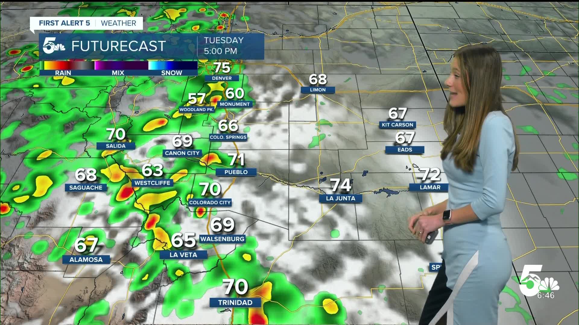
Temperatures going into Tuesday will remain on the cooler side with highs in the 60s and 70s. Heavy rain will move back into the area starting in the afternoon.
Colorado Springs forecast: Low: 54; High: 67;
Colorado Springs will have another day of heavy rain which will pick up around 3PM. These showers and storms will make their way off of the higher terrain. No flood watches are in effect at the moment, but we could still see flash flooding across the area.
Pueblo forecast: Low: 57; High: 74;
Pueblo will have a couple of storms overnight, and clouds will linger through the morning. Temperatures overnight will be in the upper 50s. Rain will return around 3PM for the Pueblo area, and will become heavy at times. Highs will stay cool in the 70s.
Canon City forecast: Low: 58; High: 72;
Canon City will clear out overnight except for the cloud cover. Rain will return into the forecast Tuesday afternoon. Flash flooding will remain a concern throughout the day. Overnight lows will be in the upper 50s and by the afternoon temperatures will be in the lower 70s.
Woodland Park forecast: Low: 46; High: 61;
Woodland Park is included in the flash flood watch until midnight. Once get we get into Tuesday morning, rain will calm but will return by the afternoon. Overnight lows will drop into the mid-40s. Afternoon highs will be in the lower 60s.
Tri-Lakes forecast: Low: 51; High: 65;
The Monument area will have a few more showers Monday evening. Waking up, temperatures will be in the lower 50s. By the afternoon rain will pick up again and keep our highs cool for the day.
Plains forecast: Low: 50s; High: 60s & 70s;
The plains will have some overnight showers across the area, especially along highway 50. Rain will return tomorrow and will be heavy at times. Highs will be in the 60s and 70s.
Walsenburg and Trinidad forecast: Low: 56/55; High: 72/74;
The southern I-25 corridor will have rain throughout Monday evening and into the overnight hours. Temperatures will dip into the mid-50s by morning. Highs will be in the 70s on Tuesday. Rain will return by the afternoon and keep everything cool.
Mountains forecast: Low: 50s; High: 70s;
The mountains will have higher rain chances going into Tuesday. There is a slight risk (2/4) for excessive rainfall for the mountains. Flash flooding will remain a concern for the higher terrain. Temperatures will be in the 70s.
Extended outlook forecast:
Rain will last throughout the week, with the heaviest rain Tuesday through Thursday. Rain chances will linger into the weekend, but rain won't be as heavy or widespread.
____
Curious about the First Alert 5 Weather Storm Impact Scale? Check out our cheatsheet explainer.
Watch KOAA News5 on your time, anytime with our free streaming app available for your Roku, FireTV, AppleTV and Android TV. Just search KOAA News5, download and start watching.
