

Tonight's Forecast:
Severe storms will be possible until 9PM this evening. Main threats will be large hail between 1-2" in diameter, strong winds up to 70mph, flooding, and an isolated tornado. The severe thunderstorm watch is set to expire at 9PM this evening.
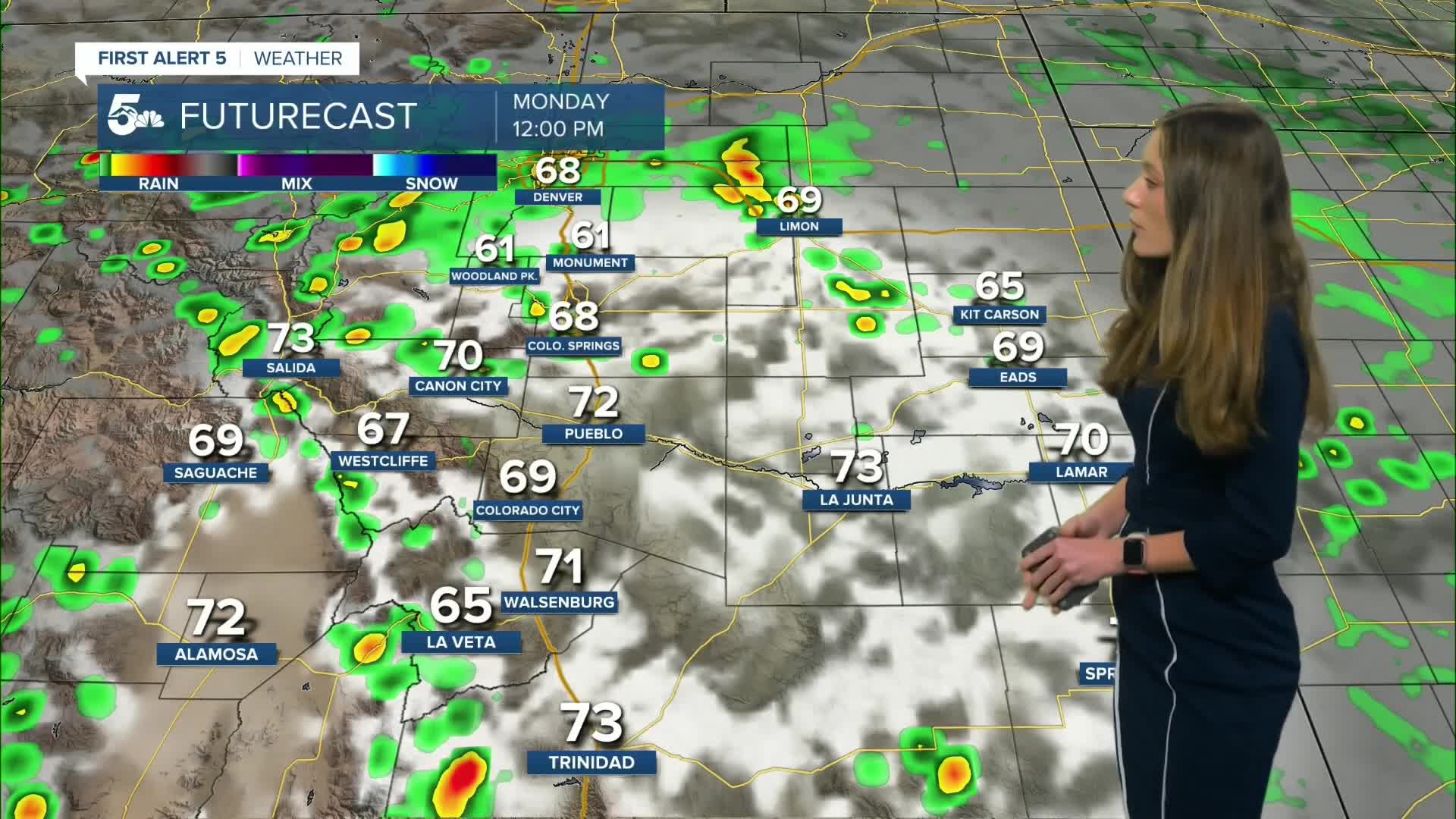
Monday, temperatures will remain cool and rain will become heavy at times. There is an increased risk for flash flooding, especially burn scars. A flood watch is in effect for the southern mountains from Monday 12PM until 12AM on Tuesday. Conditions will be favorable for flash flooding. If you experience flash flooding get to higher ground, and do not stop under bridges or overpasses on the highway!
Colorado Springs forecast: Low: 57; High: 70;
Colorado Springs will have overnight lows in the upper 50s, and rain will be possible overnight. Showers and storms will pop up around 11AM for the higher terrain and become widespread and heavy by the time it gets to the I-25 corridor. Manitou Springs will be a place to watch for flash flooding as well. Highs will be on the cooler side in the lower 70s.
Pueblo forecast: Low: 58; High: 77;
Pueblo's severe risk will diminish on Monday, but a few storms will still roll through the area. Flash flooding will be the primary concern. Heavy rain will pick up around 3PM, and last throughout the evening. Highs will be in the upper 70s.
Canon City forecast: Low: 59; High: 73;
Canon City will have heavy rain on Monday starting in the early afternoon. Parts of western Fremont county are included within the flood watch starting at noon. Creeks and lower lying areas will be susceptible to flooding. The flooding may move in quickly, so check the forecast before heading outside. Temperatures will be cool in the lower 70s.
Woodland Park forecast: Low: 50; High: 62;
Showers and thunderstorms will pick up early Monday afternoon. Rain will become heavy at times, and flooding is a possibility on streets and sidewalks. Highs will be on the cooler side in the lower 60s.
Tri-Lakes forecast: Low: 53; High: 66;
The Monument area will have overnight lows in the lower 50s with some lingering showers possible. Rain will pick up during the afternoon on Monday and it will be heavy at times. Highs will also be on the cooler side in the mid-60s, which is below average for this time of year.
Plains forecast: Low: 60s; High: 70s;
The plains will see leftover rain from Sunday night's storms. Clouds will stick around through the morning. Rain chances pick up in the late afternoon and will last through the evening. Temperatures will be the warmest along the Arkansas River, but it will still be below average.
Walsenburg and Trinidad forecast: Low: 57; High: 72/74;
The southern I-25 corridor and southern mountains have the highest chances for flash flooding going into Monday afternoon. All of Huerfano county and parts of western Las Animas will be included within the flood watch.
Mountains forecast: Low: 50s; High: 70s;
The mountains will also be included in the flood watch starting at noon on Monday. Some areas to watch will be the Oak Ridge and Deeker burn scars. Flash flooding can happen quickly, so check the forecast before heading into the mountains.
Extended outlook forecast:
Heavy rain is expected to continue through the week which will continue to elevate our flash flooding risk across southern Colorado. Drier air will move into the area towards the weekend and will help to limit storm and rain chances.
____
Curious about the First Alert 5 Weather Storm Impact Scale? Check out our cheatsheet explainer.
Watch KOAA News5 on your time, anytime with our free streaming app available for your Roku, FireTV, AppleTV and Android TV. Just search KOAA News5, download and start watching.
