


Tonight's Forecast:
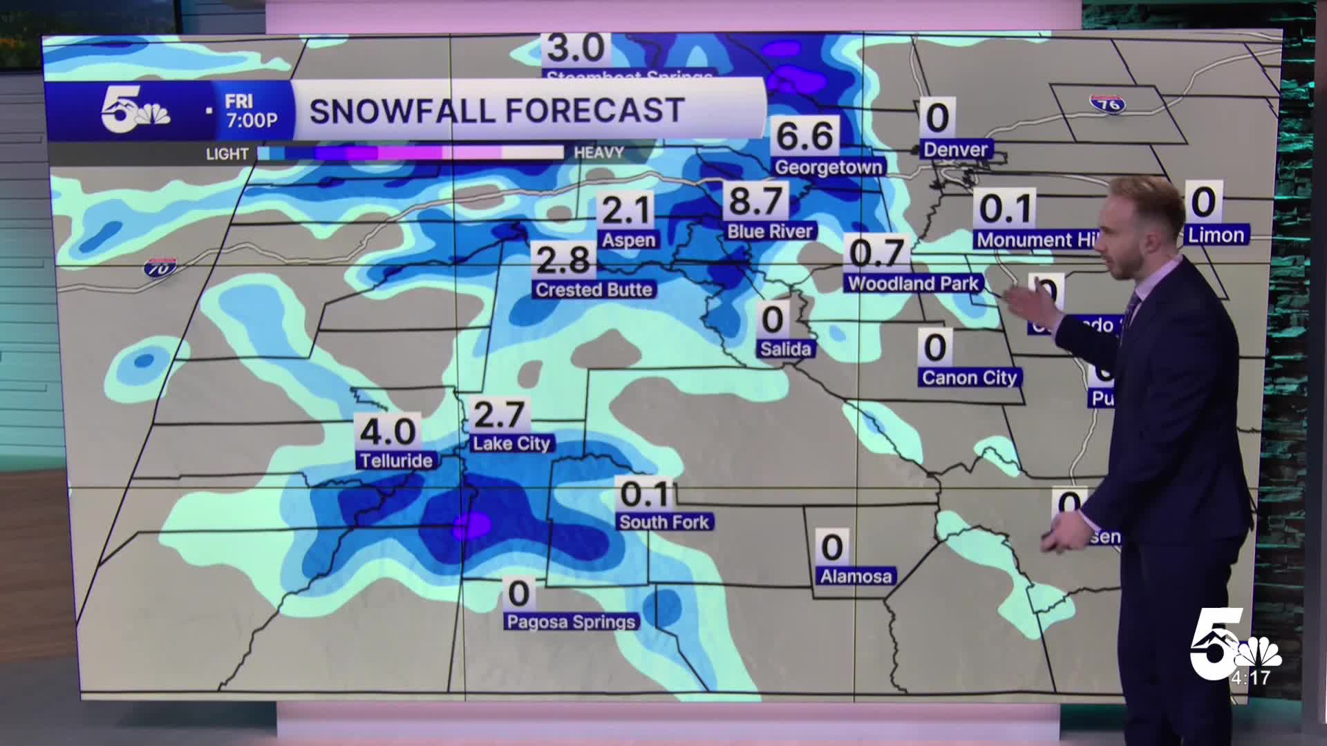
Tuesday night will see a cold front continue to push across Southern Colorado, bringing increasing cloud cover, gusty winds, and lower temperatures. Moist southwesterly flow will bring rain and mountain snow across the high country overnight. Snow levels dropping around 8,000 feet. Expect overnight lows to drop into the 30s and 40s across the lower elevations and mountain valleys.
Colorado Springs forecast: Low: 45; High: 51;
Wednesday will be much cooler across the Pikes Peak region behind the cold front. Low clouds and easterly upslope flow will keep conditions gray, with rain showers spreading across the area through the day. Highs will only reach the lower 50s.
Pueblo forecast: Low: 48; High: 55;
Pueblo will see a noticeable drop in temperatures on Wednesday with highs topping out in the mid-50s. Low stratus clouds and cool easterly breezes will dominate, with widespread rain showers spreading across the plains through Wednesday afternoon and evening.
Canon City forecast: Low: 49; High: 53;
Highs in Canon City will reach the lower 50s on Wednesday. Expect cloudy skies with widespread rain showers developing during the day. Higher terrain west of town will see snow levels drop through Wednesday night, bringing winter driving conditions to surrounding mountain passes.
Woodland Park forecast: Low: 40; High: 42;
Woodland Park will see a chilly, winter-like day on Wednesday with highs in the lower 40s. Rain and snow showers will build through the afternoon, with snow accumulations expected for Teller County.
Extended Forecast:
Noticeably cooler, wet, and active weather dominates through Thursday morning before dry and warmer conditions return for the weekend.
- Wednesday Night – Thursday: Showers continue into Wednesday night before gradually tapering off Thursday morning as the upper low moves into the Northern Plains. Thursday stays cool with highs in the 50s to around 60 degrees across the plains under gusty northerly winds of 20 to 40 mph.
- Friday: Dry and mostly clear skies return as high pressure builds in from the west. Daytime temperatures rebound back into the 60s.
- Saturday – Sunday: Warmer and pleasant fall weather settles across Southern Colorado for the weekend, with afternoon highs climbing into the upper 60s and 70s under mostly sunny skies.
A Freeze Warning has been issued for the San Luis Valley for Wednesday night with sub-freezing lows in the 20s. Portions of the eastern plains and I-25 corridor could see their first frost or freeze of the season Thursday and Friday nights.
____
Curious about the First Alert 5 Weather Storm Impact Scale? Check out our cheatsheet explainer.
Watch KOAA News5 on your time, anytime with our free streaming app available for your Roku, FireTV, AppleTV and Android TV. Just search KOAA News5, download and start watching.
