

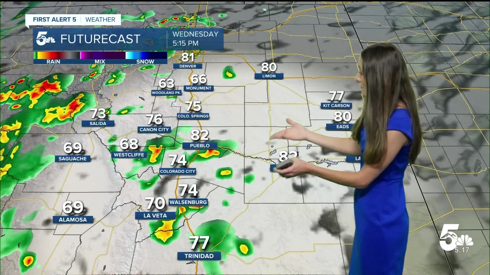


Tonight's Forecast:
Tonight, a few showers will move through the Pikes Peak Region. Some cloud cover will stay through the night and into tomorrow morning. Lows will be in the 40s and 50s.
Colorado Springs forecast: Low: 51; High: 78;
Colorado Springs will dip into the lower 50s. Those upper-level clouds will stay throughout most of the day. Rain chances look isolated with some activity picking up around dinnertime. Highs will get into the upper 70s.
Pueblo forecast: Low: 54; High: 82;
Pueblo will have lows in the mid-50s. With the steady stream of moisture into the state, it will keep some clouds in the area. Afternoon highs will be a few degrees warmer than Tuesday getting into the lower 80s. A few isolated showers will be possible in the afternoon.
Canon City forecast: Low: 58; High: 81;
Overnight lows will be in the upper 50s and temperatures will slowly rise throughout the morning. Afternoon highs will be a few degrees cooler than Tuesday, getting into the lower 80s. These upper level clouds will stick around throughout the day.
Woodland Park forecast: Low: 48; High: 73;
Woodland Park will have lows in the 40s overnight and tomorrow morning. Temperatures will still be cool with highs getting into the lower 70s by the afternoon. A couple of showers will be possible in the afternoon and evening.
Tri-Lakes forecast: Low: 50; High: 76;
Monument will have overnight temperatures in the lower 50s. Some of the upper-level cloud cover will stick around during the day, and temperatures will still be cool in the 70s. A couple of spotty showers will arrive in the evening.
Plains forecast: Low: 50s; High: 70s & 80s;
The eastern plains will have overnight lows in the 50s. The next few days will have some consistent moisture and a couple of showers in the afternoon and evening. Highs will get into the 70s and 80s.
Walsenburg and Trinidad forecast: Low: 53/55; High: 79/83;
The southern portion of I-25 will have morning temperatures in the lower-to-mid 50s. Clouds will continue to pass over the area with an increase in rain chances in the afternoon. Even after the sun sets, there will be a possibility for some showers.
Mountains forecast: Low: 40s; High: 70s;
The mountains will have rain over the next few days which means that flash flooding will be a concern. The very southwest corner of the state has some flood watches in effect through the evening on Friday. Rain arrives each and every day for the rest of the week.
Extended outlook forecast:
This moisture isn't going anywhere over the next few days. This will give us some rain chances at least through Friday. Temperatures don't look to move around too much. Highs will go back and forth between the 70s and 80s for I-25. The mountains will have highs between the 60s and 70s.
____
Curious about the First Alert 5 Weather Storm Impact Scale? Check out our cheatsheet explainer.
Watch KOAA News5 on your time, anytime with our free streaming app available for your Roku, FireTV, AppleTV and Android TV. Just search KOAA News5, download and start watching.
