


Today’s Forecast:
Another day of extremely high fire danger with wind gusts in the 40 to 60 mph range with relative humidity values below 15 percent.
Current Wind Gusts: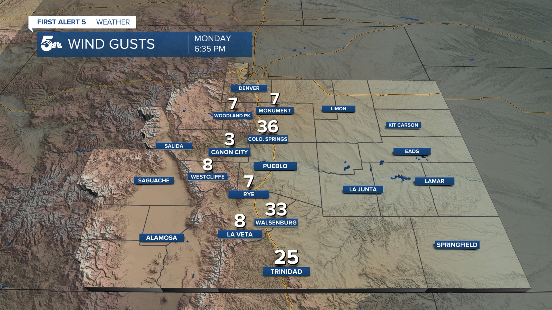
High Wind Warnings and Red Flag Warnings are both active until 7 pm today. The time frame for extreme fire danger is between 9 am and 7 pm. The strongest winds will likely occur in the Highway 50 corridor between Pueblo West and La Junta as well as I-25 south between Colorado City and Walsenburg.
Air Quality Alerts for smoke are set to expire at 9 am for Teller, El Paso, and Elbert Counties. It is possible these will be re-issued for the same areas later today, depending on smoke behavior from Park County.
Follow the latest updates on the 403 Fire in Park and Teller counties.
Colorado Springs forecast: High: 55; Low: 28. Mostly sunny but hazy from smoke blowing east out of Park county. Temperatures will be in the mid-50s with wind gusts in the 40 to low 50 mph range. The strongest wind gusts will be on the west side of town today.
Pueblo forecast: High: 65; Low: 27. Sunny and warm with strong daytime winds. Wind gusts are expected to be in the 50 to low 60 mph range. Blowing dust could reduce visibility.
Canon City forecast: High: 60; Low: 32. Sunny and warm with daytime wind gusts in the low 50 mph range. Fire danger will be high with blowing dust through the afternoon.
Woodland Park forecast: High: 41; Low: 21. Partly cloudy with haze and poor air quality from 403 fire smoke. Temperatures will be in the 40s with dry skies in the afternoon. Wind gusts will be in the 40 to 50 mph range with high fire danger despite the lack of red flag warnings.
Tri-Lakes forecast: High: 40s; Low: 20s. Mostly sunny, windy, and hazy from smoke in Park County. We'll be chilly with wind gusts in the upper 40 mph range.
Plains forecast: High: 60s; Low: 20s. Very high fire danger with blowing dust reducing visibility in the afternoon. Temperatures will be mild with wind gusts in the 40 to 60 mph range. The windiest areas will be in Pueblo, Otero, Huerfano, and northern Las Animas Counties.
Walsenburg and Trinidad forecast: High: 50s; Low: 20s. Partly cloudy and very windy with high fire danger through the afternoon. Wind gusts will be in the 50 to 60 mph range through the afternoon. Blowing dust could reduce visibility.
Mountains forecast: High: 40s; Low: 20s. Strong winds with more mountain snow across the Continental Divide. Wind gusts over 50 mph are expected in the Sangres and Wet Mountains with similar gusts over the Front Range.
Extended outlook forecast:
The entire weekend will remain windy but Sunday will be the most concerning day for additional fire danger.
Fire Weather Watches are in effect Saturday until 8 pm. These watches will turn into Red Flag Warnings with wind gusts in the 20 to 40 mph range. While fire danger is considered high Saturday, it will be worse on Sunday.
Wind gusts on Sunday will be in the 40 to 50 mph day with relative humidity values below 15 percent. Red Flag Warnings will likely be widespread Sunday afternoon.
Strong wind gusts continue Monday with more expected fire danger.
Next week will become cooler by Tuesday with a small chance for rain and snow showers along the I-25 corridor.
____
Curious about the First Alert 5 Weather Storm Impact Scale? Check out our cheatsheet explainer.
Watch KOAA News5 on your time, anytime with our free streaming app available for your Roku, FireTV, AppleTV and Android TV. Just search KOAA News5, download and start watching.
