



Today’s Forecast:
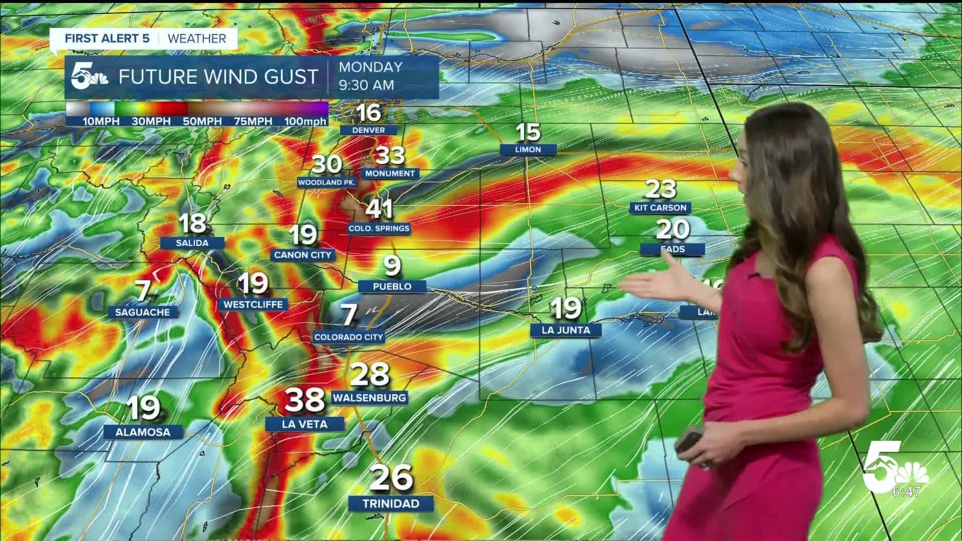
Dry and breezy conditions move into Colorado. Gusts will approach 40mph for a couple of areas along I-25. Afternoon highs will still be on the warm side in the 70s and 80s.
Colorado Springs forecast: High: 49; Low: 78.
Colorado Springs will have lows this morning in the upper 40s. Winds are already gusty this morning, and that will continue over the next several hours. Afternoon highs will soar into the 70s.
Pueblo forecast: High: 52; Low: 83.
Pueblo will have temperatures this morning in the lower 50s. Skies will remain mostly clear and breezy conditions will pick up in the afternoon. Along with breezy conditions, warm temperatures will continue. Highs will reach the lower 80s.
Canon City forecast: High: 51; Low: 78.
Canon City will wake up to temperatures this morning in the 60s. Bright and sunny conditions will last throughout the day. Winds will be on the gusty side reaching 20mph at times. Highs will still be warm in the upper 70s.
Woodland Park forecast: High: 41; Low: 66.
Woodland Park this morning will have temperatures in the 30s and 40s. Winds will be breezy with gusts approaching 30mph at times. This streak of warmer weather will continue with highs reaching the mid-60s. Later on this week there will be a big drop in temperatures and overnight lows will eventually get into the lower 30s.
Tri-Lakes forecast: High: 47; Low: 72.
Monument and the surrounding area has temperatures in the 40s this morning. Warm weather is back in the forecast this afternoon with highs getting into the lower 70s. With this next system getting closer to Colorado, it will amplify those wind gusts. Gusts will get close to 35mph at times.
Plains forecast: High: 50s; Low: 80s.
The eastern plains will have temperatures in the 50s this morning. Once the sun rises, temperatures will rise quickly. Afternoon highs will stay warm, getting into the 80s. Winds will be strong at times and humidity values will be low, so fire danger will be a concern.
Walsenburg and Trinidad forecast: High: 50; Low: 74/80.
The southern portion of I-25 will have temperatures in the 50s this morning. We are still expecting temperatures to warm rapidly and highs will reach the 70s and 80s. The warmest temperatures will be closer to Trinidad and the southern most portion of I-25.
Mountains forecast: High: 40s; Low: 60s & 70s.
The mountains will have an active week ahead with the possibility of snow towards the higher elevations. Moisture will arrive towards Tuesday and will last throughout the week. Showers will be active this week. Afternoon highs on Monday will get into the 60s and 70s.
Extended outlook forecast:
Active weather arrives by Wednesday with afternoon showers picking up across I-25. Temperatures will also take quite a hit with highs only reaching the 50s. Overnight lows will also drop very close to freezing towards the higher terrain. We are looking at the potential for our first freeze this week for a few areas. It will be interesting to see with this moisture on the way. Higher peaks will likely have more snow move in. Mountain passes may also get hit.
____
Curious about the First Alert 5 Weather Storm Impact Scale? Check out our cheatsheet explainer.
Watch KOAA News5 on your time, anytime with our free streaming app available for your Roku, FireTV, AppleTV and Android TV. Just search KOAA News5, download and start watching.
