
Tonight’s Forecast:
Moisture is starting to squeak back into Colorado. A plume of moisture is streaming into the state from New Mexico. Areas along the CO/NM border saw more cloud cover today than areas in the northern half of the state. With the clouds came a few light showers in extreme SE Colorado in Baca and Prowers Counties. Along I-25, conditions remain hot and dry, but the added cloud cover kept us a few degrees from truly maximizing our afternoon heating potential.
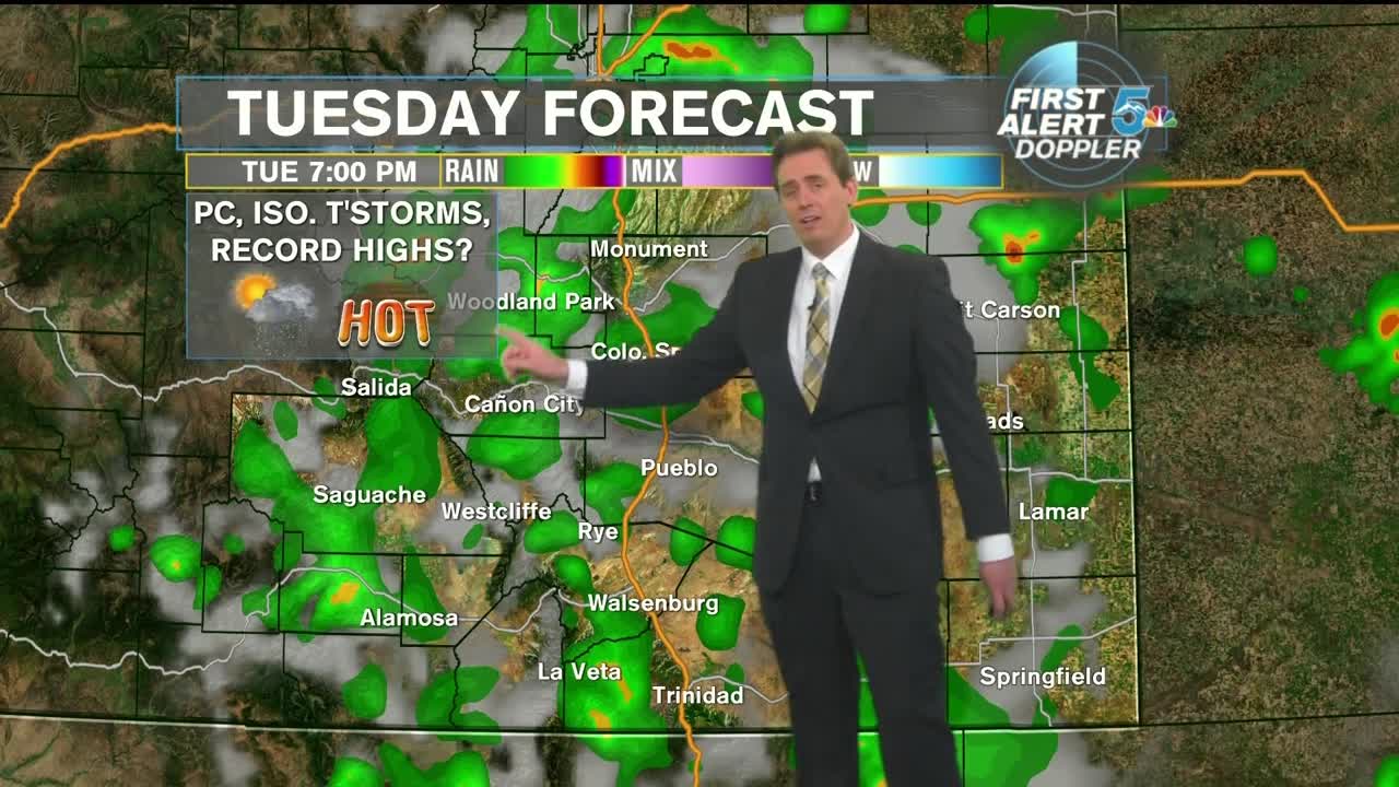
Tonight, warm and mostly clear with lows in the lower 60s and upper 50s. Sunny and hot on Tuesday morning, with increasing clouds by the late afternoon. A cold front will approach from the North and begin to provide instability to the atmosphere and advected moisture. The chance for an isolated thunderstorm returns to the mountains and Eastern Plains. Cloud cover will have an effect on afternoon temperatures, which could once again keep us from reaching new record highs. We will come to close if not exceed the current records on Tuesday!
COLORADO SPRINGS: Low: 62, High: 93. Mostly clear tonight with temperatures in the lower 60s. Increasing clouds on Tuesday afternoon with isolated chances for thunderstorms and near record temperatures once again. Highs near 93. The record high is 93.
PUEBLO: Low: 66, High: 101. Mostly clear tonight with temperatures in the mid-60s. Increasing clouds on Tuesday afternoon with isolated chances for thunderstorms and near record temperatures once again. Highs near 101. The record high is 101.
CANON CITY: Low: 66, High: 98. Mostly clear tonight with temperatures in the mid-60s. Increasing clouds on Tuesday afternoon with isolated chances for thunderstorms. Highs near 98.
WOODLAND PARK: Low: 54, High: 82. Mostly clear tonight with temperatures in the mid-50s. Increasing clouds on Tuesday afternoon with a chance for scattered thunderstorms. Highs in the lower 80s.
TRI-LAKES: Low: 50s, High: 80s. Mostly clear tonight with temperatures in the 50s. Increasing clouds on Tuesday afternoon with scattered chances for thunderstorms. Highs in the upper 80s.
PLAINS: Low: 60s, High: 90s/100s. Mostly clear tonight with temperatures in the 60s. Increasing clouds on Tuesday afternoon with isolated chances for thunderstorms and near record temperatures once again. Highs in the upper 90s to lower 100s.
WALSENBURG/TRINIDAD: Low: 60s, High: 90s. Mostly clear tonight with temperatures in the 60s. Increasing clouds on Tuesday afternoon with isolated chances for thunderstorms. Highs in the 90s.
Extended Outlook:
On Wednesday, the cold front will stall in Colorado, providing enough instability and an upslope flow for the development of scattered showers and thunderstorms in Southern Colorado. The cold front will also have a cooling effect on our afternoon highs. We won’t come close to smashing records, but we’ll be above normal with highs in the mid-80s. Thunderstorms will also be a possibility on Thursday, but the threat will shift eastward a bit. By Friday and Saturday, we’ll clear out, dry out, and look for the potential of record-breaking heat again next Sunday.
