

Tonight's Forecast:
Tonight, clouds will continue to increase and this will help to keep temperatures more mild. Overnight lows will be in the 40s for the eastern plains and I-25. 40s are still likely for the higher terrain, but a few areas will creep down into the 30s.
Colorado Springs forecast: Low: 46; High: 78;
The Springs will hit a low of 36 degrees tomorrow morning and winds will begin to pick up during the late morning hours. Westerly, downsloping winds will be the reason for the warm up tomorrow even though there will be more clouds. Highs will be in the upper 70s, and there will be another chance to break record highs. Fire danger will be a concern and red flag warnings will be in place through 8PM.
Pueblo forecast: Low: 43; High: 85;
Pueblo has another warm day ahead though not as much sunshine. Morning temperatures will be in the lower 40s and westerly winds will help afternoon temperatures to get into the mid-80s. Clouds will decrease throughout the day. Fire danger will be a concern and red flag warnings will be in place through 8PM.
Canon City forecast: Low: 49; High: 82;
Canon City will wake up to temperatures in the upper 40s. Winds will become breezy by the late morning. Afternoon temperatures will make it back into the lower 80s. Red flag warnings will start at 11am and last through 8pm. Avoid outdoor burning.
Woodland Park forecast: Low: 40; High: 68;
Woodland Park will make it down into the lower 40s overnight and morning temperatures will be similar. Winds will pick up around 11AM, and gusts will pick up from there. Gusts have the chance to reach 30-40mph. Afternoon highs will be in the upper 60s.
Tri-Lakes forecast: Low: 45; High: 72;
The Monument area will have morning temperatures in the mid-40s. There will be more clouds in the morning than the afternoon. Temperatures in the afternoon will be in the lower 70s, and this is the last warm day before the potential for some moisture arrives along with cooler temperatures.
Plains forecast: Low: 40s; High: 80s;
The eastern plains will have overnight lows drop into the 40s. With this system getting closer there will be more clouds in the area. Afternoon temperatures will be in the 80s, and winds will pick up in the afternoon.
Walsenburg and Trinidad forecast: Low: 48/45; High: 76/80;
The southern I-25 corridor will have overnight temperatures in the 40s. Things will heat up in the afternoon with highs making it into the mid-70s and lower-80s. Red flag warnings will be in place from 11AM until 8PM.
Mountains forecast: Low: 30s & 40s; High: 60s & 70s;
The mountains will have more clouds move into the area with this next incoming system. Afternoon temperatures will make into the 60s and 70s.
Extended outlook forecast:
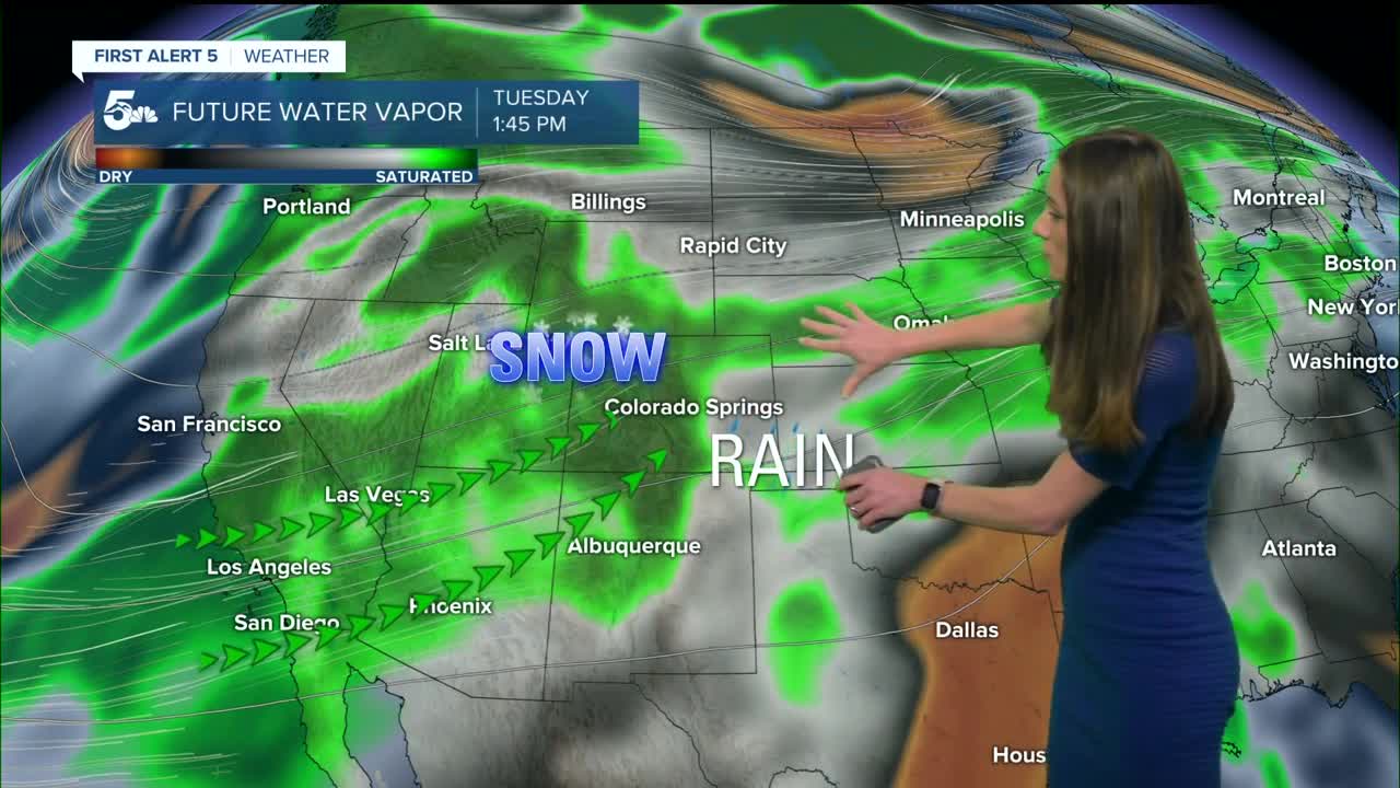
A surge of moisture arrives by Tuesday, and rain chances will pick up in the afternoon and evening. This will transition over to a mix for the lower elevations overnight into Wednesday. Snow will spread across the mountains. Colorado just loves to shake things up for us in the forecast. Wednesday will be a rainy day for the Pikes Peak Region and parts of I-25. We will have more dry air move in on Thursday, and more sunshine will be in the forecast. Still tracking some leftover moisture though on Friday and there is a small chance for some showers.
____
Curious about the First Alert 5 Weather Storm Impact Scale? Check out our cheatsheet explainer.
Watch KOAA News5 on your time, anytime with our free streaming app available for your Roku, FireTV, AppleTV and Android TV. Just search KOAA News5, download and start watching.
