

Today’s Forecast:
Cloudy skies across southern Colorado today, but with fairly mild air underneath. An area of low pressure will develop east of the Front Range, working to draw warm, down slope winds into the lower elevations and push highs back into the mid to upper 60s. We'll stay dry today and see cloudy skies continue through the evening, with lows falling back to the mid 30s.
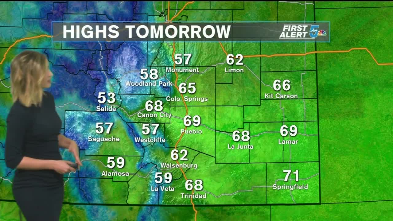
COLORADO SPRINGS: High: 65; Low: 38. Overcast but warm outside with light down sloping winds and temperatures back into the mid 60s.
PUEBLO: High: 69; Low: 34. Mostly cloudy skies, light winds, and very warm afternoon temperatures for this time of year.
CANON CITY: High: 68; Low: 38. Mostly cloudy skies, warm daytime temperatures, and light winds.
WOODLAND PARK: High: 60; Low: 32. Overcast and mild for this time of year with dry skies and light winds.
TRI-LAKES: High: 60s; Low: 30s. Overcast but warm outside with light winds and daytime temps in the low 60s.
PLAINS: High: 60s; Low: 30s. Clear and cold in the morning with increasing clouds through the day and highs warming into the mid 60s.
WALSENBURG/TRINIDAD: High: 60s; Low: 30s. Breezy and mostly cloudy today with highs warming quickly into the mid 60s.
Extended Outlook:
Saturday is going to be very similar to Friday with overcast skies and high temperatures back in the mid to upper 60s. A chance for a wintry mix to light snow exists Saturday evening, mainly for the Palmer Divide and northern Teller County, but the chance is very low. If we do see snow in Teller County Saturday evening, it'll stay under an inch, and Monument Hill will also likely just see a dusting at the most. Sunday will be a few degrees cooler but dry.
