

Tonight's Forecast:
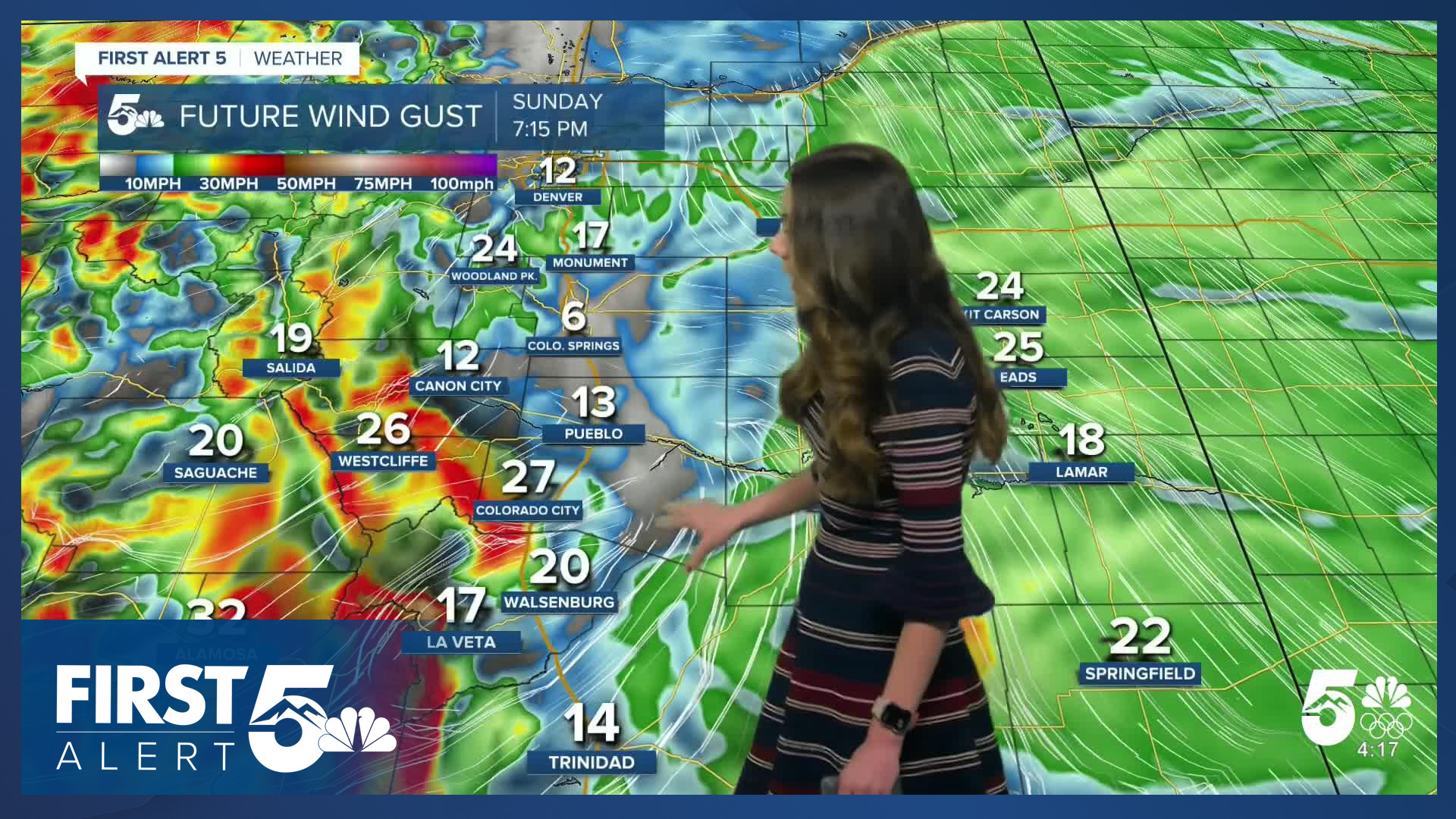
Rain chances pick up later on tonight and will clear out overnight. With the initial push of moisture, areas across I-25 will have some stronger winds. Some gusts will be strong approaching 40mph. Overnight lows will be a touch cooler than previous nights.
Colorado Springs forecast: Low: 37; High: 60;
Colorado Springs will have winds pick up around 11AM on Monday. Wind gusts will get strong at times. With westerly, down sloping winds temperatures will reach the 60s again. There will be partly cloudy skies and no rain.
Pueblo forecast: Low: 36; High: 69;
Pueblo will be in the 40s during the morning hours, and afternoon highs will be in the upper 60s. There will be partly cloudy skies throughout the day. Winds will also be strong at times.
Canon City forecast: Low: 42; High: 62;
Tonight, there will be some rain chances, but this will clear before midnight. Clouds will start to clear by the morning, and temperatures will warm up nicely. Afternoon highs will be in the lower 60s.
Woodland Park forecast: Low: 30; High: 53;
Parts of Teller county will see a few flurries, but its not too likely that much of it will stick. Overnight lows will drop into the lower 30s. By the afternoon on Monday, temperatures will be in the lower 50s. More snow chances will come later in the week, so if you are looking to enjoy warmer temperatures take advantage of it.
Tri-Lakes forecast: Low: 36; High: 54;
Monument will possibly have a few flurries overnight, but nothing will stick. Temperatures will be too warm. By the afternoon on Monday, temperatures will be in the mid-50s. It will be a nice fall day with some stronger gusts.
Plains forecast: Low: 30s & 40s; High: 60s;
The Plains have another warm and dry day with afternoon highs in the 60s. Some strong winds will move in during the afternoon. No rain will move in overnight with this system lifting towards the northeast. Rain will start to evaporate.
Walsenburg and Trinidad forecast: Low: 41/39; High: 63;
The southern I-25 corridor will have some of the strongest gusts tonight and into tomorrow. Overnight lows will be in the upper 30s and lower 40s. By the afternoon, highs will reach the lower 60s.
Mountains forecast: Low: 20s & 30s; High: 50s;
The mountains have some winter weather advisories in place (Eastern San Juans) until 5AM on Monday. Anyone trying to travel through mountain passes overnight should use caution. Snow will ease up towards the south but continue for the northern side of the state. Highs will be in the 50s.
Extended outlook forecast:
A parade of systems will move through bring multiple chances for some flurries. Woodland Park will have the best chances for some snow. It will be hard for any snow to stick with afternoon highs getting into the 40s and 50s behind that system. We are specifically looking at Thursday. For I-25, it will likely start off as rain and if the timing is right with the moisture and temperatures, we could get our first flurries.
____
Curious about the First Alert 5 Weather Storm Impact Scale? Check out our cheatsheet explainer.
Watch KOAA News5 on your time, anytime with our free streaming app available for your Roku, FireTV, AppleTV and Android TV. Just search KOAA News5, download and start watching.
