

Tonight's Forecast:
Skies will stay clear overnight and this will help temperatures get into the 20s and 30s overnight. Winds will calm over the next few hours.
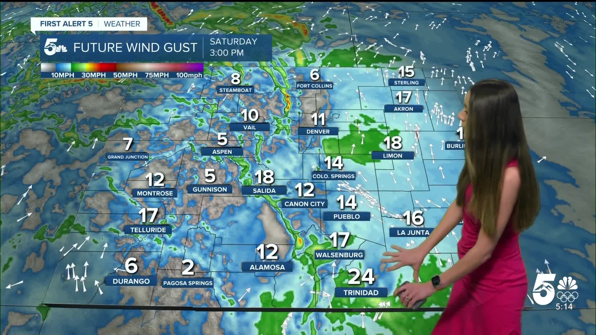
Tomorrow's Forecast:
An upper level ridge will keep southern Colorado warm and dry. Winds will remain calm, but a few isolated areas in between Denver and the Springs have an opportunity to see some higher gusts. Highs across the region will be in the 50s and 60s.
Colorado Springs forecast: Low: 30; High: 57;
Colorado Springs will have morning lows in the lower 30s. More clouds will fill in throughout the day, but this won't keep temperatures from getting too warm. Highs will be in the upper 50s.
Pueblo forecast: Low: 26; High: 61;
Pueblo will dip into the mid-20s overnight and will last through the morning. Temperatures will slowly warm in the morning, and by the afternoon highs will be in the lower 60s. More clouds will move in throughout the day on Saturday.
Canon City forecast: Low: 35; High: 62;
Canon City will have chilly morning temperatures in the mid-30s. Conditions will remain dry throughout the day, but more clouds will move in by the afternoon. Temperatures will reach the lower 60s by the afternoon.
Woodland Park forecast: Low: 27; High: 55;
A chilly morning is ahead with lows in the upper 20s. Clouds will fill in throughout the day. Afternoon highs will be in the mid-50s for Saturday. Winds will be between 5-15mph.
Tri-Lakes forecast: Low: 30; High: 58;
Monument will have morning lows in the lower 30s. Some breezy conditions are possible for this area tomorrow, but winds will mainly pick up on Sunday. Highs on Saturday will be in the upper 50s.
Plains forecast: Low: 20s; High: 60s;
The plains will be chilly tomorrow morning with lows reaching the 20s. More clouds will fill in throughout the day. Highs will still be on the warmer side even with the cloud cover. Windy conditions will pick up on Sunday.
Walsenburg and Trinidad forecast: Low: 33/28; High: 63;
The southern I-25 corridor will have morning temperatures in the 20s and 30s. Sunshine will start the day off in the morning, but more clouds will move in. Highs will be in the lower 60s by the afternoon. Some breezy conditions look to pick up again during the afternoon with gusts up to 25mph.
Mountains forecast: Low: Teens & 20s; High: 50s;
The mountains will have overnight temperatures in the teens and 20s. Highs will be in the 50s. Snow showers will pick up overnight on Sunday.
Extended outlook forecast:
The following few days will be breezy and fire danger will be a concern on Sunday and Monday. Breezy conditions will linger into Tuesday. Colder temperatures arrive towards the end of the week. There is a small chance for some precipitation along I-25 on Thursday.
____
Curious about the First Alert 5 Weather Storm Impact Scale? Check out our cheatsheet explainer.
Watch KOAA News5 on your time, anytime with our free streaming app available for your Roku, FireTV, AppleTV and Android TV. Just search KOAA News5, download and start watching.
