

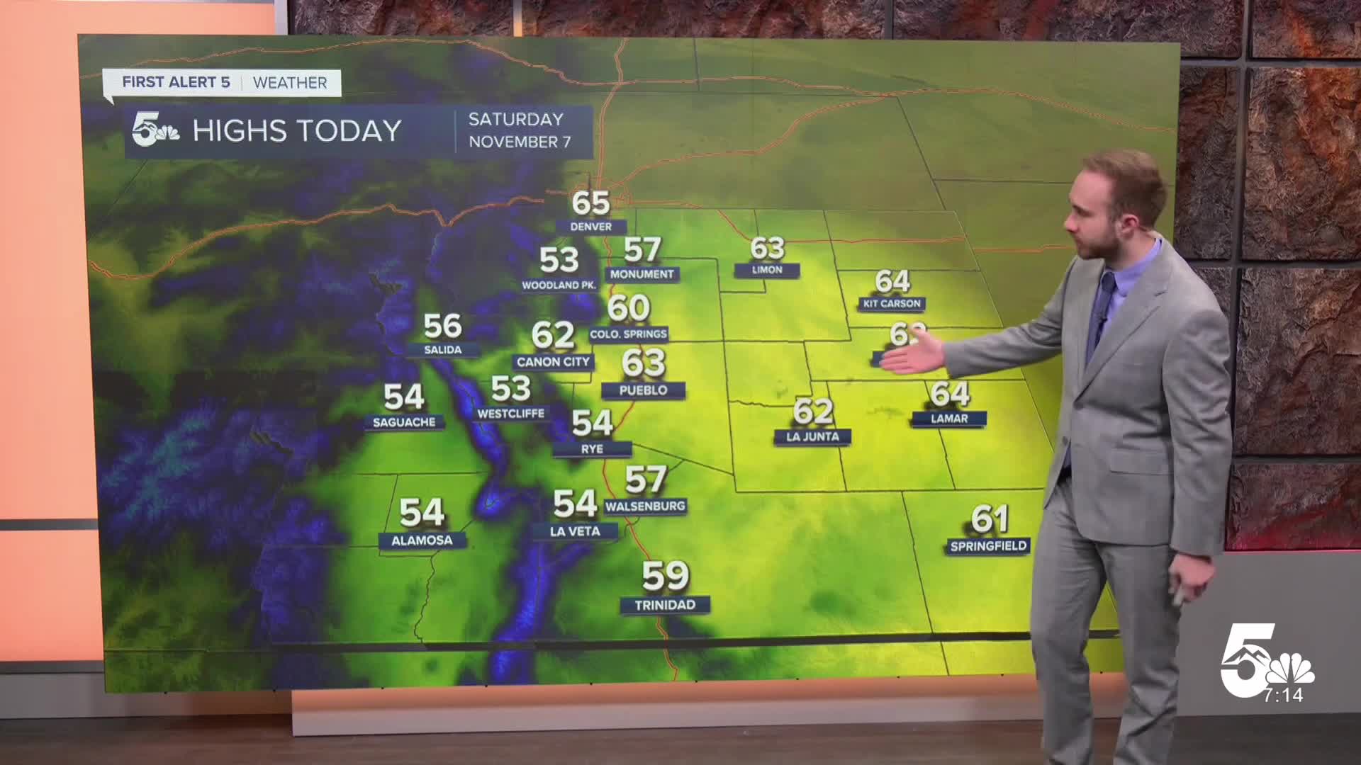

Today's Forecast: A beautiful fall day is on tap across Southern Colorado with mostly sunny skies and light winds. Temperatures climb slightly compared to Friday, topping out in the upper 50s to low 60s for the plains, and mostly in the 40s and 50s across the higher country. Any patchy early morning fog in the lower Arkansas River and San Luis valleys will quickly clear after sunrise.
Tonight's Forecast: Skies remain mostly clear to partly cloudy across the area overnight. Lows stay near to slightly above seasonal averages, dropping into the 20s and 30s area-wide, with the warmest readings held along the plains.
Colorado Springs: Low: 36; High: 60; A gorgeous Saturday with blue skies, abundant sunshine, and light winds staying under 10 mph. Highs climb into the low 60s before skies stay mostly clear overnight with lows dropping into the mid-30s.
Pueblo: Low: 37; High: 63; Warm and sunny for your Saturday as daytime temperatures reach the mid-60s. Light winds keep conditions feeling extra comfortable. Overnight skies stay mostly clear with lows dipping into the mid-30s.
Canon City: Low: 38; High: 62; Mostly sunny and pleasant throughout the day with afternoon highs in the low 60s. Evening hours stay dry and quiet, with overnight lows falling into the mid-30s.
Woodland Park: Low: 30; High: 53; A crisp mountain day with plenty of sunshine and highs topping out in the lower 50s. Skies remain mostly clear overnight as temperatures drop into the low 30s.
Extended Forecast
An upper-level ridge of high pressure builds over the Rockies, locking in a dry, bright, and unseasonably warm stretch into next week.
Sunday – Tuesday: Temperatures continue to climb several degrees above average each afternoon under mostly sunny skies. Highs across the plains and lower elevations reach the upper 60s on Monday and Tuesday, while mountain valleys enjoy highs in the 50s.
Wednesday – Friday: A passing disturbance to our north pushes a weak, dry cold front through early Wednesday, briefly trimming highs back to near-seasonal levels in the low 60s. High pressure rebuilds by late week to maintain warm, dry conditions right into the weekend.
____
Curious about the First Alert 5 Weather Storm Impact Scale? Check out our cheatsheet explainer.
Watch KOAA News5 on your time, anytime with our free streaming app available for your Roku, FireTV, AppleTV and Android TV. Just search KOAA News5, download and start watching.
