



Today’s Forecast:
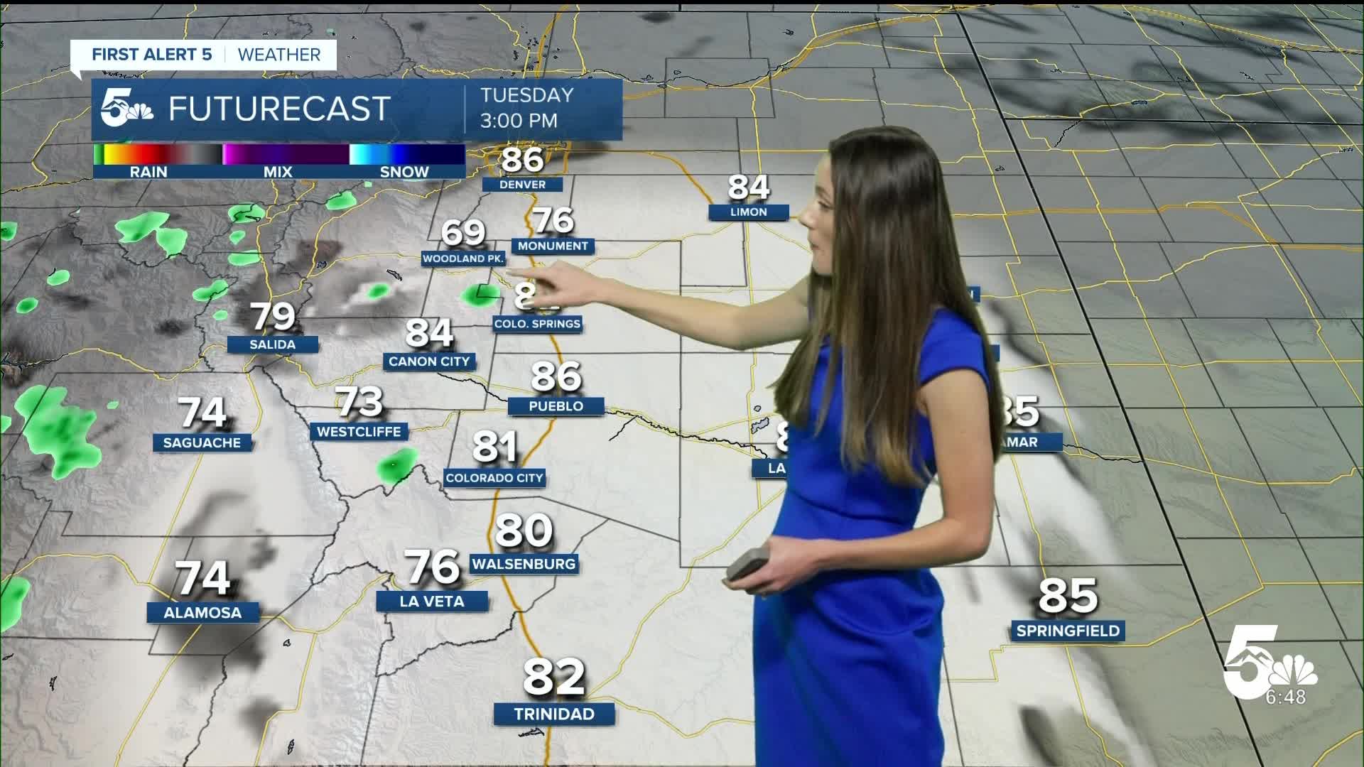
There will be a few more mid- to upper level clouds during the day today. With a small disturbance moving through, it will help get a few showers going over the mountains and parts of the Pikes Peak Region. Most of the area will be remaining dry and temperatures will possibly break records today.
Colorado Springs forecast: High: 83; Low: 55.
Colorado Springs will start the day off with temperatures in the 50s. This is a few degrees warmer than yesterday morning. There will be a few more clouds today and a couple of sprinkles are possible on the north side of town. Highs will likely break records getting into the lower 80s.
Pueblo forecast: High: 86; Low: 54.
Pueblo will have temperatures in the 50s this morning, and once the sun rises temperatures will also quickly warm up. Pueblo is likely out of reach from any records being broken today. There will be a few more mid-to-upper level clouds, but the sun will still peak through. Highs will get into the mid-80s.
Canon City forecast: High: 84; Low: 55
Canon City will have temperatures this morning in the mid-50s. Upper level clouds will move in this morning and into the afternoon. Highs will still be on the warmer side eventually breaking into the 80s.
Woodland Park forecast: High: 69; Low: 48.
Woodland Park will have morning temperatures in the 40s, so a light jacket may be needed. There will be some mid-to-upper level clouds pushing into the area later this morning. There will still be some sunshine and temperatures will eventually get into the 60s .
Tri-Lakes forecast: High: 79; Low: 51.
Monument and the surrounding area will have temperatures in the lower 50s. As we go throughout the morning these temperatures will warm quickly. There will be some mid-to-upper level clouds that will move in later this morning. Highs will eventually get into the upper 70s.
Plains forecast: High: 80s; Low: 50s.
The eastern plains will start off with some clear conditions, but as the morning continues there will be some mid-to-upper-level clouds that move in. Temperatures this morning will be in the 50s. By the time the afternoon rolls around, these temperatures will be in the 80s.
Walsenburg and Trinidad forecast: High: 80/83; Low: 51/50.
The southern I-25 corridor will have morning lows in the 50s, but we are still expecting a warm afternoon. Highs will be a few degrees warmer than yesterday eventually getting into the lower 80s.
Mountains forecast: High: 70s & 80s; Low: 30s & 40s.
The mountains will have more clouds and a couple of spotty showers today. Afternoon highs will be breaking into the 70s and 80s.
Extended outlook forecast:
Throughout the rest of the week, temperatures will be staying pretty consistent. Highs will continue to stay above average. Looking ahead to Sunday and Monday of next week, cooler and wetter conditions will arrive. There is some uncertainty with the track of this system which will likely shift around over the next few days.
____
Curious about the First Alert 5 Weather Storm Impact Scale? Check out our cheatsheet explainer.
Watch KOAA News5 on your time, anytime with our free streaming app available for your Roku, FireTV, AppleTV and Android TV. Just search KOAA News5, download and start watching.
