
Tonight’s Forecast:
The monsoonal flow into Colorado has been shut off. Drier air has worked into the state and has brought down what was once widespread daily chances for rainfall to isolated brief showers at best. This evening, light rain showers will still be possible in the Pikes Peak Region and along the I-25 corridor. Once the sun sets, showers will come to an end. Skies will become mostly clear overnight and with the drier air in place, temps will fall back into the mid and upper 50s around the area.
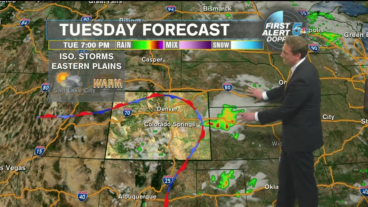
Tuesday will be mostly sunny throughout Southern Colorado for the first half of the day. By the afternoon, mountain showers and light thunderstorms will develop. Additionally, thunderstorms will develop on the Eastern Plains along a stationary front. I-25 looks like it might escape the activity while the Pikes Peak Region will once again need to keep an eye out for a brief afternoon shower in and around the higher terrain. Afternoon highs should top off in the mid-80s to lower 90s.
COLORADO SPRINGS: Low: 56, High: 88. Becoming mostly clear tonight with temperatures in the mid-50s. Sunny to start Tuesday with afternoon clouds and a slight chance for a brief afternoon shower to thunderstorm. Highs in the upper 80s.
PUEBLO: Low: 60, High: 93. Mostly clear tonight with temperatures near 60. Sunny to start Tuesday with afternoon clouds and an isolated chance for a brief afternoon shower to thunderstorm. Highs in the lower 90s.
CANON CITY: Low: 62, High: 90. Becoming mostly clear tonight with temperatures in the lower 60s. Sunny on Tuesday with afternoon clouds and a slight chance for a brief afternoon shower to thunderstorm. Highs near 90.
WOODLAND PARK: Low: 49, High: 77. Becoming mostly clear tonight with temperatures in the upper 40s. Sunny to start Tuesday with afternoon clouds and a slight chance for a brief afternoon shower to thunderstorm. Highs in the upper 70s.
TRI-LAKES: Low: 50s, High: 70s/80s. Becoming mostly clear tonight with temperatures in the lower 50s. Sunny to start Tuesday with afternoon clouds and a chance for a brief afternoon shower to thunderstorm. Highs in the upper 70s to lower 80s.
PLAINS: Low: 60s, High: 90s. Becoming mostly clear tonight with temperatures in the 60s. Sunny to start Tuesday with increasing afternoon clouds and isolated showers and thunderstorms developing. Highs in the lower 90s.
WALSENBURG/TRINIDAD: Low: 50s, High: 80s. Becoming mostly clear tonight with temperatures in the 50s. Sunny to start Tuesday with afternoon clouds and a slight chance for a brief afternoon shower to thunderstorm. Highs in the upper 80s.
Extended Outlook:
Wednesday and Thursday will trend on the drier side, with mountain showers possible on Wednesday. By Friday and Saturday, Colorado may catch the tail end of a system way up in Canada, bringing the potential for a few isolated showers and storms in the afternoon. Once that passes, high pressure sets up and we’ll look for our temperatures to be hot and out skies to be clear.
