

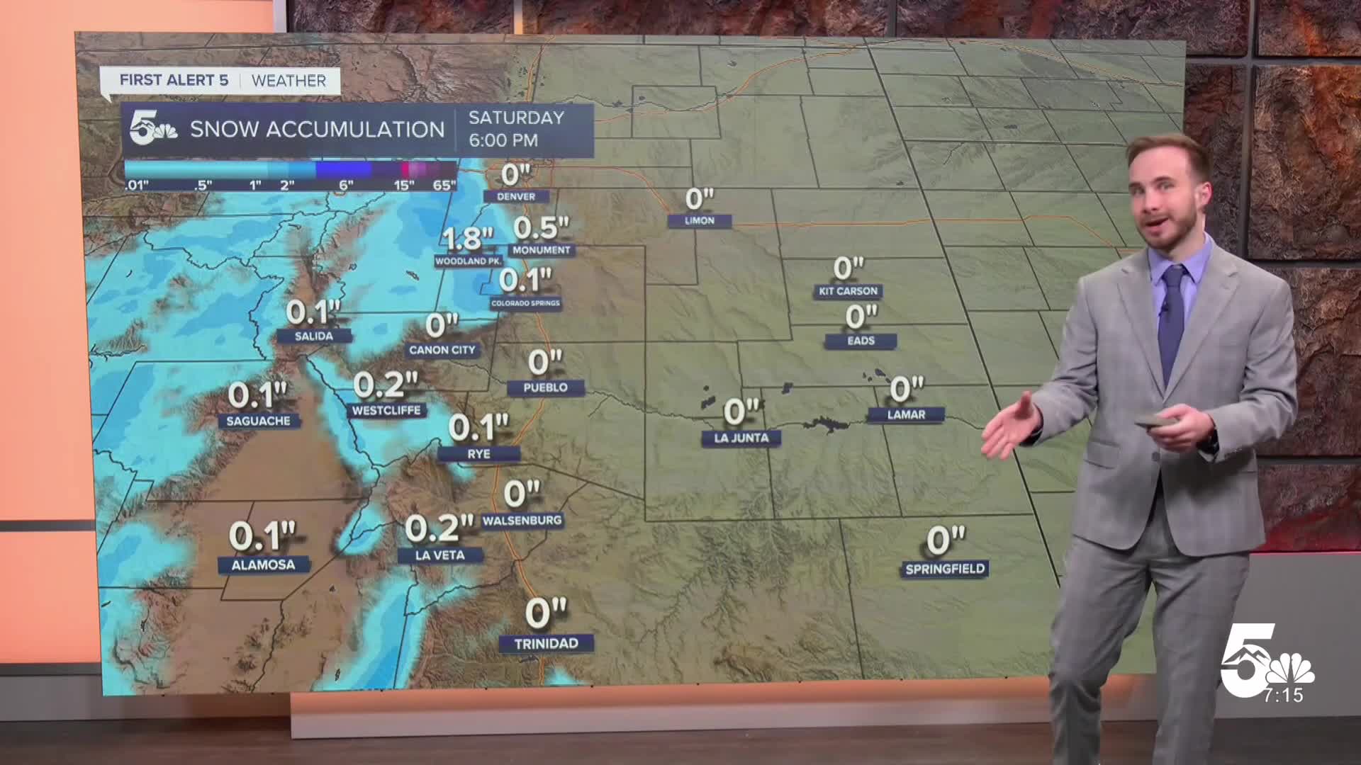

Today's Forecast: An upper-level storm system moves across Southern Colorado today, spreading light snow from the Continental Divide into the southeast mountains and adjacent plains. Morning snow favors the southwest mountains before shifting toward the central mountains this afternoon as winds turn out of the northwest.
Mountain areas can expect 1 to 3 inches of additional snow, with a quick 1 to 2 inches possible across the southeast mountains. Along the I-25 corridor and the Palmer Divide, a few spotty afternoon rain or snow showers could pass through, though warm ground temperatures and the quick pace of the storm will keep travel impacts minimal. Afternoon highs will reach the 40s across the lower elevations and the 30s in the high country.
Tonight's Forecast: Dry air sweeps in behind the departing system this evening, bringing an abrupt end to any lingering snow showers. Skies will clear out rapidly overnight, allowing temperatures to plunge across Southern Colorado. Expect a cold night with lows dropping into the teens and 20s for most areas, while some of the colder mountain valleys dip into the single digits. Light winds will accompany the clearing skies.
Colorado Springs forecast: Low: 24; High: 43; Expect increasing cloud cover through the morning with a chance for passing afternoon rain or snow showers, mainly near Monument Hill and the Palmer Divide. Warm pavement will prevent any accumulation on local roads, and afternoon highs will top out in the low 40s. Skies clear out quickly after sunset, dropping overnight temperatures into the mid-20s with light northwest winds.
Pueblo forecast: Low: 25; High: 46; Partly sunny skies this morning will turn mostly cloudy by early afternoon as the system passes overhead. Conditions will stay mostly dry in the Steel City, with afternoon highs reaching the upper 40s. Skies clear out rapidly tonight, allowing temperatures to fall into the mid 20s under calm winds.
Canon City forecast: Low: 27; High: 45; Clouds will build across Fremont County through the morning hours, bringing a slight chance for a brief afternoon shower. Highs will reach the upper 40s before drier air moves in late in the day. Clear skies and light winds follow overnight, dropping temperatures into the upper 20s.
Woodland Park forecast: Low: 17; High: 34; Teller County will see scattered snow showers develop today as the upper-level wave moves across the high country. Any snow accumulations will remain light, with afternoon highs topping out in the mid-30s. Skies clear out quickly tonight, allowing temperatures to plunge into the upper teens.
Extended Forecast: Cold air sticks around through the start of next week, accompanied by a couple more rounds of light mountain snow ahead of the Thanksgiving holiday.
Sunday: Dry and sunny weather returns to wrap up the weekend, though temperatures remain below normal. Afternoon highs will hold in the upper 30s and 40s across the plains, with 30s in the high country.
Monday – Tuesday: Another fast-moving weather system brings 1 to 3 inches of snow to the Continental Divide on Monday, while isolated showers could spill onto the plains Monday night for a localized dusting. Dry, sunny, and slightly milder weather returns on Tuesday.
Wednesday – Next Week: A gradual warming trend pushes temperatures closer to seasonal averages by mid-week. Forecast models suggest another storm system could bring renewed chances for mountain snow around the Thanksgiving holiday, while the southeast plains trend mostly dry.
____
Curious about the First Alert 5 Weather Storm Impact Scale? Check out our cheatsheet explainer.
Watch KOAA News5 on your time, anytime with our free streaming app available for your Roku, FireTV, AppleTV and Android TV. Just search KOAA News5, download and start watching.
