

Tonight's Forecast:
A cold front drops south bringing some cooler temperatures to the area. Overnight lows will still be on the warmer side in the 30s and 40s.
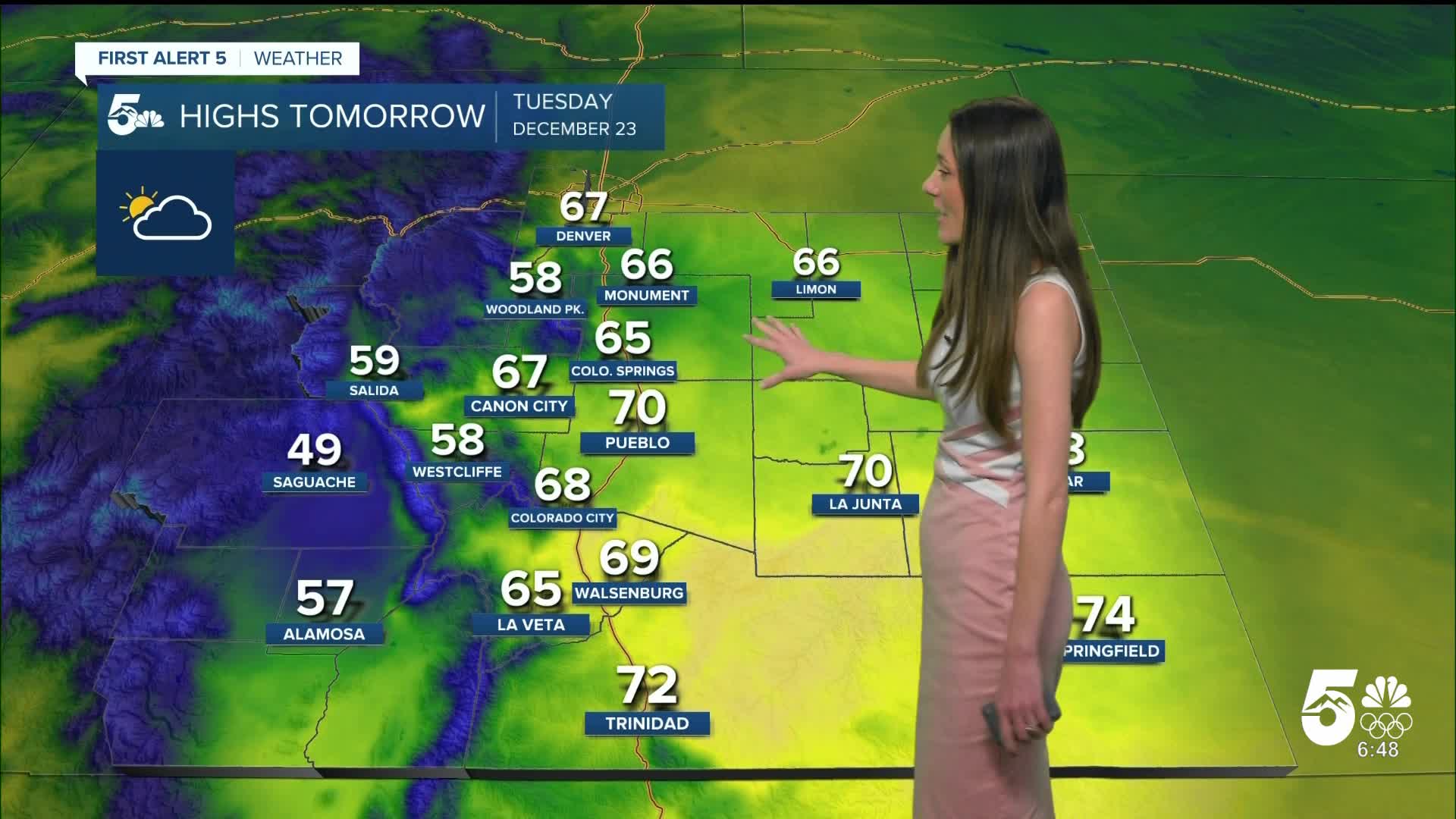
Colorado Springs forecast: Low: 40; High: 65;
Colorado Springs will drop into the 40s overnight. Some breezy conditions will pick up as this front moves through, but will calm shortly after. Highs by the afternoon will be in the mid-60s.
Pueblo forecast: Low: 35; High: 70;
Pueblo will have overnight lows in the mid-30s on Tuesday. This cold front will not help cool down the area much, and highs will remain in the 70s. Windy conditions will also calm on Tuesday.
Canon City forecast: Low: 42; High: 67;
Canon City will be on the warmer side overnight with lows only making it into the 40s. Afternoon highs will also be warm in the upper 60s. Winds will calm down going into Tuesday.
Woodland Park forecast: Low: 34; High: 58;
Woodland Park will briefly get breezy overnight with this incoming cold front. It won't help to cool temperatures down too much. Lows in the morning will reach the mid-30s. By the afternoon, temperatures will be in the upper 50s.
Tri-Lakes forecast: Low: 41; High: 66;
Monument will have some breezy conditions overnight as this front passes through. Conditions will calm though and Tuesday will remain calm. Highs tomorrow afternoon will reach the mid-60s.
Plains forecast: Low: 30s; High: 60s & 70s;
The plains will reach the 30s overnight and by tomorrow afternoon highs will be in the 60s and 70s. The warmest temperatures will be along highway 50 and the Arkansas River. Winds should remain calm tomorrow.
Walsenburg and Trinidad forecast: Low: 43/41; High: 69/72;
The southern I-25 corridor will have some breezy conditions overnight with this cold front passing through. Overnight lows will be in the lower 40s, so this cold front won;t be cooling things down too much. Afternoon highs will still be warm in the upper 60s and lower 70s.
Mountains forecast: Low: 30s; High: 50s;
The mountains will have some clouds across the area. Overnight, temperatures will drop into the 30s. Afternoon highs on Tuesday will be in the 50s.
Extended outlook forecast:
Mountain snow will move in late on Christmas eve and last throughout the day on Christmas. Some areas will be seeing rain in the mountains, and this is due to temperatures. Snow will continue into Friday. If you plan on traveling on I-70 and the mountains, use caution. I-25 will stay warm and dry. By the end of the week a more potent cold front moves through and temperatures will become more seasonable on Sunday.
____
Curious about the First Alert 5 Weather Storm Impact Scale? Check out our cheatsheet explainer.
Watch KOAA News5 on your time, anytime with our free streaming app available for your Roku, FireTV, AppleTV and Android TV. Just search KOAA News5, download and start watching.
