

Today’s Forecast:
Get ready for a wild weather ride in Colorado. We're going to see very hot and smoky conditions today followed by very cold air, rain, and snow from Tuesday through Wednesday morning.
Smoke will be most dense in and around the mountains today, but we'll get pretty thick with smoke through the afternoon in most of the region. Highs will soar into the 90s and triple digits today, with high fire danger across most of our mountains.
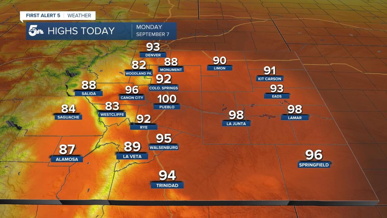
COLORADO SPRINGS: High: 92; Low: 34. Hot and smoky with gusty afternoon winds and elevated fire danger.
PUEBLO: High: 100; Low: 42. Very hot and hazy today with gusty winds in the afternoon and elevated fire danger.
CANON CITY: High: 96; Low: 43. Hot and smoky with gusty afternoon winds and elevated fire danger.
WOODLAND PARK: High: 82; Low: 27. Warm and smoky with dry skies and elevated fire danger.
TRI-LAKES: High: 80s; Low: 20s. Hot and smoky with gusty afternoon winds and elevated fire danger.
PLAINS: High: 90/100s; Low: 30s. Very hot across the plains with hazy skies and elevated fire danger.
WALSENBURG/TRINIDAD: High: 90s; Low: 20s. Hot and windy today with Red Flag Warnings in place due to extreme fire danger.
Snow tonight - Wednesday:

Heat will be replaced by cold, rain, and snow from Tuesday through Wednesday. Our cold front arrives tonight from 9 pm through midnight and we'll see wind gusts ranging from 30 to 60 mph following the front. The strongest winds will be in El Paso, Pueblo, Lincoln, and Crowley counties.
There will be periods of rain turning to snow Tuesday morning, sometime after 6am for southern Colorado, but mainly for elevations at or over 7,000 feet. The bulk of our snow accumulation seems to want to come from late in the day Tuesday through Wednesday morning. Above is our current best guidance for snowfall, but we know that is likely going to change throughout the day.
The biggest concerns will be tree limbs breaking from the extra weight of snow and leaves, power lines falling, freezing temperatures, and slick commutes Tuesday night and Wednesday morning.
