All quiet on the western front for another 24 hours. Monday seems warm, but not quite as warm as Sunday. But as high pressure moves across, it’s own circulation will turn our winds southerly, and encourages some lightweight moisture to be drawn up from Mexico and New Mexico.
A Tropical Storm off the coast of Puerto Vallarta will move into Mexico’s high country, and that pushes the southern moisture, north, too. But, there really isn’t a lot of moisture to rain out of those clouds, so for many, it may wind up being little more than on and off sprinkles later Tuesday…into Wednesday morning. It’ll be a fine line, between rain…or just sprinkles.
After that, it’s back to this spectacular weather again.
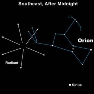
PS: One last chance to spot a meteor, tonight…

Colorado Springs: Low: 42, High: 68. Clear and cool tonight. Sunny & mild, Monday.
Pueblo: Low: 38, High: 72. Clear and seasonably cool, tonight. Sunny and warm Monday…clouds increase late.
Canon City: Low: 41, High: 69. Clear, cool tonight. Sunny through early afternoon, Monday. Clouds increase late.
Woodland Park: Low:36, High: 58. Clear and chilly tonight. Sunny and, mild Monday.
Tri-Lakes: Low: 39, High: 65. Starry skies tonight. Sunny and mild, Monday.
The Plains: Low: 43, High: 75. Clear tonight. Sunny through midday, Monday, increasing clouds late-day.
Trinidad/Walsenburg: Low: 42, High: 70. Starry skies, tonight. Sunny morning, Monday, then increasing clouds.
Extended Outlook…The only realistic rain chance is with increasing clouds early Tuesday, which decrease later Wednesday. Rain chances increase south, first (Trinidad/Walsenburg/etc) Tuesday afternoon…not till at night Colorado Springs. Ends west to east, later Wednesday morning along I-25, and early afternoon for the Plains.
Back to spectacular weather after that, but come Halloween, early projections are for spook-tacular weather, as a cold air mass pushes in the day before!

