Today’s Forecast:
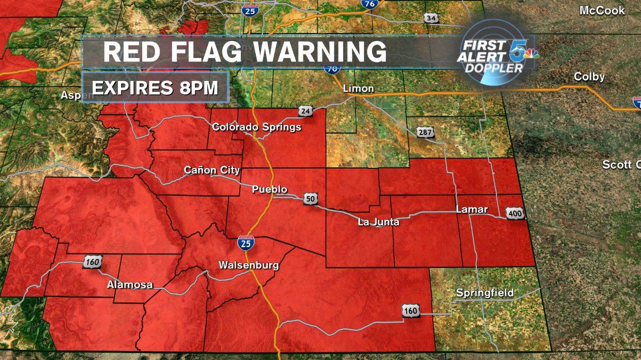
High heat and extremely high fire danger become the main story in today’s forecast. The winds will be strong again today, especially through the afternoon with critically low humidity. The dry air will also help temperatures soar with Colorado Springs climbing into the mid 90s and Pueblo to the lower 100s. Smoke trapped in the atmosphere may make the skies look hazy, especially through the morning hours. Mountain thunderstorms with dry lightning will be a large threat on fire prone ground through the afternoon.
COLORADO SPRINGS: High – 94; Low – 60. Very hot and dry today with critically low afternoon humidity and strong afternoon winds. This will lead to very high fire danger well into the evening. Dry lightning is possible in the mountains west of the city.
PUEBLO: High – 101; Low – 63. Extremely hot and dry today with stronger afternoon winds and very low humidity. Fire danger will stay very high well into the evening.
CANON CITY: High – 98; Low – 65. Very hot and dry today with a stronger afternoon wind and very low humidity. Fire danger stays high through the early evening.
WOODLAND PARK: High – 83; Low – 54. Very warm, dry and windy today with high based dry thunderstorms possible. Any storms today would likely put down gusty winds and dry lightning meaning fire danger is extreme through Teller county.
TRI-LAKES: High – 80s; Low – 50s. Hot, dry and windy today with critical fire danger. An isolated storm is possible late today east of the Tri Lakes just off the Palmer Divide but most of the area will likely stay dry.
PLAINS: High – 90s/100s; Low – 60s. Extremely hot and dry today with continued high fire danger. We’ll stay dry through most of the area but an isolated storm is possible through Las Animas county late today.
WALSENBURG/TRINIDAD: High – 90s; Low – 60s. Hot, dry and windy today with critical fire danger remaining in place as the humidity tanks this afternoon. High based and dry thunderstorms over the mountains west of the area are likely with lightning the main worry today.
WEEKEND OUTLOOK OR NEXT WEATHER MAKER:
The 4th of July looks hot, and mostly dry. Weak moisture will be pushed back into the region and while that could spark a few scattered thunderstorms, pretty dry air will remain across most of the region. Fire danger will stay elevated with strong afternoon winds expected through Wednesday. Thursday still looks like the best day for rain through much of southern Colorado with flash flooding as our main concern.
