Today’s Forecast:
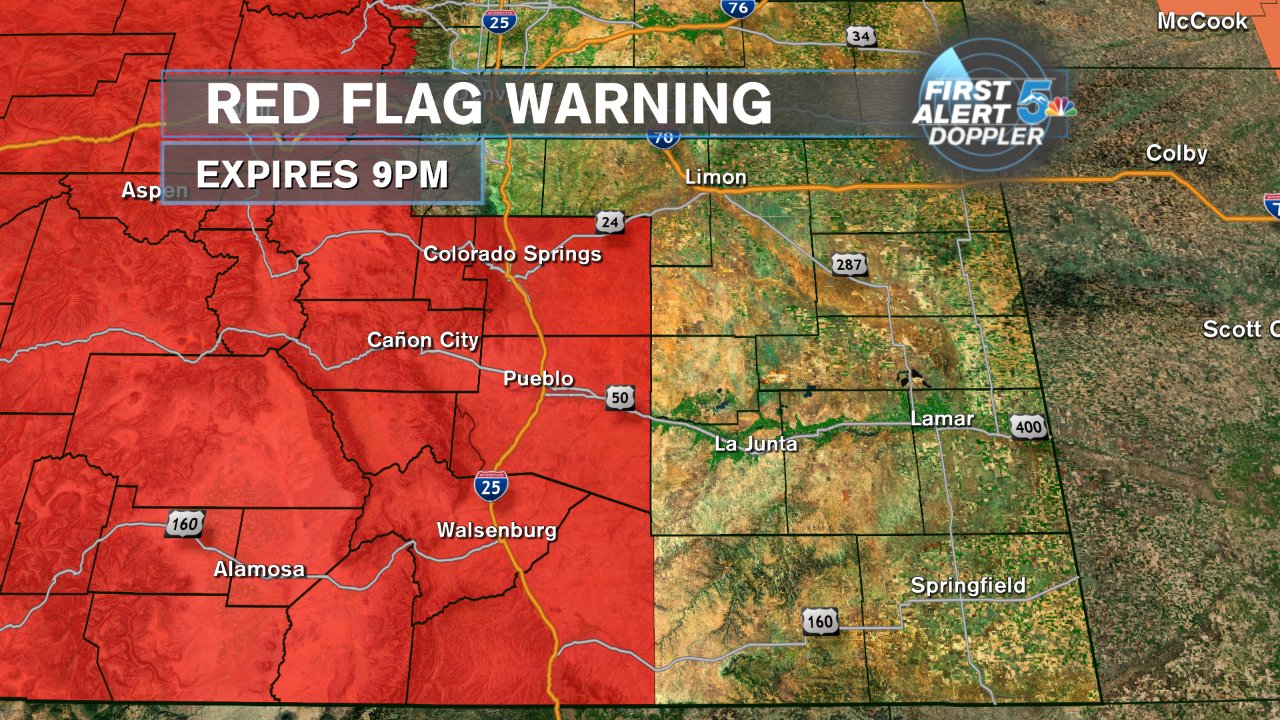
Prepare for another very hot day across southern Colorado with very high fire danger. We will not break records in the Springs or Pueblo today, but we’ll still see highs well into the 90s for Colorado Springs and lower 100s in Pueblo. The winds will stay strong today, especially in the afternoon and we’ll likely keep blowing smoke into the area from the south. Red Flag Warnings are in effect through 9pm tonight. Most of the area will stay dry but storms are possible along the eastern border late today and early tonight. A cold front moves through tonight helping to clear the smoke and bring much cooler air for Saturday.
COLORADO SPRINGS: High – 96; Low – 62. Hot and windy today with smoke heavier through the morning. High based thunderstorms could develop over the mountains west of the city but the dry air would likely mean we see gusty winds instead of rain making it to the ground.
PUEBLO: High – 103; Low – 65. Very hot again today with strong winds through the afternoon. The smoke will likely be thickest through the morning.
CANON CITY: High – 100; Low – 65. Hot and windy again today with smoke thicker through the afternoon but still present again early this evening.
WOODLAND PARK: High – 87; Low – 50. Very warm and dry today but surrounding mountain high based thunderstorms are possible with gusty winds more likely than rain. Smoke will be thick at times but you’ll notice it more in the morning.
TRI-LAKES: High – 80s; Low – 50s. Very warm and dry today with strong winds will into the evening. Smoke and haze will be present but more through the morning and less into the afternoon.
PLAINS: High – 100s; Low – 60s. Very hot again today with a steady breeze through the morning and afternoon. Storms are possible later today for counties bordering Kansas. These storms could be severe with hail and strong winds as the biggest issue.
WALSENBURG/TRINIDAD: High – 90s; Low – 50s/60s. Smoke once again heavy as southwest winds blow it up the interstate. Hot today with high winds and dry skies. One or two high based storms are possible into the mountains but gusty winds rather than rain are the most likely things to come out of storms.
WEEKEND OUTLOOK OR NEXT WEATHER MAKER:
A cold front moves through tonight and early Saturday morning. This will drop high temps Saturday about 15 degrees cooler than we’ll see today with heavier cloud cover and returning humidity. There is a chance for storms in the region tomorrow with the most likely areas of rain being along the Palmer Divide and the plains east of El Paso and Pueblo counties. Colorado Springs and Pueblo may see storms Saturday evening but keep in mind the best energy and the best chances are east of the cities. Sunday looks dry with highs in the 80s and low 90s for much of the lower elevations.
RELATED LINKS:
| Drive the Doppler | Colorado Temperatures |
| 7-Day Forecast | National Temperatures |
| Weather Cameras | Wind Chills |
| Traffic | Wind Speeds |
| Closings and Delays | Photos |
| Take 5 to Prepare | Storm Safe |
