Today’s Forecast:
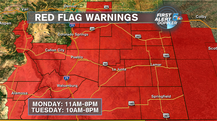
Red Flag Warnings are back in effect through southern Colorado as very dry air combines with strong afternoon winds to elevate our fire danger. The winds will really pick up after 11am today and die down after 7pm tonight. Temperatures will be great today with highs well above average across most of the area.
COLORADO SPRINGS: High – 67; Low – 33. Warm and windy today with gusts up near 30mph. Staying breezy and mild tonight.
PUEBLO: High – 67; Low – 33. Very warm and windy today with gusts up near 30mph. Staying breezy and mild tonight.
CANON CITY: High – 67; Low – 33. Warm and windy today with gusts up near 25mph. Staying breezy and mild tonight.
WOODLAND PARK: High – 67; Low – 33. Mild and windy today with gusts up near 25mph. Staying breezy and mild tonight.
TRI-LAKES: High – 67; Low – 33. Warm and windy today with gusts up near 25mph. Staying breezy and mild tonight.
PLAINS: High – 67; Low – 33. Very warm and windy today with gusts up near 30mph. Staying breezy and mild tonight.
WALSENBURG/TRINIDAD: High – 67; Low – 33. Very warm and windy today with gusts up near 35mph. Staying breezy and mild tonight.
WEEKEND OUTLOOK OR NEXT WEATHER MAKER:
Tuesday looks dry but even windier with Red Flag Warnings in effect from 10am till 8pm. A cold front will knock about ten degrees off the highs for Tuesday but we’ll stay dry. A cutoff low looks to bring very wet conditions back into southern Colorado by the end of the week with moisture moving in late Thursday night and giving us rain off and on through Saturday morning.
RELATED LINKS:
| Drive the Doppler | Colorado Temperatures |
| 7-Day Forecast | National Temperatures |
| Weather Cameras | Wind Chills |
| Traffic | Wind Speeds |
| Closings and Delays | Photos |
| Take 5 to Prepare | Storm Safe |
