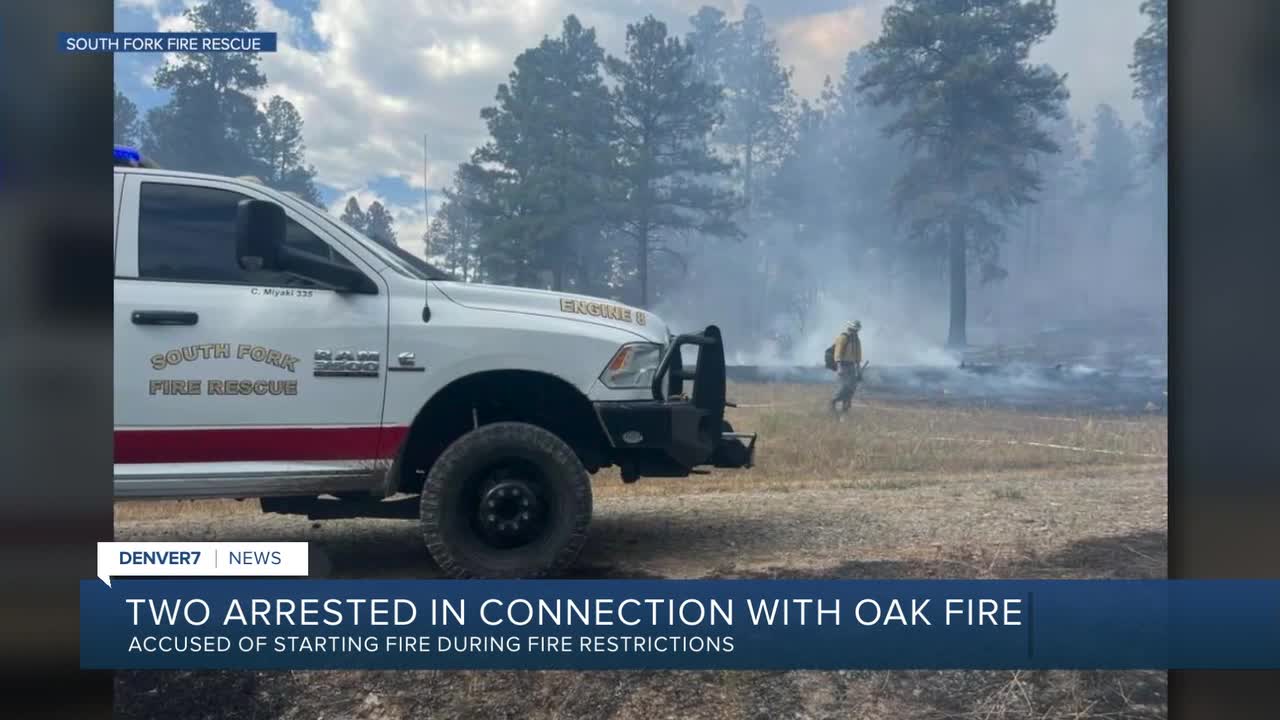


PAGOSA SPRINGS, Colo. — Two men were arrested Sunday in connection with the Oak Fire, the Archuleta County Sheriff's Office said.
Sergio Alaniz Jr., 40, and Ross Heirigs, 60, were arrested on multiple counts of fourth-degree arson. They're accused of an illegal burn that sparked the Oak Fire.
Firefighters originally reported the Oak Fire was a structure fire. The Archuleta County Sheriff's Office now said, the Oak Fire spread from a burn barrel in a subdivision off Oak Drive in Aspen Springs, in violation of open burning regulations for unincorporated areas of the county.
The Oak Fire started at 1:15 p.m. on Sunday, August 10 and quickly spread throughout the subdivision, extending a half mile into a neighboring subdivision.
Firefighters were able to contain the wildfire at 75 acres that same evening.
However, Archuleta County remains in a Stage 1 Fire Restriction, according to Sheriff Mike Le Roux.
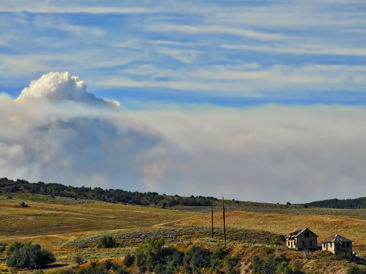
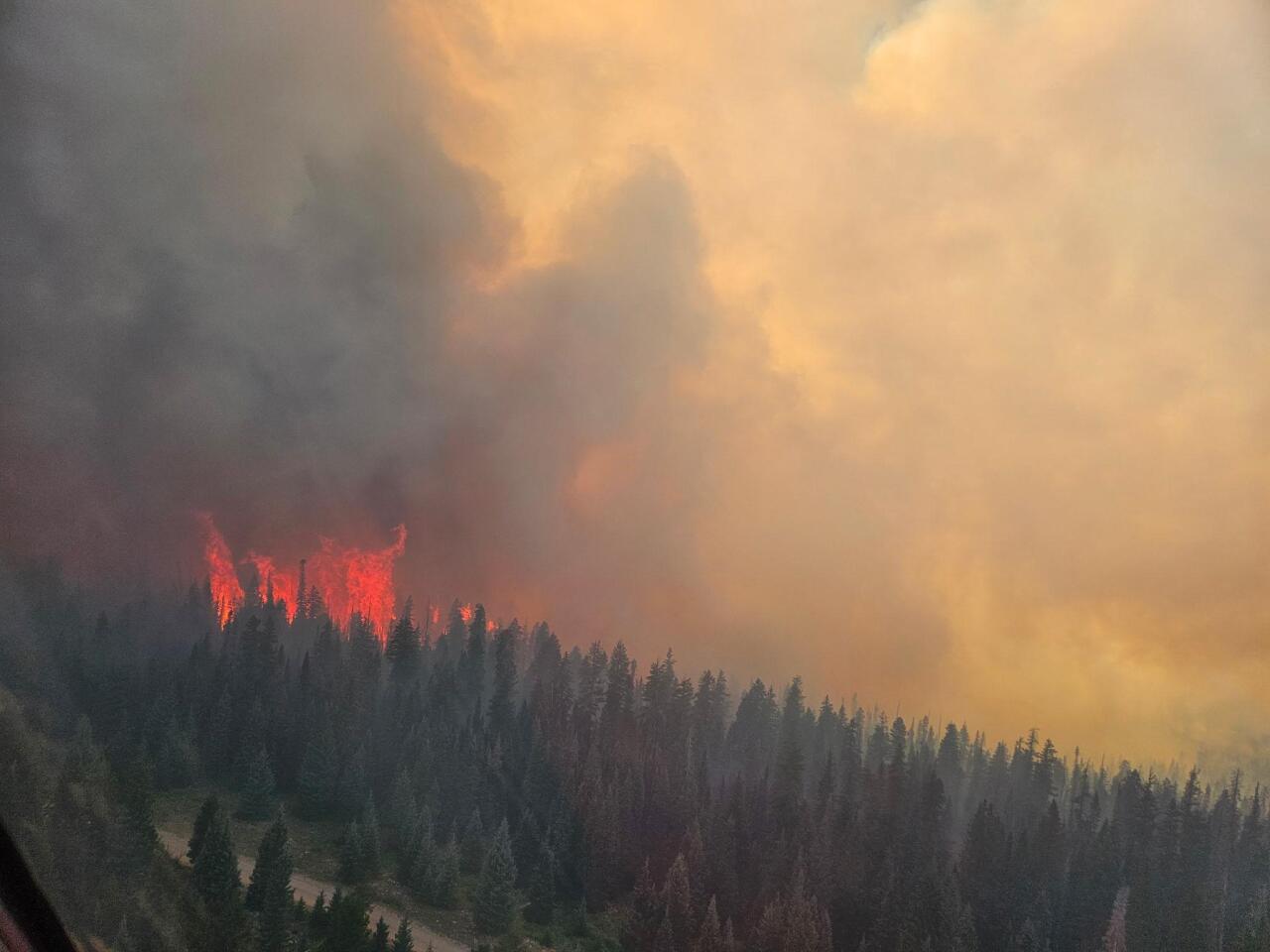
The Oak Fire is just one of several wildfires that have been burning across the state over the last few weeks.
At least 11 different fires have burned nearly 100,000 acres on the Western Slope across Delta, Dolores, Garfield, Grand, Mesa, Moffat, and Montrose counties.
The extreme fire behavior prompted Gov. Jared Polis to sign an executive order declaring a disaster emergency for the whole state on Thursday to bolster the state's response to these and any new potential wildfires.
Polis has also mobilized the Colorado National Guard to support response efforts for Rio Blanco County and has verbally declared a disaster declaration for fires elsewhere in the Western Slope. FEMA has authorized the use of federal funds to help with firefighting costs.

Size: 137,453 acres
Containment: 32%
First reported: Aug. 2
Cause: ⚡️
Location: 18 miles southwest of Meeker
Evacuations 🏠: For the most up-to-date evacuation map, click here.
Pre-evacuations: For the most up-to-date pre-evacuation map, click here.
The lightning-sparked Lee Fire, first reported on Aug. 2, is burning 18 miles southwest of Meeker in Rio Blanco County.
Three homes and 12 outbuildings have burned so far in the Lee Fire, according to officials in Rio Blanco County, who said firefighters made steady progress on the north side of the fire and continued to work along Hogback Ridge Thursday.
The Rio Blanco County Sheriff’s Office downgraded several evacuation zones from GO (red) to SET (yellow) and from SET to READY (green). The Garfield County Sheriff’s Office downgraded Zone 70 on the east side of Highway 13 in northern Garfield County from GO (red) to SET (yellow). Other zones have not changed.
On Saturday, firefighters secured containment line along the north and west edges of the fire perimeter, allowing officials to reopen Highway 13.

The following road closures are still in effect for residents in Rio Blanco County:
- RESTRICTED TO LOCAL TRAFFIC ONLY COUNTY ROADS: County Road 13 (residents who live in the area).
- CLOSED COUNTY ROADS: County Road 5, 22, 33, 40, 45, 47, 49, 63, 66, 67, 117,127, 129
The Rio Blanco County Sheriff's Office said a partial closure of the White River National Forest was also in effect due to the fire within the Blanco Ranger District west of and including the Long-Lost Trail system.
Updates posted to:
Elk and Lee Fire Information
Rio Blanco County Sheriff's Office
InciWeb

Size: 2,004 acres
Containment: 5%
First reported: Aug. 11 at 3:25 pm.
Cause: Unknown
Location: Routt National Forest in Rio Blanco County
Evacuations 🏠: A map of the evacuation zones can be viewed through this link.
Pre-evacuations: Residents in the area bordered by County Road 19 to the north, Highway 131 to the east, County Road 13 to the south and the Crosho Lake area to the west are included.
The 2,004-acre Crosho Fire, first reported on Aug. 11, is burning in Routt National Forest in Rio Blanco County. The cause of the blaze, which is threatening 240 structures, is unknown at this time.
On Saturday, some evacuees were allowed to return home. Officials have determined that it is safe for residents to return to Zones 3 and 4.
Nearby landowners and ranchers were contacted by fire officials, and plans to move livestock if needed were made, they said. Transition to a Type III Incident Management Team will occur on Wednesday afternoon.
The following roads are closed, effective immediately, due to the Crosho Fire and response efforts:
- Intersection of Routt County Road 15 and Routt County Road 17
- Intersection of Routt County Road 25 and Routt County Road 132A
- Rio Blanco County Road 8 (Dunckley Pass) at mile marker 38
A portion of the Routt National Forest, the Chapman Reservoir Campground, and dispersed camping in the Crosho Lake area are closed to the public. The Medicine Bow-Routt National Forests also issued an emergency closure order around the Crosho Fire.
Updates posted to:
InciWeb
Crosho Fire Information
Rio Blanco County Sheriff's Office
Size: 8,369 acres
Containment: 0%
First reported: July 28
Cause: ⚡️
Location: 20 miles northeast of Dolores
Evacuations 🏠: No current evacuations
Pre-evacuations: No pre-evacuations at this time
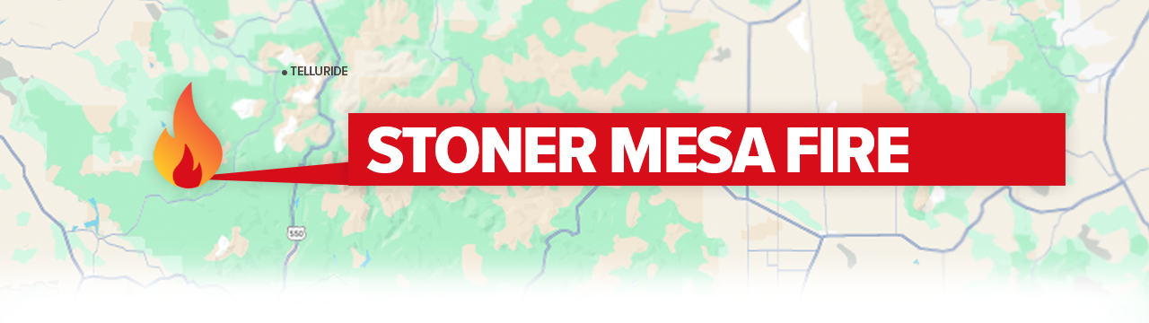
The lightning-sparked Stoner Mesa Fire, first reported on July 28, is burning west of Telluride inside the San Juan National Forest in Dolores County.
Officials said in a Sunday update that current warm and dry conditions will increase fire activity. Fine fuels, such as grass, will become receptive to fire and promote fire spread.

Additionally, they said firefighters continue to make good progress on containment lines in areas where the fire has been the most active while continuing to scout for opportunities for indirect containment lines in inaccessible parts of the fire.
Updates posted to:
Stoner Mesa Fire Information
USDA Forest Service Facebook page
InciWeb
Size: 31,679 acres
Contained: 79%
First reported: July 10
Cause: ⚡️
Location: 8 miles northeast of Gateway in Mesa County
Evacuations 🏠: No evacuation orders at this time
Pre-evacuations: All private lands in the Big Creek and Divide Forks Campground Evacuation Zones, including private inholdings in the Uncompahgre National Forest from Forest Road 406 to 409 (seen as the Cold Springs Evacuation Zone on evacuation maps), as well as all private in-holdings in the Ute Creek Evacuation area, which includes areas in the Uncompahgre National Fores.
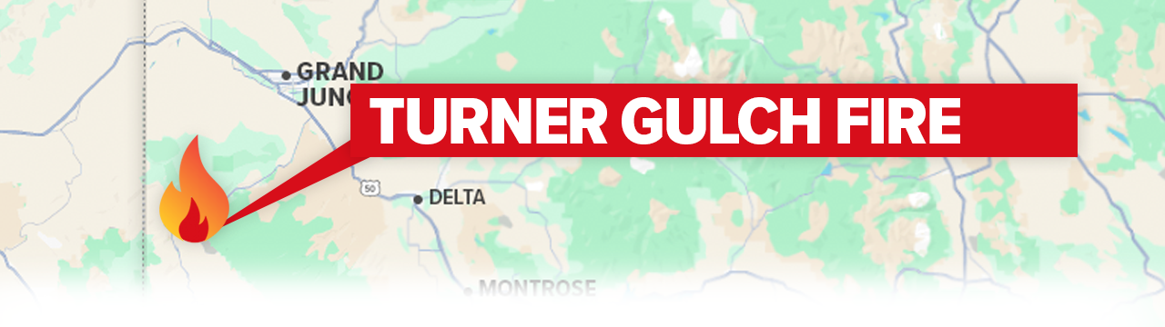
The lightning-sparked Turner Gulch Fire, burning off Highway 141 northeast of the town of Gateway in Mesa County, has burned more than 31,000 acres. The blaze was discovered on July 10, during a red flag event following a period of widespread dry lightning.
Command of the fire transferred to Northern Rockies Team 3 under Incident Commander Mike Behrens Saturday night.
The incident objectives remain the same and the new team will continue with suppression activities while also providing initial attack resources and support to the agencies.
No injuries have been reported, and no structures have been lost.
Updates posted to:
InciWeb
Turner Gulch Fire Info.
Upper Colorado River Interagency Fire Management Unit Facebook
WILDFIRES THAT HAVE BEEN FULLY CONTAINED OR NEARING FULL CONTAINMENT
Blue Ridge Fire
Size: 25 acres
Containment: N/A
First reported: Aug. 15
Cause: Under investigation
Location: La Plata County
Elk Fire
Size: 14,518 acres
Containment: 100%
First reported: Aug. 2
Cause: ⚡️
Location: 11 miles east of Meeker
Deer Creek Fire
Size: 17,724 Acres
Containment: 100%
First reported: July 10
Cause: ⚡️
Location: Eastern Utah, Montrose County
Leroux Fire
Size: 195 Acres
Containment: 100%
First reported: Aug. 3
Cause: ⚡️
Location: Delta County
Oak Fire
Size: 75 acres
Contained: 78%
First reported: Aug. 10
Cause: Structure fire
Location: Archuleta County west of Pagosa Springs
Peninsula Fire
Size: 17 acres
Containment: 80%
First reported: Aug. 8
Cause: ⚡️
Location: South of Highway 145, between Norwood and Placerville
South Rim Fire
Size: 4,232 Acres
Containment: 80%
First reported: July 10
Cause: ⚡️
Location: Black Canyon of the Gunnison National Park
Windy Gap Fire
Size: 30 acres
Containment: 100%
First reported: Aug. 6
Cause: Unknown
Location: Grand County
Wright Draw Fire
Size: 466 acres
Containment: 100%
First reported: July 10
Cause: ⚡️
Location: Mesa County
Yellowjacket Fire
Size: 35 acres
Contained: N/A
First reported: August 15
Cause: Unknown
Location: Northeast of Meeker, Colo.
___

Pueblo restaurant adapts as a relief hub for Aspen Acres Fire first responders
A local business owner in Pueblo who, like so many others, sprung into action in response to the Aspen Acres Fire.
____
Watch KOAA News5 on your time, anytime with our free streaming app available for your Roku, FireTV, AppleTV and Android TV. Just search KOAA News5, download and start watching.
