


Highway 285 is a popular drive to get from the metro to Gunnison, Buena Vista, Durango, Telluride, Black Canyon of the Gunnison and other great destinations. However, the drive can get long, especially when there’s traffic.
The Beaver Creek Trail is a pleasant trail to stretch your legs and spend a little time in the forest instead of traffic.
The Beaver Creek Trail trailhead is just 3.5 miles from the intersection of Highway 285 and Highway 9 in Fairplay.

There’s a large parking lot and a little dirt trail that winds through the forest of pine trees and Aspens.
Start at the sign that says trail #687 and walk through the fence opening into the forest. Here, you'll find a pleasant trail that really just winds through the forest.
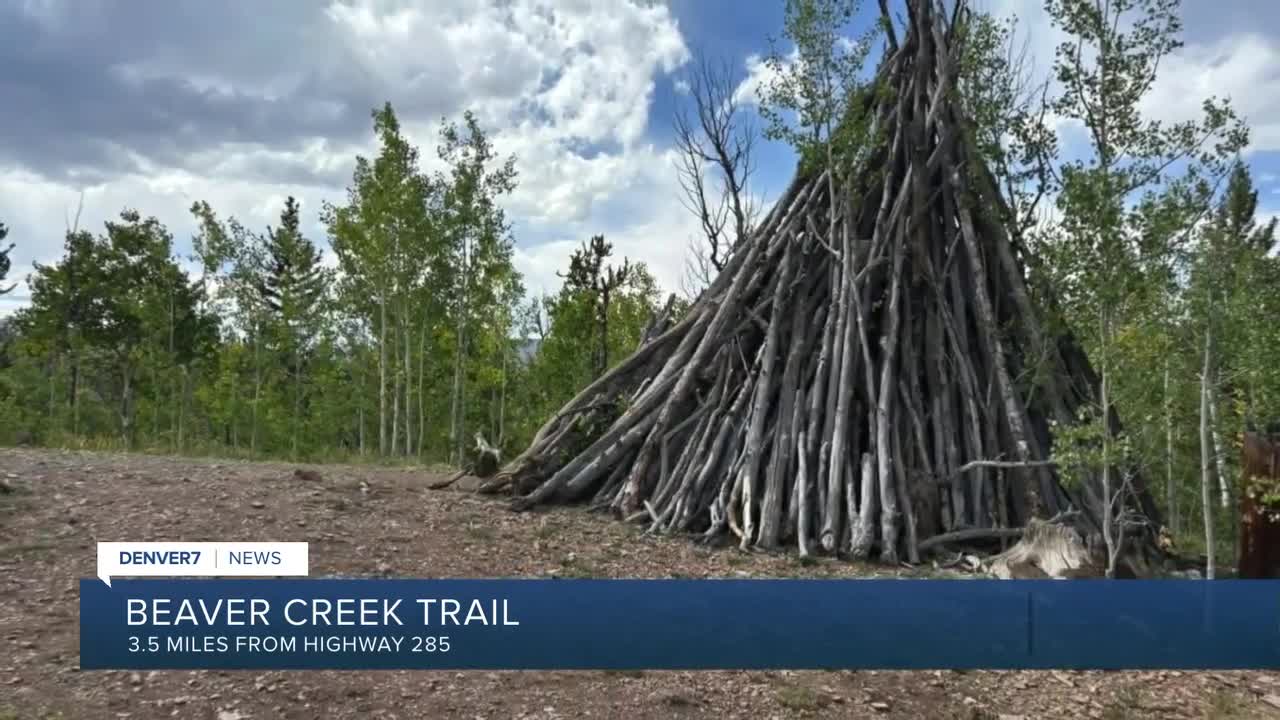
At 0.4 miles in, you may notice a trail split. Take a moment to go left and check out the very large teepee of tree logs. There are also views of the nearby mountains just over the treetops.
Back on the main trail, you may notice blue diamonds on the trees, that’s because this trail is open to snowshoers in the winter.
At 0.75 miles, you’ll come to an old trail split. The old trail is now blocked off, and there’s a sign showing that trail #687 continues on. This is a good place to turn around if you would like a 1.5 mile round-trip hike.
If you continue on, the trail meanders through the trees. These are actually switchbacks and the trail goes downhill, meaning there’s going to be some uphill on the way back (148-ish feet).

At about 1 mile, the trail comes out of the forest, into a meadow and curves back to the road, farther up from where you started. That means someone could hike 1 mile one-way, while someone else drives up the road to pick them up at the upper parking lot.
One of the nice things about the AllTrails app is sometimes the comments have good advice. In this case, one of the comments said, “Make sure you walk the boardwalk at the end of the trail.” While AllTrails thought I was off trail, I found a very nice boardwalk through the willows.
As I walked the flat, wheelchair-friendly boardwalk, I heard running water below me. The boardwalk is just high enough to keep you out of the wetlands, water, mud, and willows. I even saw a squirrel taking advantage of the boardwalk.
At the end of the boardwalk, there’s another dirt trail that heads into the forest on the other side of the valley, creating a longer hike, if that’s what you want.
Since I was looking for a short walk, I turned around and headed back
Remember, there is some elevation gain on the way back.
Details: My hike, with the boardwalk, was about 2.65 miles round-trip with about 150 feet of elevation gain. However, you can make this a 1 mile round-trip, 3 mile round-trip, 1.15 one way or create your own option.
Directions: I googled Beaver Creek Trail Fairplay, and got directions to the trailhead. If you don’t have cell service, from the intersection of Highway 285 and Highway 9, go north on Highway 9. Drive-through part of town, and turn right on 4th Avenue. Go 0.2 miles and turn left on Beaver Lane. Drive 2.4 miles on a dirt road that has washboards, making it a little rough, but fine for 2WD cars. Turn right on Beaver Creek Road and drive .3 miles to the large parking lot/trailhead.
Note: the Beaver Creek Trail is on AllTrails under the Pike National Forest, but it’s not on the COTREX app.
If you have any questions, or hike suggestions, email me at HikingDebbie@gmail.com and find more great hikes by following me on Facebook at Facebook.com/DenverHikingExaminer.
