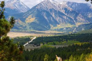
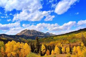
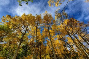
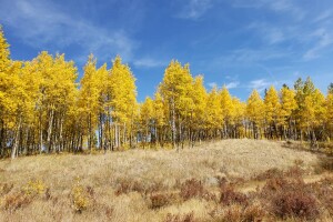
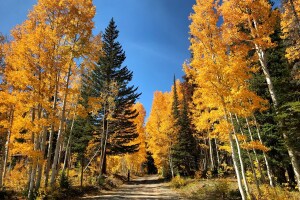
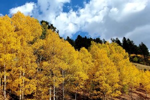
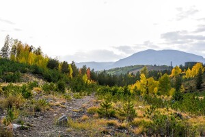
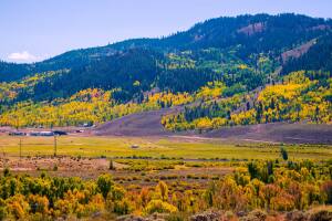
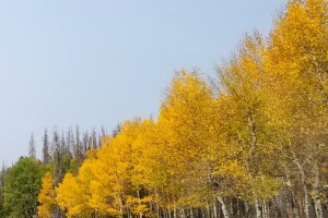
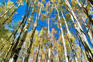
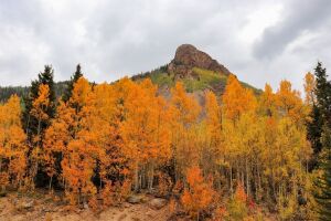
Along with cooler weather, autumn also brings one of the most beloved natural spectacles to Colorado: gold aspens.
Denver7’s Chief Meteorologist Mike Nelson says the dry weather this summer will bring aspens to their golden glory a little faster than usual. The colors are expected to peak a week or so ahead of schedule.
Nelson says the northern Colorado mountains will see the best color from Sept. 12-24. The central mountains will peak about five days later, and the southern mountains will reach their most brilliant colors the last few days of September and first five days or so of October.
Aspens turn gold as the amount of sunlight slowly decreases, switching off the mechanism in the leaves that creates chlorophyll. As the green fades, the gold color dominates until the leaf dies and falls off the branch. In some places popular for leaf peeping, including Kenosha Pass, the aspen leaves are also turning brown.
Dr. Dan West, an entomologist with the Colorado Forest Service specializing in trees and tree issues, blamed the issue on drought and bugs. Click here to read Denver7's interview with West.
So, where will you go this year to see the changing aspens? Looking for a hike? Or maybe a scenic drive or train ride? With hundreds of beautiful places to choose from, it can be difficult to narrow down the best choices near you. We’ve put together a list and interactive map of some of the top drives, hikes and train rides you can check out for all your fall foliage viewing.
Note: Is your favorite spot not on this list? Want to include it? Send a picture, location information and any other details about the spot to newstips@thedenverchannel.com or the Denver7 Facebook inbox, and we’ll include it in the “Recommended by Denver7 viewers” section below.
“Leaf Peeping” season in Colorado is on; please peep responsibly 🍂https://t.co/r03akmQoYZ pic.twitter.com/MQMSbJGYGn
— CPW NE Region (@CPW_NE) September 25, 2020
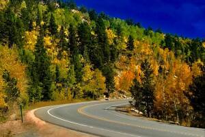
Top 10 drives
(Please check to ensure each road is open before you leave home. Wildfires may close some areas unexpectedly)
Gold Camp Road
Start and end points: Colorado Springs to Victor
Drive time from Denver: 1 hour, 30 minutes
Notes: Fittingly named, the Gold Camp Road runs from west Colorado Springs to Victor. Beautiful views of the countryside and aspens will fill the curvy drive. There are plenty of places along the way to pull off the road to snap a few pictures. The road starts in Colorado Springs, but you’ll need to drive several miles west before you'll start to see aspens.
Kebler Pass
Start and end points: Crested Butte to Paonia
Drive time from Denver: 4 hours, 20 minutes
Notes: Also called Gunnison County Road 12, this road starts in Crested Butte, heads west, and ends near the south end of Paonia State Park east of Paonia. The high mountain pass takes drivers up to just over 10,000 feet, with stunning views of the landscape on both sides. This is a favorite location for leaf peeping. The pass is not paved.
Gunnison County Road 3
Start and end points: South Carbondale to east of Crystal
Drive time from Denver: 4 hours, 50 minutes
Notes: Explore this road — which is a mix of pavement and dirt — by car or bike (or foot!). Also called the Road to Marble, this roadway is about 12 miles long from Evergreen Lane in south Carbondale to the split at Forest Road 317 through Marble and Crystal. Drive slowly here, especially on the rocky terrain and when passing traffic moving in the opposite direction.
Trail Ridge Road
Start and end points: Rocky Mountain National Park
Drive time from Denver: 1 hour, 45 minutes
Notes: The 48-mile Trail Ridge Road will bring you — slowly — around this national park, in full view of the changing trees. There are plenty of places to pull off and explore the wilderness on foot. Even if you choose to stay in the comfort of a car, be sure you’re hydrating because the road climbs about 4,000 feet quickly. You will need a reservation if you plan to enter the park between 6 a.m. and 5 p.m. Click here for details on reservations.
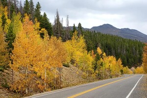
Top of the Rockies Scenic Byway
Start and end points: Copper Mountain to Aspen
Drive time from Denver: 1 hour, 20 minutes
Notes: This byway, which hovers around 9,000 for several miles, has several spots along the way where you can get out to stretch your legs and explore the foliage. The byway is about 80 miles long in total and takes drivers over Tennessee Pass.
Peak to Peak Scenic and Historic Byway
Start and end points: Boulder to Black Hawk
Drive time from Denver: Varies, depending on point of entry
Notes: This is Colorado’s oldest scenic byway (it was established in 1918!). It winds about 60 miles though national forests along the Front Range. There are multiple spots along the way — including Rocky Mountain National Park and Golden Gate Canyon State Park — where you can get out to see more golden aspens on foot.
San Juan Skyway
Points along the way: Ouray, Ridgway, Telluride, Rico, Dolores, Durango, Silverton
Drive time from Denver: 5 hours, 40 minutes
Notes: This 230-mile looped byway travels through multiple southwestern towns and the San Juan and Uncompahgre National Forests. Experts recommend spending at least two days soaking in the area and scenery.
Guanella Pass Scenic Byway
Start and end points: Georgetown to Grant
Drive time from Denver: 50 minutes
Notes: If you’re itching to see the changing aspens sooner than later, Guanella Pass is your go-to. The leaves usually start changing here earlier than other places. The new road makes the going easy for this drive — nice and smooth riding. If you want to stretch your legs, you can hop out to walk on the Bierstadt Trail (or go all the way to the summit at 14,065 feet for more breath-taking views). As with all high-elevation spots, weather can change quickly here, so keep an eye on the sky.

West Elk Loop
Points along the way: Paonia, Gunnison, Crested Butte and Carbondale
Drive time from Denver: 3 hours
Notes: Take a couple days — or one, if you're OK with driving 6-8 hours — and explore this loop, which spans more than 200 miles long. See the Crystal River, Mount Sopris and Black Canyon of the Gunnison. While enjoying the yellow aspens, you can also check out the area's rich mining history.
Cottonwood Pass along County Road 306 between Buena Vista and Taylor Park
Start and end points: Buena Vista to Almont
Drive time from Denver: 2 hours, 45 minutes
Notes: Drive over the Continental Divide and enjoy the changing aspens on the way up and down, while taking in an incredible mountain pass at 12,126 feet in the middle. The pass is paved, so most cars should be able to make it to the top just fine. In fact, Cottonwood Pass is the highest paved mountain route over the Continental Divide. Camping is available in the area. Cyclists often use this county road, so remember to share the road.
Top 10 hikes
(Please check to ensure each trail and trailhead is open before you leave home. Wildfires may close some areas unexpectedly)
Fourth of July Trailhead/Hessie Trailhead (Nederland)
Trailhead: West of Nederland and Eldora
Length: Multiple lengths
Drive time from Denver: 1 hour, 20 min
Fee: None
Notes: From the trailhead, ascend into the Indian Peaks Wilderness Area, which is filled with aspens. Parking at this split trailhead fills quickly on the weekends, so come early or take the free shuttle from Nederland Park and Ride to the trailhead.
Jud Wiebe Trail (Telluride)
Trailhead: Northern end of N. Aspen Street or northern end of N. Oaks Street
Length: 2.6 miles
Drive time from Denver: 6 hours, 10 minutes
Fee: None
Notes: This trail provides a beautiful view of Telluride while taking hikers up through aspen and spruce forests to an open meadow. It’s a heavily used trail.
Booth Creek Falls (Vail)
Trailhead: Northern end of Booth Falls Road
Length: Multiple lengths (to get to the waterfall and back is about 4 miles)
Drive time from Denver: 1 hour, 40 minutes
Notes: Parking is limited, so you can take the free Town of Vail bus from the Vail Village parking structure to the trailhead. This trail starts climbing immediately, but offers plenty of places to sit at the waterfall.
Golden Gate Canyon State Park (Golden)
Trailhead: Multiple entry points
Length: Multiple trails
Drive time from Denver: 1 hour
Fee: Daily pass is $9 unless you have a state park pass
Notes: Just about 30 miles away from Denver, this state park offers many different trails — both long and short — for visitors. Enjoy the aspens during the climbs, downhills and open fields.
Staunton State Park (Pine)
Trailhead: Take S. Elk Creek Road (Elk Creek Road exit) north off Highway 285 and continue about 1.5 miles to the park entrance on the right.
Length: Multiple trails
Drive time from Denver: 45 minutes
Fee: Daily pass is $9 unless you have a state park pass
Notes: Don’t want to drive too far to see the changing aspens? Staunton State Park, at just 45 minutes away from downtown Denver, offers the best of both worlds: short drive, beautiful fall foliage! Some of the trails in the park are rugged, so be prepared for some long uphills and rocky terrain.
Spring Creek Road and Trail (Steamboat Springs)
Trailhead: Corner of Amethyst Drive and E. Maple Street
Length: A little more than 10 miles roundtrip (it’s an out-and-back trail, so turn around early if you want to shorten the hike)
Drive time from Denver: About 2 hours, 45 minutes
Fee: None
Notes: This moderate trail starts at the intersection and heads west. It boasts beautiful wild flowers in the summer that leads to the changing aspen colors come autumn. There are some benches along the first section that are shaded if you need a break to enjoy the scenery. Park before you reach the ponds on the left. It starts as a dirt road and leads into a trail.
Kenosha Pass (Jefferson)
Trailhead: Forest Road 849 off of US Highway 285
Length: Multiple lengths along the Colorado Trail
Drive time from Denver: 1 hour, 15 minutes
Fee: None
Notes: If you can grab a parking spot at Kenosha Pass (go early!), you can spend many miles hiking on the Colorado Trail in the glow of the yellow aspens. Bathrooms are available on the southern side of the trail. The trail is split by the highway, so use extra caution when crossing. This area gets very congested on weekends during peak leaf peeping season, so please drive carefully.
Dyke Trail (Crested Butte)
Length: 13.9-mile loop
Drive time from Denver: 4 hours, 50 minutes
Fee: None
Notes: If you’re willing to work hard for it, this trail will reward you with spectacular views. It’s a climb that dumps you out around 10,500 feet. Be prepared for single-track, technical downhills, a few small water crossings and beautiful views of the mountains, sprinkled in yellow splotches of aspen groves.
Argentine Central Railroad Grade (Silver Plume)
Trailhead: Take exit 226 off I-70, look for the hiking sign and turn onto Mountain Street heading east. It ends at the trailhead.
Length: Up to 13 miles one way
Drive time from Denver: 50 minutes
Fee: None
Notes: This trail takes users from Silver Plume toward, but not to, Grays and Torreys Peaks. It’s a long steady uphill, but is an out-and-back trail, so hikers can turn around at any point. The trail runs through many aspen groves. Keep an ear out for the nearby Georgetown Loop Railroad.
Butler Gulch trail (Clear Creek County) (CURRENTLY CLOSED DUE TO WILLIAMS FORK FIRE)
Trailhead: Butler Gulch Trailhead
Length: 5 miles out and back
Drive time from Denver: 1 hour
Fee: None
Notes: Find parking at the trailhead or the nearby Henderson Mine facility and then head south on Butler Gulch Trail. You’re just barely an hour outside of Denver, but it will feel like a total mountain experience with miles-long views, waterfalls, aspens (of course!) and more. If you want to check this out during peak leaf-changing season, leave early. The parking lot fills up fast on weekends.

Take a train ride instead
If you’d rather relax to the max, but enjoy the fall foliage just as much, there are multiple trains that weave their way through the mountains, giving you beautiful views from the comfort of a train car. Some aspects of these train rides may change throughout the season due to COVID-19. Visit each company's website to review guest safety requirements.
Cumbreas & Toltec Scenic Railroad
Start and end locations: Antonito, Colorado to Chama, New Mexico
Fee: $20.50-$27.50 (price may change)
Notes: This train run daily until Oct. 20. If you want a train ride specifically catered toward the changing leaves, look into hopping aboard this railroad’s Fall Colors Explorer Train, which runs from Sept. 9 to Oct. 12.
Georgetown Loop Railroad
Start and end locations: Georgetown and Silver Plume
Fee: $30-$40 (price may change)
Notes: This railroad has two options catered toward leaf peeping: The Fall Colors Train and the Fall Colors Express. As of Aug. 31, the Grizzly Creek Fire (and its smoke), which is 100 miles away, is not impacting the train operations, according to the company's website.
Leadville Colorado & Southern Railroad
Start and end locations: Leadville and Climax
Fee: $22-$86 (price may change)
Notes: Take a trip around the Continental Divide and San Isabel National Forest. Roundtrips are 2.5 hours long. Trips are offered through the week at 1 p.m. with rides catered toward photographers at 10 a.m. and 2 p.m. on the weekends.
Cripple Creek and Victor Narrow Gauge Railroad (season will end Sept. 7)
Start and end locations: Cripple Creek and Victor
Fee: $50-$205 (price may change)
Notes: This ride, which is narrated with information on the area, takes visitors four miles in 45 minutes, including stops along the way. The train runs every 40 minutes from 10 a.m. to 5 p.m. and is pet friendly. It is first come, first serve, so no reservations are required.
Durango and Silverton Train
Start and end locations: Rockwood Station to Cascade Canyon
Fee: $70-$86 (price may change)
Notes: All train rides to Silverton have been canceled for the rest of the 2020 season. However, trains are still running from Rockwood Station to Cascade Canyon on Tuesdays through Saturdays. The ride is about two hours long and travels deep into the wilderness to places far from any roads.
Recommended by Denver7 viewers
Have you been to a place that you think deserves to be on this list? Send a picture, location information and any other details about the spot to newstips@thedenverchannel.com or to the Denver7 Facebook inbox. We'll include it below. This section will be updated throughout the 2020 season. Want to see more Colorado photos? Click here to join the Our Colorado photography Facebook group.
Breckenridge (photo by Janette Jaynes)
Grand Mesa (photo by Stefan Pigorsch)
Road from Divide to Cripple Creek (photo by Katie Steckly)
From the Old Dillon Reservoir area between Lake Dillon and I-70 (photo by Steve Johnson | taken Sept. 16, 2020)
Granby area (photo by Unique Photos For Life Photography by Melissa Walker)
Between Grand Lake and Granby (photo by Mary Sue Albers)
Near the Gold Hill Trailhead on Highway 9 (photo by Steve Johnson | taken Sept. 16, 2020)

Granby (photo by Kris Ramer)
Between Ouray and Silverton (photo by Jessica Warick)
Wellington Mine near Breckenridge (photo by Bob Kinhart)
Leadville area (photo by Tami Loyche)
Between Twin Lakes and Minturn