COLORADO SPRINGS — On this date two years ago, parts of Colorado saw over one foot of snow just days after record-breaking heat!
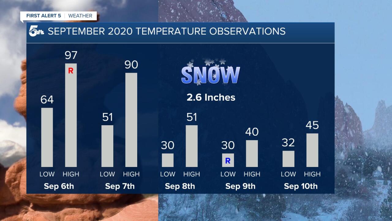
From September 6th to September 9th in 2020, we saw highs in the 90s and 100s fall to lows in the 30s with accumulating snow.
yesterday vs. today pic.twitter.com/0RuOBtQEvG
— Luke Runyon (@LukeRunyon) September 8, 2020
The snow was a welcome sight to firefighters working on the Cameron Peak Fire.
That fire, the largest in Colorado's history, had grown well past 100,000 acres since it first ignited back in mid-August.
The snow didn't put out the blaze, but it did slow the growth considerably until more snow fell in October.

Here's how things evolved in that four day period.
We saw record heat in Colorado Springs, Pueblo, and Denver on September 6th. Colorado Springs reached a high of 97 degrees while Pueblo hit 103.
September 7th, Labor Day, was still very hot in both cities with Colorado Springs hitting 90 degrees and 94 in Pueblo.
Rain started falling on September 8th with a brief high temperature in the mid-50s.
Rain then turned to snow and continued to accumulate through the morning of September 9th.
Below is a map of snow totals that were reported from September 8th through the 9th.
Be sure to zoom in down around Westcliffe and Alamosa where some of the heaviest snow fell!

Del Norte in Rio Grande County reported a total of 16 inches, the highest report of the event.
El Paso County saw a wide range of snow from 5 to 7 inches up in the Tri-Lakes area to a broad 2 to 4 inches across town.
Pueblo central saw around 1.5 inches of snow while Pueblo west saw just over 3 inches.

This was a very historical event for the region with multiple records breaking across the state.
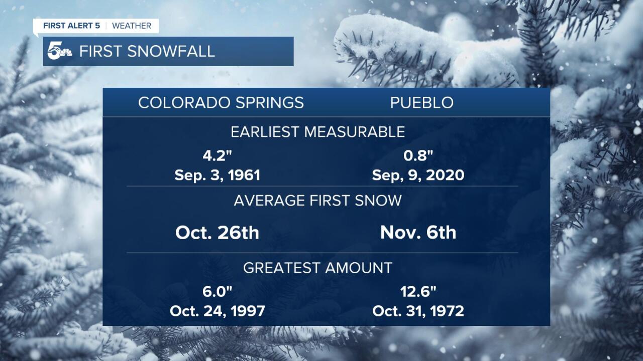
While not the earliest measurable snowfall in Colorado Springs, last year was the first measurable for Pueblo.
On a normal year, we wouldn't see snow until the end of October in Colorado Springs and the beginning of November in Pueblo.


