


Everyone knows about rain and snow, but have you ever seen sleet, graupel, or freezing rain?
We'll breakdown four of the main precipitation types that fall in the atmosphere and go over how they form.
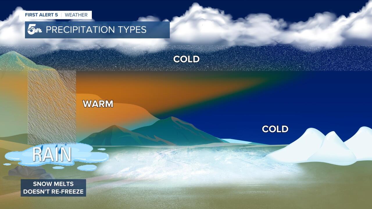
Rain, which is probably the most common form of precipitation in the world, is formed when the air between the cloud bottom and the ground is above freezing.
During the transition seasons like Spring or Fall, the column of warm air can be a little smaller than what you'll see in the warmer Summer month. It's possible for rain to start out as snow, or a rain/snow mix as it leaves the clouds, only to warm up and melt as it falls to the ground.
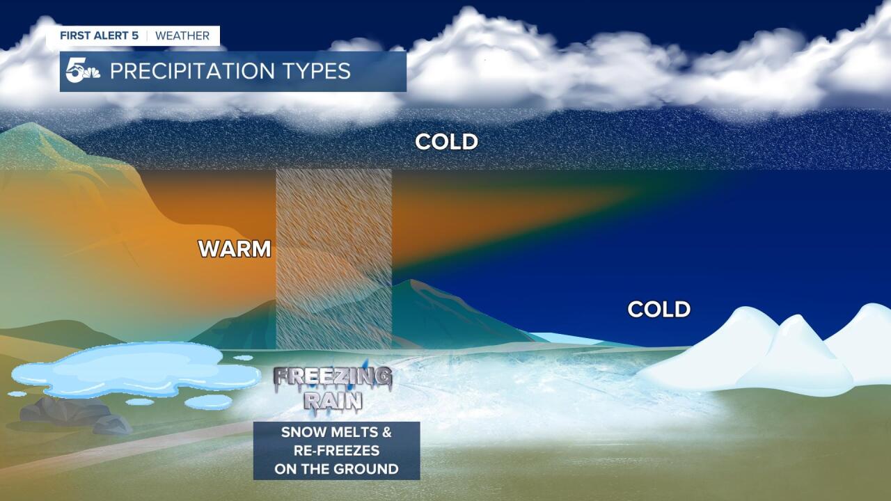
If you've lived in parts of the South or the Midwest, you might have heard (and dread) of freezing rain.
Freezing rain is formed when rain or snow falls through a warm layer in the atmosphere and then hits freezing air right on the ground.
If really shallow, or thin air sneaks in under a warm layer, that freezing air can stay right near the surface. Freezing rain is probably one of the most dangerous forms of precipitation because it can lead to a large coating of ice on power lines, sidewalks, and roadways.
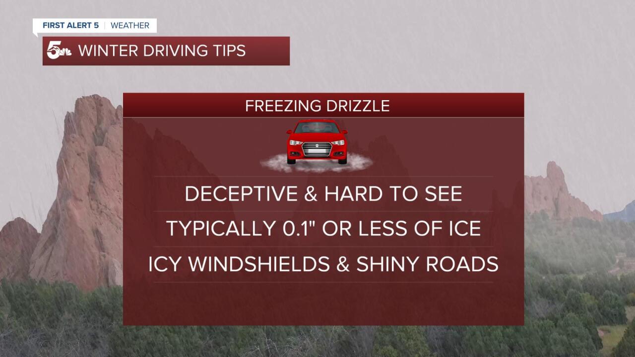
Freezing drizzle is a similar process, but you just tend to see less moisture and a thinner glaze of ice compared to freezing rain.

Sleet is usually associated with things like a rain/snow mix, wintry mix, or ice pellets.
Sleet is typically seen just before and after winter and forms when snow falls from a cloud, hits warmer air at some point down through the sky, and then re-freezes again before it hits the ground.
That melting and re-freeze will often result in a wet and mushy type of precipitation and can look like ice pellets or a mix of raindrops and snow mixed together.

Snow is the second most common form of precipitation, and it's a pretty easy one to explain.
Snow forms when the air from the cloud to the ground is at or below freezing.
The amount of snow depends on the storm's strength, the temperature of the air, and how much moisture is being pulled into the storm.
Southern Colorado tends to see either rain or snow, we don't often get a mixed form or precipitation or freezing rain.
When we have an easterly wind (an upslope wind), really moist air, and freezing temperatures at or near the ground, we can occasionally get freezing drizzle.
Freezing drizzle is a high impact event in southern Colorado because it's not very common, and it can lead to a very thin and hard-to-see layer of ice on the roads.
If we're ever concerned about a freezing drizzle event, listen to the forecast, and try to delay travel as late as possible into the day for the air and roads to heat up and melt any ice that has accumulated.
