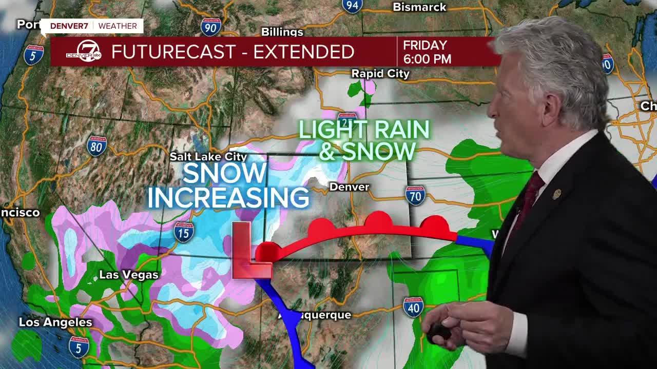
While an incoming snowstorm is still hundreds of miles away from Colorado, it may grow to become one of the biggest storms to hit Denver in several years.
LEARN MORE: Live Streaming | Forecast | Weather Page | Traffic Map | Closings & Delays | Radars
After a few dry days in the 60s, the Front Range is in for a big change as a storm that originated in the Gulf of Alaska moves its way across the west coast and into the central Rockies.
Denver7 Chief Meteorologist Mike Nelson explained that current models for the storm range from a few inches to several feet of snow dumping around the Denver metro area. The National Weather Service in Boulder on Wednesday issued a winter storm watch for the Denver area and the foothills and a winter storm warning for parts of the southeastern plains.
READ MORE: Just how much snow Colorado could get this weekend, and why it's tough to predict
Looking at the data from these various models, Meteorologist Nelson said by late Wednesday, rain and snow will begin falling over the western United States. This slow-moving storm will begin to move across the Great Basin, Nevada and into Utah. All the while, snowfall will increase and colder temperatures will settle around the Denver metro area.

Weather News
Weather 24/7: Live Colorado radar, current conditions on your TV
The National Weather Service in Boulder issued a winter storm warning for the storm on Thursday afternoon for the Front Range and mountains, which will go into effect at 5 a.m. Saturday through 6 a.m. Monday and calls for heavy and widespread snow.
Light precipitation is possible throughout the day Friday before snow showers start to develop along and east of the Continental Divide Friday afternoon before the storm begins in earnest Friday night into Saturday morning.
Latest update on the storm shows that it is slowing down! That means the heavy snow starts later and lasts longer! Would not be surprised to see over 5 feet in some places east of the Continental Divide! @denverchannel #cowx #Coloradosnow pic.twitter.com/op2xLiqbKv
— Mike Nelson (@MikeNelson247) March 11, 2021
A trough is expected to position itself in the Four Corners area by Saturday morning, which will move slowly east throughout the day Saturday – part of the combination of conditions that are expected to create the heavy snowfall along the Front Range, according to the National Weather Service.
READ MORE: Heavy snow is in the forecast. Here's why Colorado needs it
Whether that trough tracks more northward or more to the south will have an impact on the snow totals – with a more southerly track showing higher snowfall amounts, the NWS said in its forecast discussion Thursday.
But combined with easterly, upsloping winds, meteorologists still expect widespread heavy snowfall, which could include rates of nearly 3 inches per hour in the foothills on Saturday night.
The NWS said Boulder and Fort Collins could see rates of about 2 inches per hour during that same time period. Snow is expected to linger into Sunday night and Monday morning before ending around noon on Monday, though wind gusts could also pick up on the plains on Sunday.
Updated storm total snow map! 15-25" expected across urban corridor with up to 30" in Boulder and Fort Collins. 2 to 4 feet of snow in the foothills. Lower amounts west of Continental Divide and east of DIA. #COwx pic.twitter.com/ykTuxhsuiC
— NWS Boulder (@NWSBoulder) March 11, 2021
The National Weather Service said Thursday the Denver metro area should still expect 15-25 inches of snow, with 20-30 inches in the Boulder and Fort Collins area, 2 to 4 feet in the foothills, and up to 5 feet in some places in the northern foothills.
“There is high confidence in the impacts for the urban corridor and foothills with nearly impossible travel conditions Saturday night and Sunday,” the NWS wrote in Thursday’s forecast discussion.
Both AAA Colorado and the Colorado Department of Transportation have asked all drivers to avoid travel as much as possible this weekend. Conditions may make driving very difficult, or even impossible in places, CDOT said. If you have to travel, check Denver7’s live traffic radar before you head out the door.
READ MORE: How Colorado is preparing for this weekend's potentially historic snowstorm
In addition, power outages are possible. Xcel Energy is asking residents to reduce their energy consumption as best they can.
As the weekend approaches, here is a broad overview of impact levels on travel and infrastructure from the expected heavy snowfall. Be prepared, change/alter plans if possible. #cowx pic.twitter.com/D6MmC27Lr0
— NWS Boulder (@NWSBoulder) March 11, 2021
The NWS also said that conditions may become dangerous for livestock and to prepare ahead of time.
This storm has the potential of bringing massive moisture to Colorado, which remains in need of the precipitation. NWS says there is moderate to high potential that the incoming storm will surpass totals in the March 23, 2016 storm. There’s a low to moderate chance that it’d surpass totals from the March 2003 snowstorm which dumped 31.8 inches around the city. Click here to learn more about Denver’s biggest snowstorms.
Stay with Denver7 as we continue to monitor this storm system as it develops this week.


